Method for estimating subsurface properties from geophysical survey data using physics-based inversion
a geophysical survey and subsurface technology, applied in the field of geophysical prospecting, can solve the problems of inability to uniquely determine the difficulty in identifying the fluid type and rock properties of permeable reservoirs, and inability to isolate the bulk properties of subsurface rocks and their composition, so as to achieve the effect of minimizing misfi
- Summary
- Abstract
- Description
- Claims
- Application Information
AI Technical Summary
Benefits of technology
Problems solved by technology
Method used
Image
Examples
first embodiment
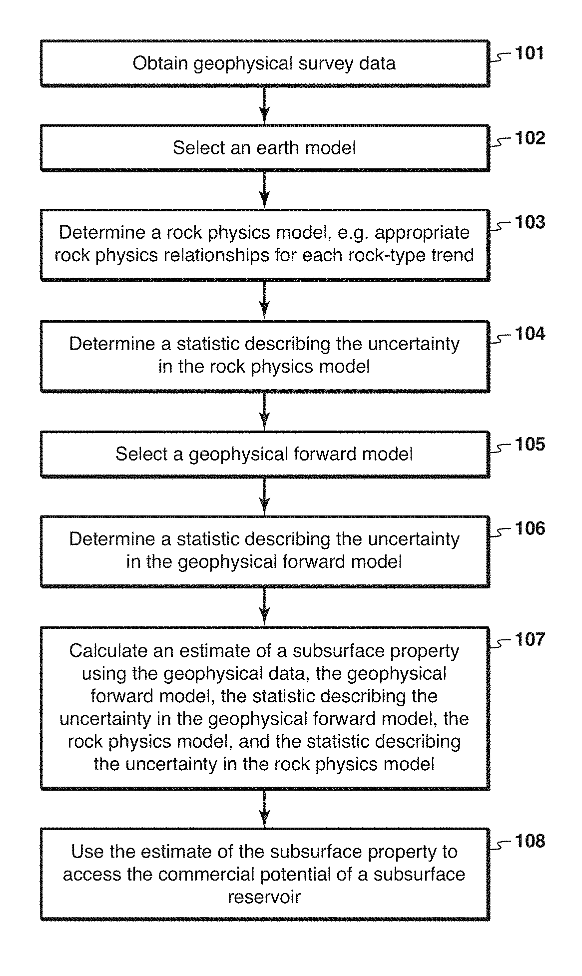
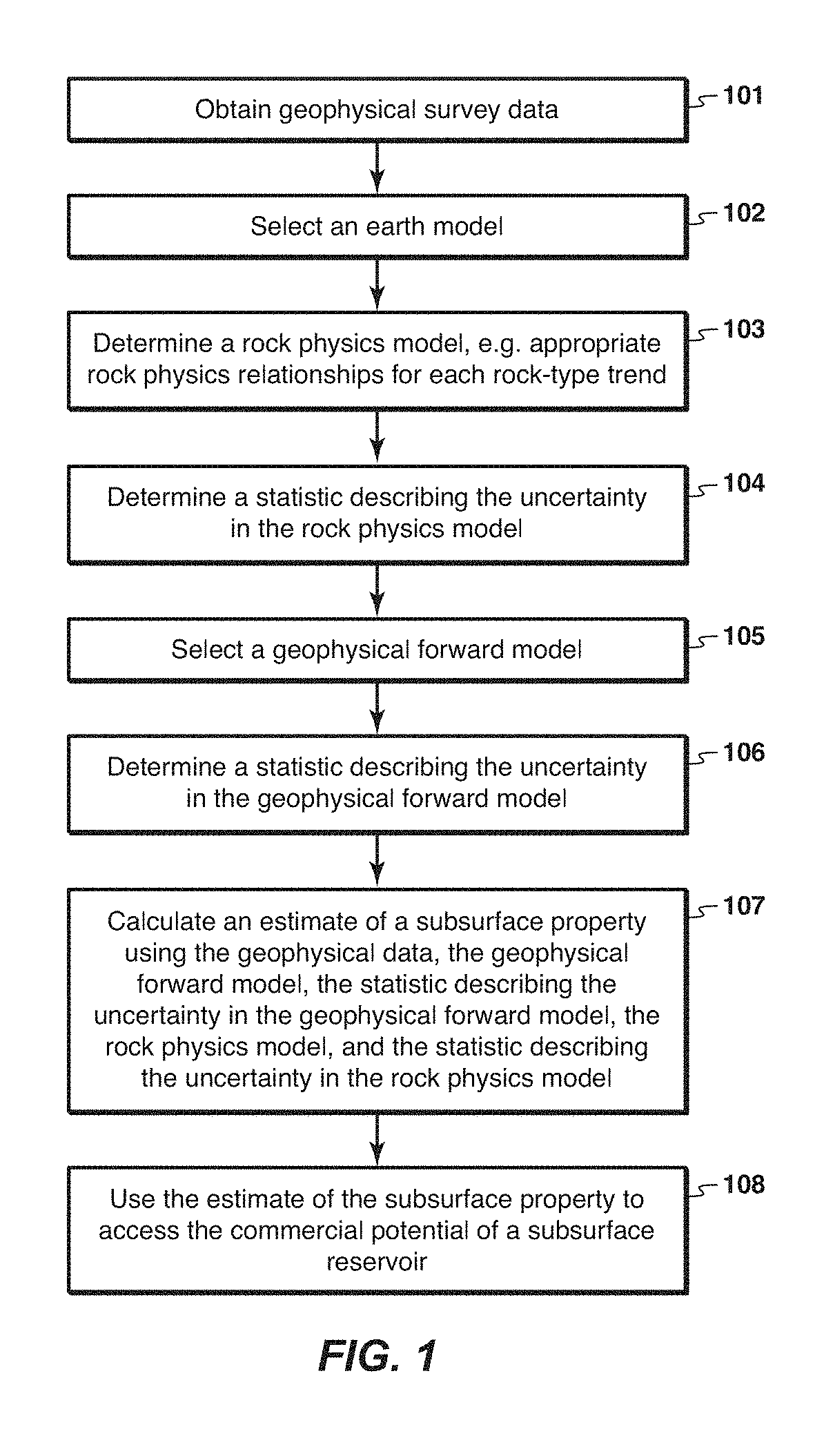
[0029]the invention will now be described. With reference to FIG. 1, this embodiment involves procedures to estimate the rock and fluid properties of a subsurface reservoir from geophysical survey data. As illustrated in FIG. 1, geophysical survey data is obtained (step 101). The inventive method may be applied to geophysical survey data of a single type, for example to a seismic survey, a 2D case example of which is shown in FIG. 3, or of multiple types, for example combining at least two of: a seismic survey, a CSEM survey, an MT survey, a gravity survey, and a passive seismic survey, where the multiple survey data types sense properties of overlapping subsurface regions. Persons of ordinary skill in the art with the benefit of this disclosure will recognize that the present inventive method may be applied to these and other types of geophysical survey data singly or in combination.
[0030]Step 102 is selecting an earth model which gives the subsurface properties of interest through...
second embodiment
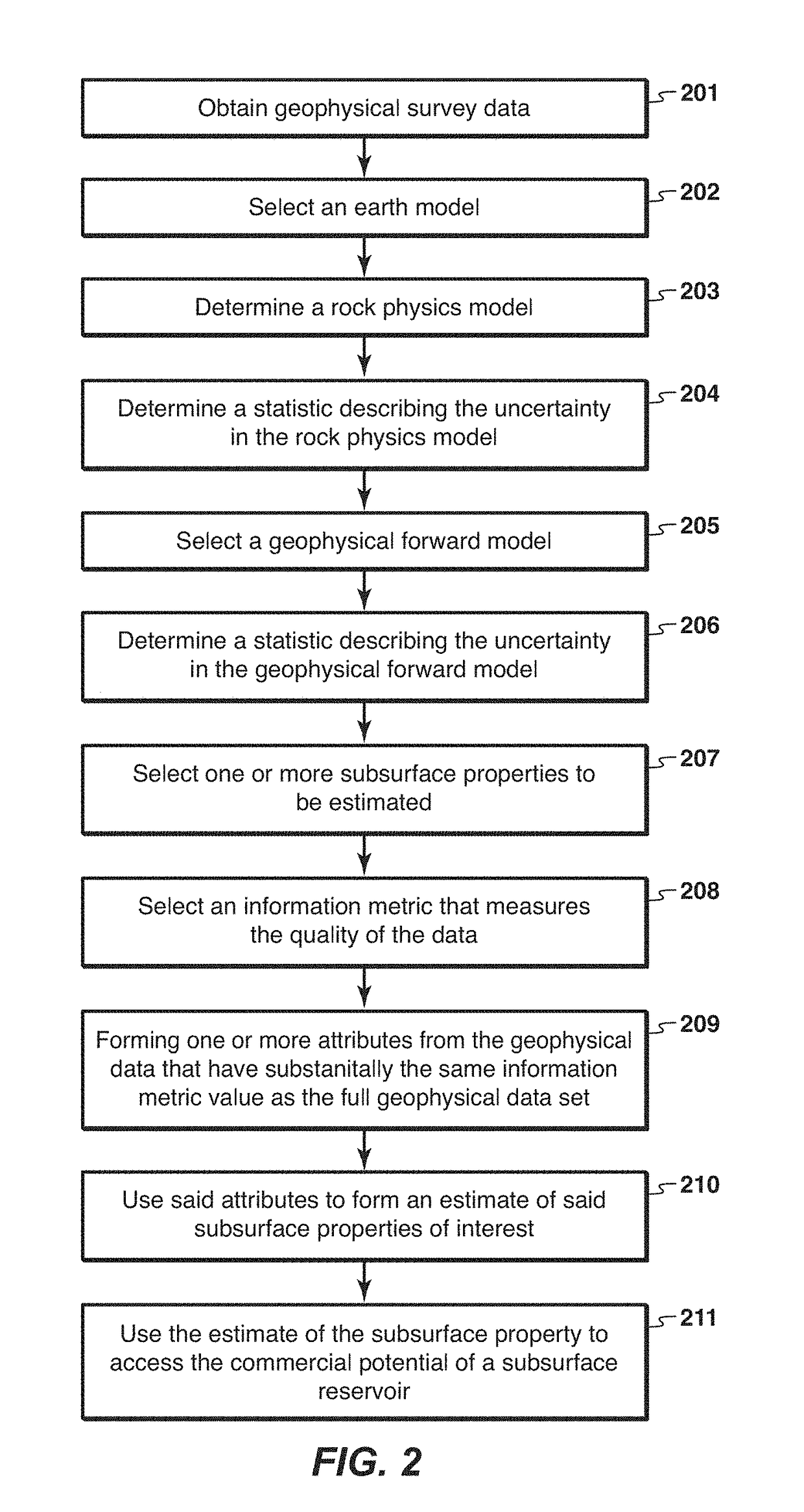
[0044]the invention will now be described. With reference to FIG. 2, this embodiment involves procedures to estimate the rock and fluid properties of a subsurface reservoir from geophysical survey data. As illustrated in FIG. 2, geophysical survey data is obtained (step 201). This step is the same as step 101 described previously. Steps 202-206 are also the same as steps 102-106, respectively.
[0045]Step 207 selects one or more subsurface properties to be estimated instead of the full set of model parameters θ. These selected subsurface properties are typically quantities relevant to particular aspects of hydrocarbon commercial potential. For instance, this could be a certain direct hydrocarbon indicator (“DHI”) x as a function of the model parameters i.e. x=f(θ). The subsequent steps then estimate these properties from a set of reduced attributes that preserve all the information in the raw survey data about x.
[0046]Step 209 is to apply a transformation to the geophysical data set d...
PUM
 Abstract
Description
Claims
Application Information
 - R&D
- Intellectual Property
- Life Sciences
- Materials
- Tech Scout
- Unparalleled Data Quality
- Higher Quality Content
- 60% Fewer Hallucinations
Browse by: Latest US Patents, China's latest patents, Technical Efficacy Thesaurus, Application Domain, Technology Topic, Popular Technical Reports.
© 2025 PatSnap. All rights reserved.Legal|Privacy policy|Modern Slavery Act Transparency Statement|Sitemap|About US| Contact US: help@patsnap.com


