Simulated three-D real environment guidance system

A navigation system and real-world technology, applied to navigation calculation tools, road network navigators, etc., can solve the problems of being unable to confirm the location of other vehicles, having only a single window, and being inconvenient

Inactive Publication Date: 2008-01-09
FENG CHIA UNIVERSITY
View PDF0 Cites 31 Cited by
  • Summary
  • Abstract
  • Description
  • Claims
  • Application Information

AI Technical Summary

Problems solved by technology

[0004] 1. Only a single window
Traditional satellite navigation systems only have a single window, and can only query or display a single piece of information at the same time. If there are multiple pieces of information that need to be looked up, they need to be looked up one at a time, which is quite inconvenient and loses timeliness
[0005] 2. Unable to switch / display 2D images and 3D images at the same time
The traditional satellite navigation system is only two-dimensional images, without three-dimensional images, in the face of road reconstruction, changes in buildings, and even the most important traffic signs that guide the journey, they cannot be displayed in reality. When viewing two-dimensional images , it is quite inconvenient to check whether the real scene is in line
[0006] 3. It is impossible to display the top-view image from all angles, which is more rigid
Due to software design factors, traditional satellite navigation systems can only display two-dimensional images from a single angle, and cannot change other angles.
[0007] 4. Unable to display the dynamics of the car and other cars
The existing satellite navigation system can only display the dynamic data of the own car, but if the caravan travels, it can only confirm its own position, but cannot confirm the direction of other cars. Knowing real-time information still needs to rely on telecommunications, which is extremely inconvenient

Method used


Image

  • Simulated three-D real environment guidance system
  • Simulated three-D real environment guidance system
  • Simulated three-D real environment guidance system

Examples


no. 1 example

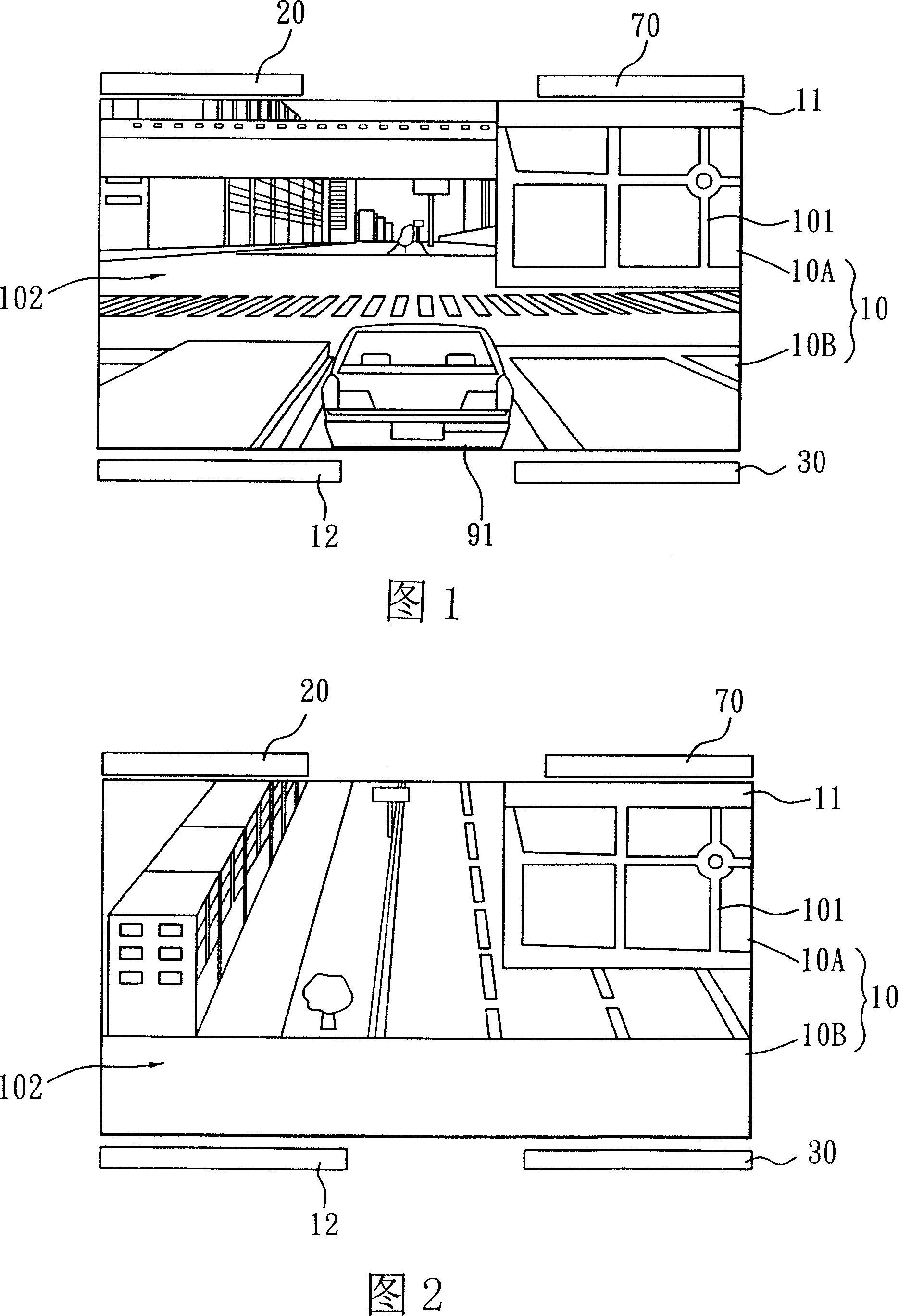
[0044] Referring to Fig. 1, the present invention is a kind of " simulated three-dimensional reality navigation system ", and its first embodiment comprises:

[0045] A display unit 10 has at least a first window 10A (which can be regarded as a child window) and a second window 10B (which can be regarded as a parent window), wherein:

[0046] The first window 10A is provided with a first control unit 11 to control and display a vertically overlooking two-dimensional image 101 of the position of a target object 91;

[0047] The second window 10B is provided with a second control unit 12 to control and display a 3D image 102 in Virtual Reality Modeling Language (VRML) format. The 3D image 102 displays and records dynamic data of the object 91 .

[0048] The above constitutes the simulated three-dimensional reality navigation system of the present invention.

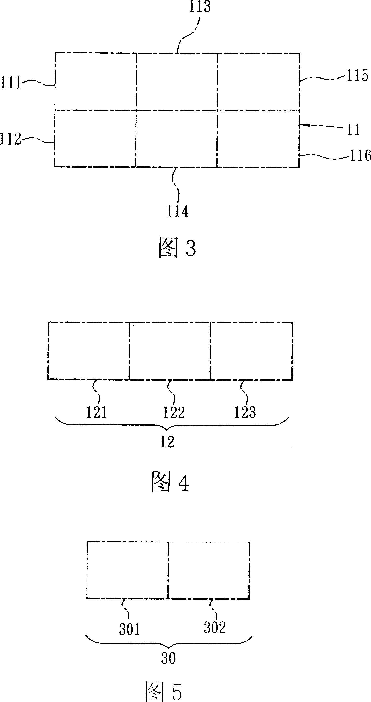
[0049] The first control portion 11 is at least provided with an enlargement / reduction key 111, a position adjustment ke...

no. 2 example

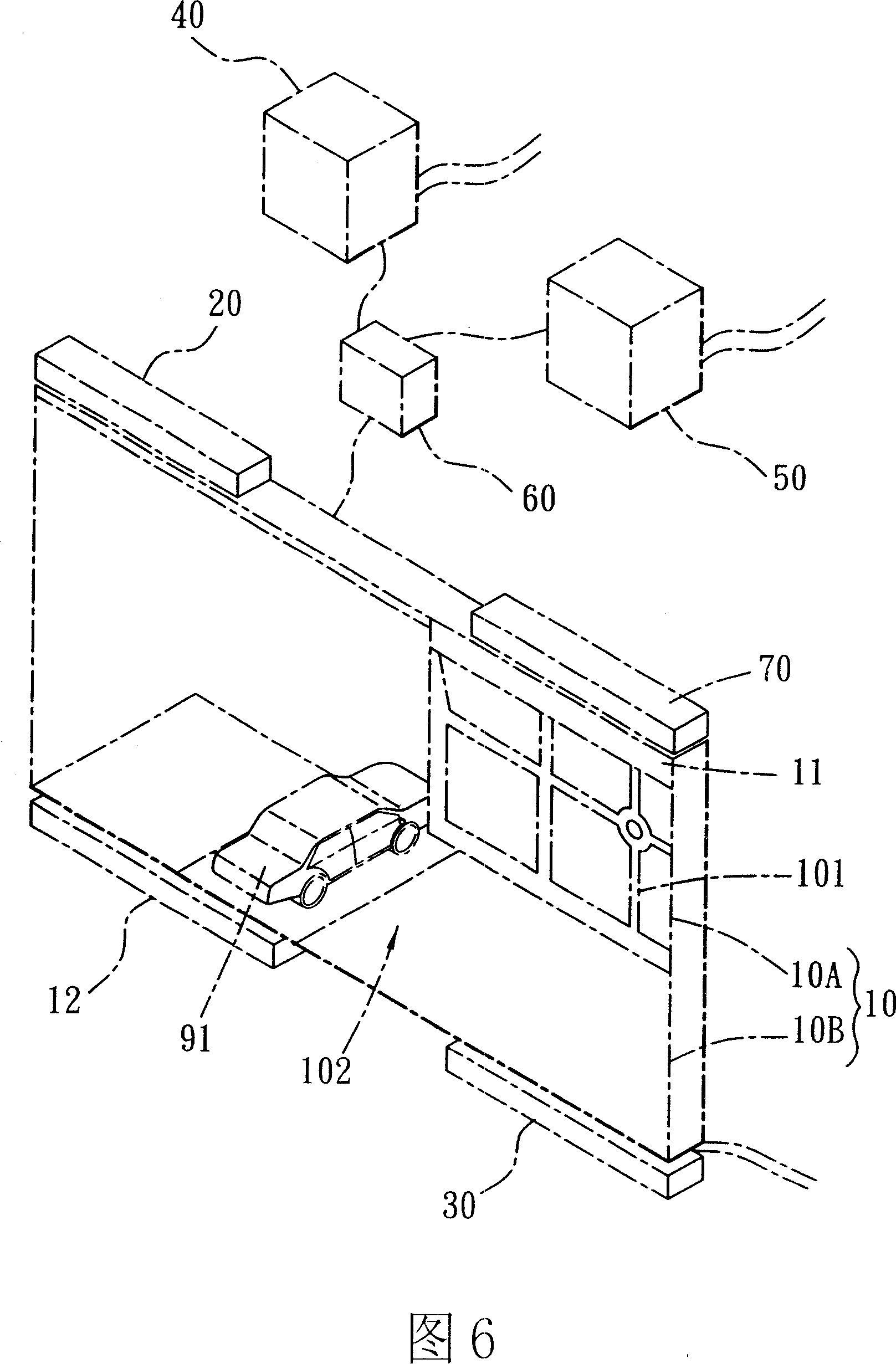
[0063] Refer to Fig. 6, be the second embodiment of the present invention, be provided with again:

[0064] A Global Positioning System (Global Position System, referred to as GPS) 40, and a geographic information system (Geographic Information System, referred to as GIS) 50 (as shown in Figure 6); by the Global Positioning System 40 and the geographic information system 50 cooperates with the search key 113 of the first control part 11 to generate functions of finding, instructing and guiding locations, and the global satellite positioning system 40 can also provide (or display) the current location of the object 91 .

[0065] Cooperating with the global satellite positioning system 20 and the geographic information system 30, it is further provided with:

[0066] A dynamic / quantity display part 60, when other vehicles are all configured with the global satellite positioning system 40, this dynamic / quantity display part 60 can show the vehicle condition around the current pos...


PUM


Abstract

The invention relates to a three-dimensional simulation of reality navigation system, including a show part that at least has: a first window, with a first control division, controls the first window to show the vertical overlooking the two-dimensional image of the location of an object; a second window, with a second control division, controls the second window to display a virtual reality modeling language (VRML) format 3-D images, the 3-D image is used to display and record the dynamic information of the subject; the two-dimensional, three-dimensional images with each other constitute a navigation system. The invention has the son mother switch window, switches / at the same time displays the two-dimensional images and three-dimensional images, and to the point of overlooking the images showed more changes, but also indicates the car with his vehicle dynamics.

Description

technical field [0001] The invention relates to a simulated three-dimensional reality navigation system. Background technique [0002] Modern people often need to travel around for work, and also waste a lot of time finding the way because they are not familiar with the road. Therefore, there are satellite navigation systems for cars on the market, which can search for the required road information through satellites. . [0003] But the traditional satellite navigation system has the following problems: [0004] 1. Only a single window. The traditional satellite navigation system only has a single window, and can only query or display a single piece of information at the same time. If there are multiple pieces of information to be queried, it needs to be queried one at a time, which is quite inconvenient and loses timeliness. [0005] 2. It is not possible to switch / display 2D images and 3D images at the same time. The traditional satellite navigation system is only two-...

Claims


Application Information

Patent Timeline
Patent Type & Authority Applications(China)
IPC IPC(8): G01C21/26G01C21/20
Inventor 周天颖衷岚焜陈慧雯蔡元璋林嘉豪
Owner FENG CHIA UNIVERSITY
Why Eureka
Try Eureka