Avigation close range photography displacement measurement system based on unmanned aerial vehicle as well as measurement method thereof

A technology of close-range photography and displacement measurement, which is applied in the field of aerial close-range photography displacement measurement, which can solve problems such as dead angles in hand-held photography, and achieve the effects of high displacement measurement efficiency, large monitoring area, and strong site adaptability

Inactive Publication Date: 2008-06-18
INST OF ROCK AND SOIL MECHANICS - CHINESE ACAD OF SCI
View PDF0 Cites 31 Cited by
  • Summary
  • Abstract
  • Description
  • Claims
  • Application Information

AI Technical Summary

Problems solved by technology

After years of development, at present, for small-scale projects, the measurement accuracy has reached the engineering requirements; however, for large-scale pr...

Method used


Image

  • Avigation close range photography displacement measurement system based on unmanned aerial vehicle as well as measurement method thereof
  • Avigation close range photography displacement measurement system based on unmanned aerial vehicle as well as measurement method thereof

Examples


Embodiment Construction

[0033] Below in conjunction with accompanying drawing and implementation example the utility model is further described:

[0034] 1. The structure of this system
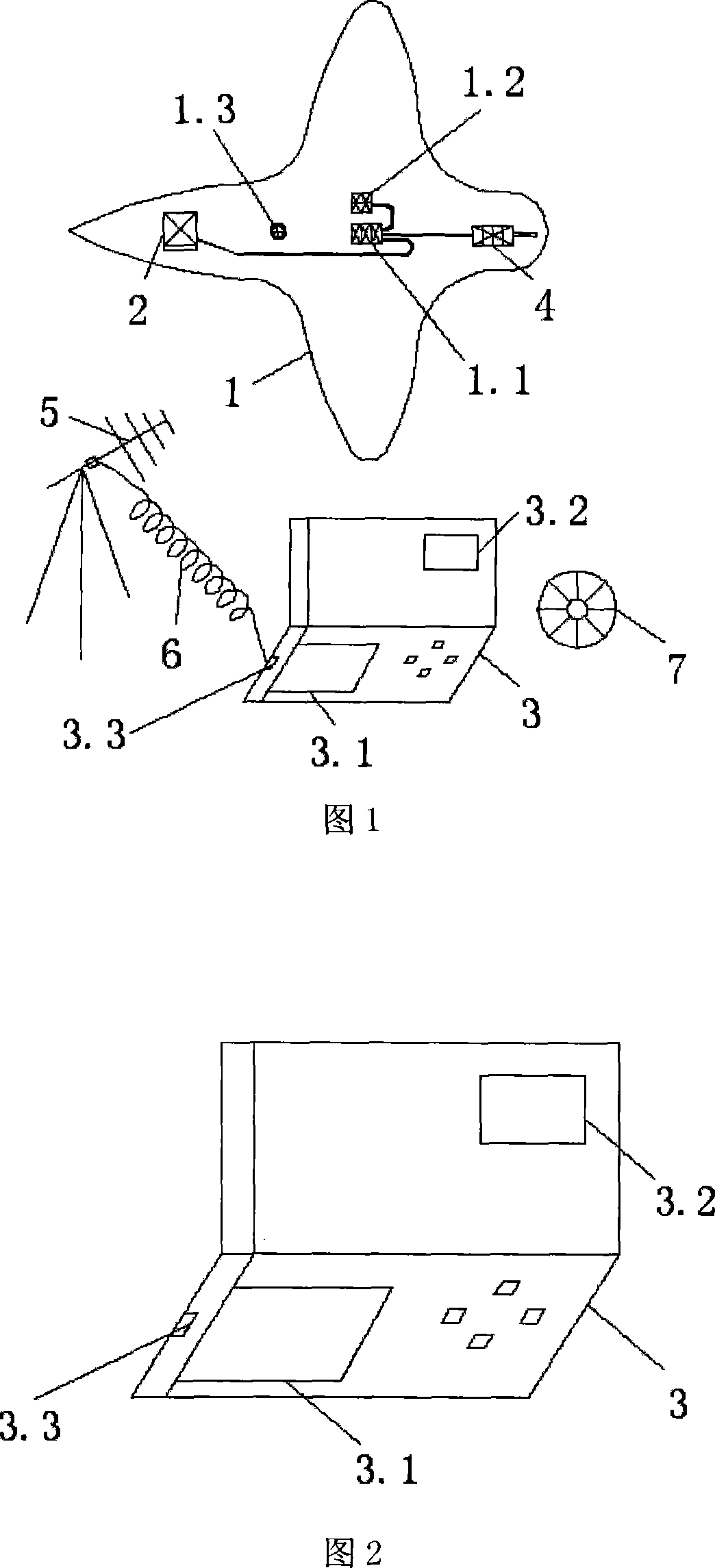
[0035] 1. UAV (1)

[0036] As shown in Figure 1, flight auxiliary equipment such as flight control board (1.1), GPS (1.2) and self-stabilizing balancer (1.3) and microwave transmitters (4) are installed on the unmanned aerial vehicle (1); the route passes through the ground station ( 3) Import the drone (1).

[0037] The unmanned aerial vehicle (1) is electric and has a battery life of more than 30 minutes.

[0038] 2. Ground Control Station (3)

[0039] As shown in Fig. 2, the ground control station (3) is a foldable box shape, a notebook computer (3.1) is arranged below, a display screen (3.2) is arranged above, and a computer serial port (3.3) is set.

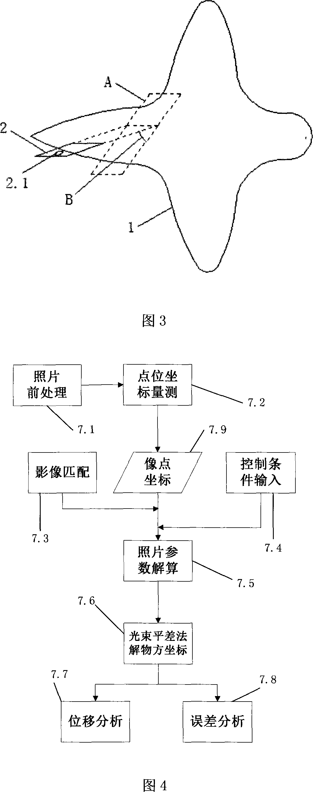
[0040] 3. Connection between digital camera (2) and drone (1)

[0041] As shown in Figure 3, the digital camera (2) is connected to the drone (1) by fixing t...


PUM


Abstract

The invention discloses an aero near view photography displacement measuring system based on a drone and a method of the system, and relates to an aero near view photography displacement measuring technology. The system comprises a drone (1), a digital camera (2), a ground control station (3), a microwave transmitter (4), a microwave receiving antenna (5), a data cable (6) and computer software (7); the drone (1) is provided with the digital camera (2) and the microwave transmitter (4) which are connected by a fly control board (1.1)of the mini model drone (1); the data cable connects a computer serial port (3.3) of the ground control station (3) and the microwave receiving antenna (5); the computer software (7) is installed in a notebook (3.1) of the ground control station (3). The invention can prevent some problems of traditional displacement measurement, and thus is applicable to displacement measurement to large displacement and large scale projects, in particular to displacement measurement to projects with difficult passage and in dangerous areas.

Description

technical field [0001] The present invention relates to an aerial close-range photographic displacement measurement technology, in particular to an aerial close-range photographic displacement measurement system and method based on an unmanned aerial vehicle (miniature model unmanned aerial vehicle); Non-contact measurement technology for large displacement engineering. Background technique [0002] Displacement measurement is an important means for safety evaluation, construction control and effect inspection of geotechnical engineering. In places with difficult access or dangerous operations, such as high and steep slopes, mine subsidence areas, and areas where debris flows occur, most existing displacement measurement technologies are time-consuming and labor-intensive, or even impossible to implement. Although technologies such as satellite remote sensing and aerial photogrammetry are not limited by site conditions, their measurement accuracy is low, and the latter is a...

Claims


Application Information

Patent Timeline
IPC IPC(8): G01C11/00G01C11/02G01C11/04G01B11/00G01B11/03
Inventor 李小春杜学飞任伟
Owner INST OF ROCK AND SOIL MECHANICS - CHINESE ACAD OF SCI
Why Eureka
Try Eureka