

Map vector data displaying method in network navigation of mobile phone
A technology of vector map data and display method, which is applied to road network navigators, electrical components, transmission systems, etc., can solve problems such as unsatisfactory navigation effects, achieve friendly display effects, reduce time occupation, and facilitate navigation habits
- Summary
- Abstract
- Description
- Claims
- Application Information
AI Technical Summary
Problems solved by technology
Method used
Image

Examples
Embodiment Construction
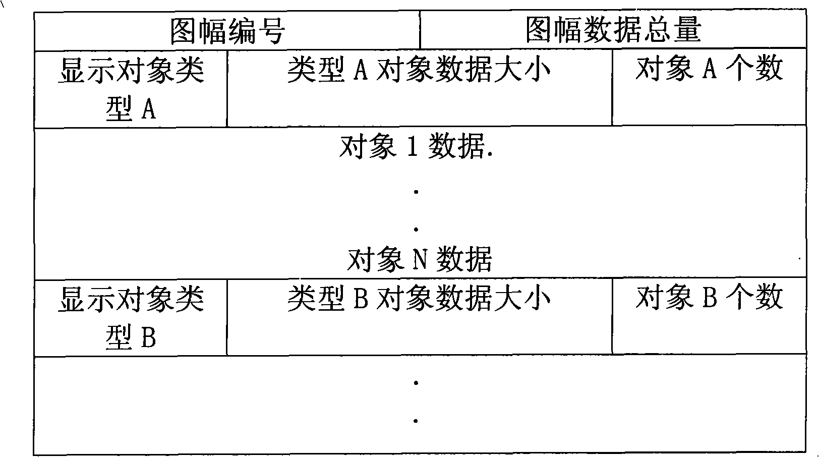
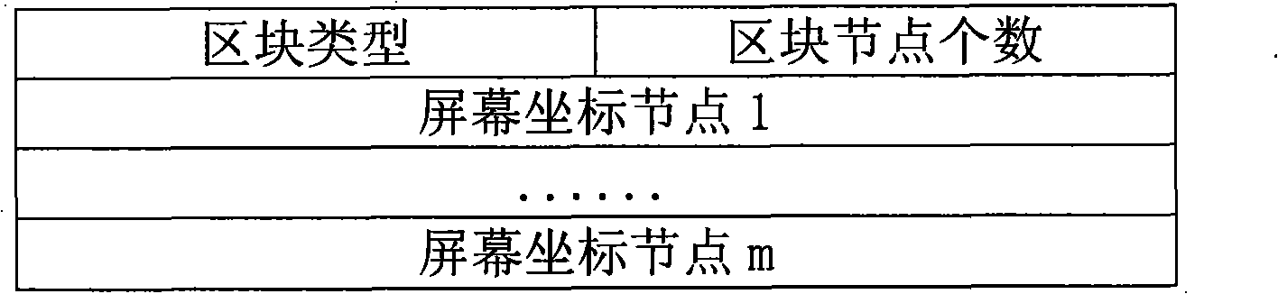
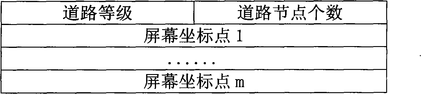
[0055] A method for displaying vector map data in mobile phone network navigation of the present invention comprises the following steps:
[0056] Step 1. Interactive confirmation of mathematical elements in the vector map
[0057]The display of a navigation map is based on the mathematical elements of the map such as scale, coordinate system, and map orientation. The mobile terminal confirms these elements by interacting with the network navigation center. The mobile terminal uploads related data such as screen size to the navigation center through the data transmission channel of the wireless communication network (such as GPRS), and the navigation center determines the optimal display scale of the terminal map. At the same time, the coordinate system and map direction displayed by the terminal navigation map are also determined by the navigation center. The navigation center will send the determined mathematical element parameters to the mobile terminal.
[0058] Step 2....
PUM
 Abstract
Description
Claims
Application Information