Compatible navigation receiver positioning system and positioning method thereof

A technology of a navigation receiver and a positioning system, which is applied in the field of satellite navigation, can solve problems such as the increase in the calculation amount of Kalman filtering, and achieve the effects of improving the perfect monitoring performance, enhancing the strength of geometric figures, and ensuring continuity.

Inactive Publication Date: 2009-12-23
BEIHANG UNIV
View PDF0 Cites 46 Cited by
  • Summary
  • Abstract
  • Description
  • Claims
  • Application Information

AI Technical Summary

Problems solved by technology

Although, with the rapid development of modern micro-processing technology, calculation requirements are no longer the main obstacle to the application of Kalman filter, but in the application of

Method used


Image

  • Compatible navigation receiver positioning system and positioning method thereof
  • Compatible navigation receiver positioning system and positioning method thereof
  • Compatible navigation receiver positioning system and positioning method thereof

Examples


specific Embodiment approach

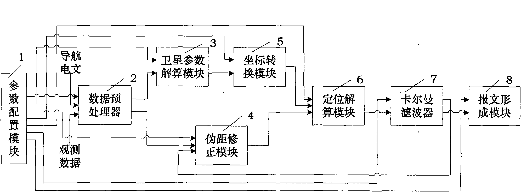
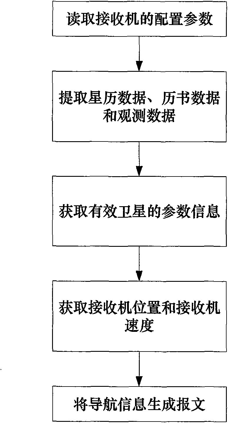
[0087] After the receiver has completed the acquisition and tracking, obtained a complete navigation message subframe and the observation data has been updated, it needs to output navigation information according to the needs of the user. The specific implementation of the compatible navigation receiver positioning method of the present invention is as follows:

[0088] Step 1: Read the configuration parameters of the receiver;

[0089] The parameter configuration module 1 reads the configuration parameters of the receiver,

[0090] First, according to user needs, determine the working status of the receiver and the satellite navigation system used; the working status is: dual-satellite navigation system combined positioning, the satellite navigation systems used include: Beidou second-generation navigation system BD2 and global positioning system GPS;

[0091] Then, according to user requirements, determine that the working state of Kalman filter 7 is working, determine that the ...


PUM


Abstract

The invention discloses a compatible navigation receiver positioning system and a positioning method thereof. The system comprises a parameter configuring module, a data preprocessor, a satellite parameter calculating module, a pseudo-distance modifying module, a coordinate conversion module, a positioning calculating module, a kalman filter and a message forming module. The positioning method comprises the steps of: reading a configuration parameter of a receiver; extracting ephemeris data, almanac data and observation data; obtaining parameter information of effective satellites; obtaining the position of the receiver and the speed of the receiver; and generating a message by the navigation information. The invention realizes alternative use of the global positioning system, the independent navigation of the second big dipper navigation system breaks away from the dependency to the other navigation systems at emergency period, and the combination of the many satellite navigation systems increases the quantity of the effective satellites, so as to guarantee the continuity, the usability and the security of satellite positioning service, enhance the geometric figure intensity of the observation satellites, and improve the reliability of the whole global positioning system.

Description

Technical field [0001] The invention belongs to the field of satellite navigation, and specifically relates to a compatible navigation receiver positioning system and a positioning method thereof. Background technique [0002] Satellite navigation can provide accurate and continuous position, speed and time information to various users and sports platforms in real time. The Global Navigation Satellite System (GNSS) is the second-generation satellite navigation and positioning system, which has the characteristics of all-round land, sea and air, global, all-weather, continuous and real-time. [0003] The two major global satellite navigation and positioning systems that already exist in the world are the Global Positioning System (Global Positioning System, referred to as GPS) system of the United States and the Global Navigation Satellite System (Global Navigation Satellite System, referred to as GLONASS) of Russia, which are under design and construction. There are European "Gal...

Claims


Application Information

Patent Timeline
IPC IPC(8): G01S5/02G01S1/02G01C21/20
Inventor 张晓林霍航宇陈灿辉
Owner BEIHANG UNIV
Why Eureka
Try Eureka