

Precise surveying and mapping method of 0.25m contour interval of flat ground with large scale of 1:500 to 1:200
A technology of equal height distance and scale, which is applied in the field of large-scale digital aerial photogrammetry, can solve problems such as difficult to meet high-precision requirements, and achieve a highly practical effect
- Summary
- Abstract
- Description
- Claims
- Application Information
AI Technical Summary
Problems solved by technology
Method used
Image

Examples
Embodiment Construction
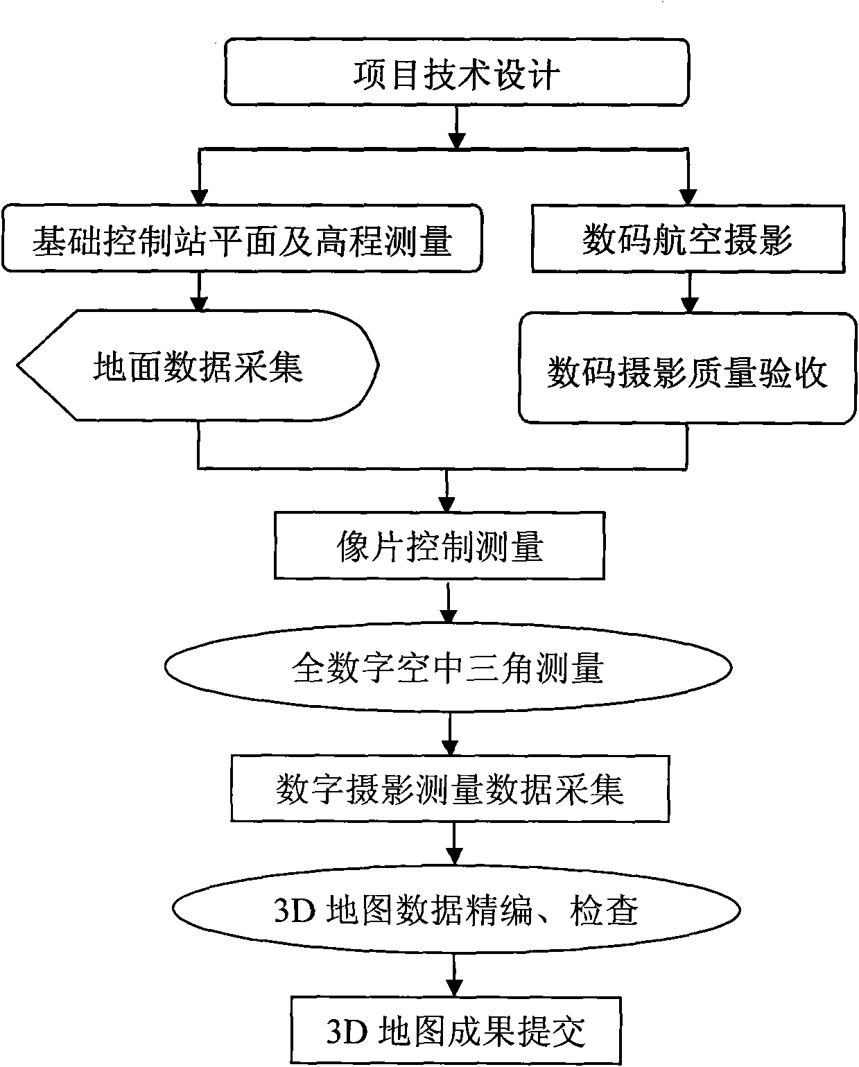
[0024] Technical flow chart of the present invention sees figure 1 , see figure 1 , the technical process of the present invention is:
[0025] 1. Project technical design;
[0026] 2. Plane and elevation measurement of the basic control station; ground data collection; digital aerial photography; digital photography quality acceptance;
[0027] 3. Photo control measurement;
[0028] 4. Full digital aerial triangulation;
[0029] 5. Digital photogrammetry data acquisition;
[0030] 6. 3D map data editing and inspection;
[0031] 7. Submission of 3D map results.
[0032] The present invention firstly adopts the Z / I Imagine DMC aerial digital video camera jointly produced by the U.S. and Germany with world advanced level, which can obtain high quality (high signal-to-noise ratio, high contrast), high geometric and radiation resolution (pixel size 12 μm, Ground resolution can reach 5cm, radiation resolution is greater than 8 bits / pixel) and image information with high imag...
PUM
 Abstract
Description
Claims
Application Information