Environmental satellite 1-based surface temperature single-window inversion method

A surface temperature and satellite technology, applied in the field of thermal infrared remote sensing, can solve problems such as difficulty in obtaining atmospheric water vapor content, errors, and many parameters

Inactive Publication Date: 2011-06-22
SATELLITE ENVIRONMENT CENT MINIST OF ENVIRONMENTAL PROTECTION
View PDF1 Cites 44 Cited by
  • Summary
  • Abstract
  • Description
  • Claims
  • Application Information

AI Technical Summary

Problems solved by technology

The radiative transfer equation method is more complicated and requires many parameters, which is inconvenient to apply in the actual inversion of surface temperature. Although the latter two methods only need surface temperature, atmospheric water vapor content and surface specific emissivity (Qin Zhihao’s single-window algorithm also needs atmospheric average temperature), but the atmospheric water vapor content is not easy to obtain. Although the atmospheric water vapor distribution is obtained through other remote sensing data, such as the water vapor product of MODIS (an important sensor on the terra and aqua satellites) or the band ratio method, different Errors are also likely to occur when sensors and data of different resolutions are fused

Method used


Image

  • Environmental satellite 1-based surface temperature single-window inversion method
  • Environmental satellite 1-based surface temperature single-window inversion method
  • Environmental satellite 1-based surface temperature single-window inversion method

Examples


Embodiment Construction

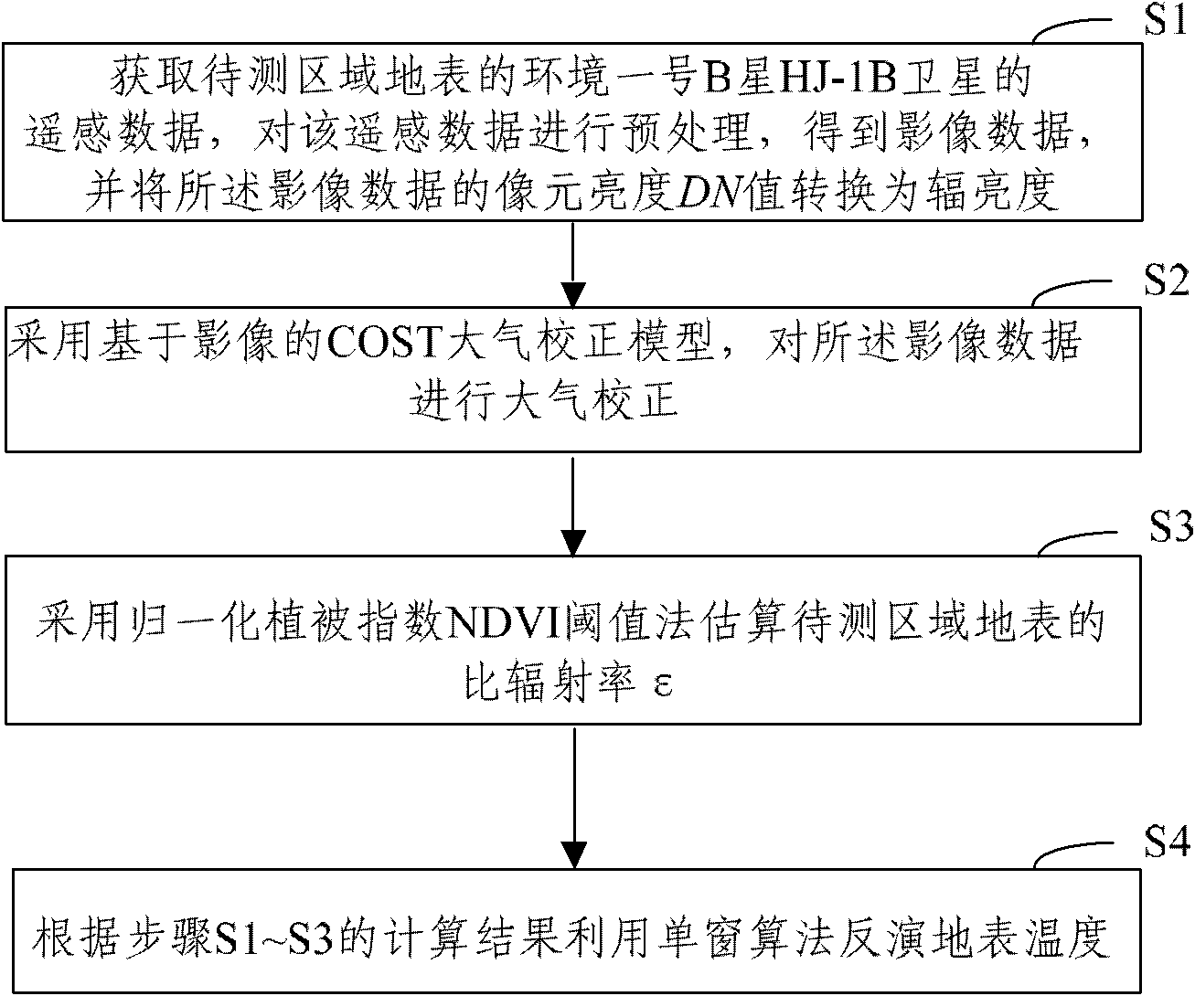
[0039] The specific implementation manners of the present invention will be further described in detail below in conjunction with the accompanying drawings and embodiments. The following examples are used to illustrate the present invention, but are not intended to limit the scope of the present invention.

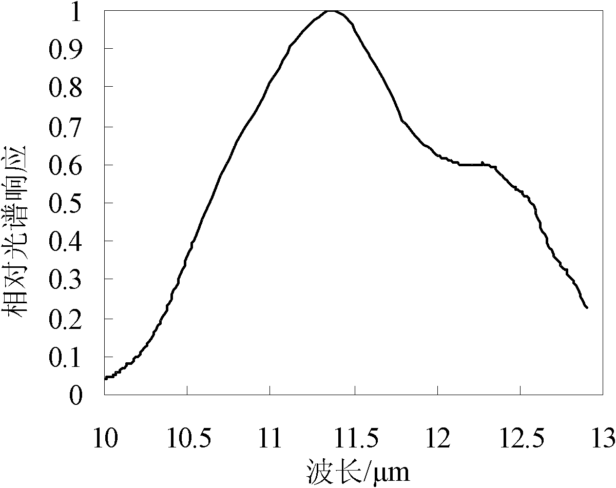
[0040] Environment No. 1 satellite has only a suitable thermal infrared band (10.5-12.5um), therefore, the present invention adopts a kind of simple and easy single-window algorithm (being prior art, by Artis and Carnahan in 1982) that does not need atmospheric water vapor content parameter proposed; Weng et al. applied in 2004) to retrieve the surface temperature.

[0041] figure 1 Show the flow chart of the method of the embodiment of the present invention, as figure 1 As shown, the method includes the following steps:

[0042] S1, preprocessing

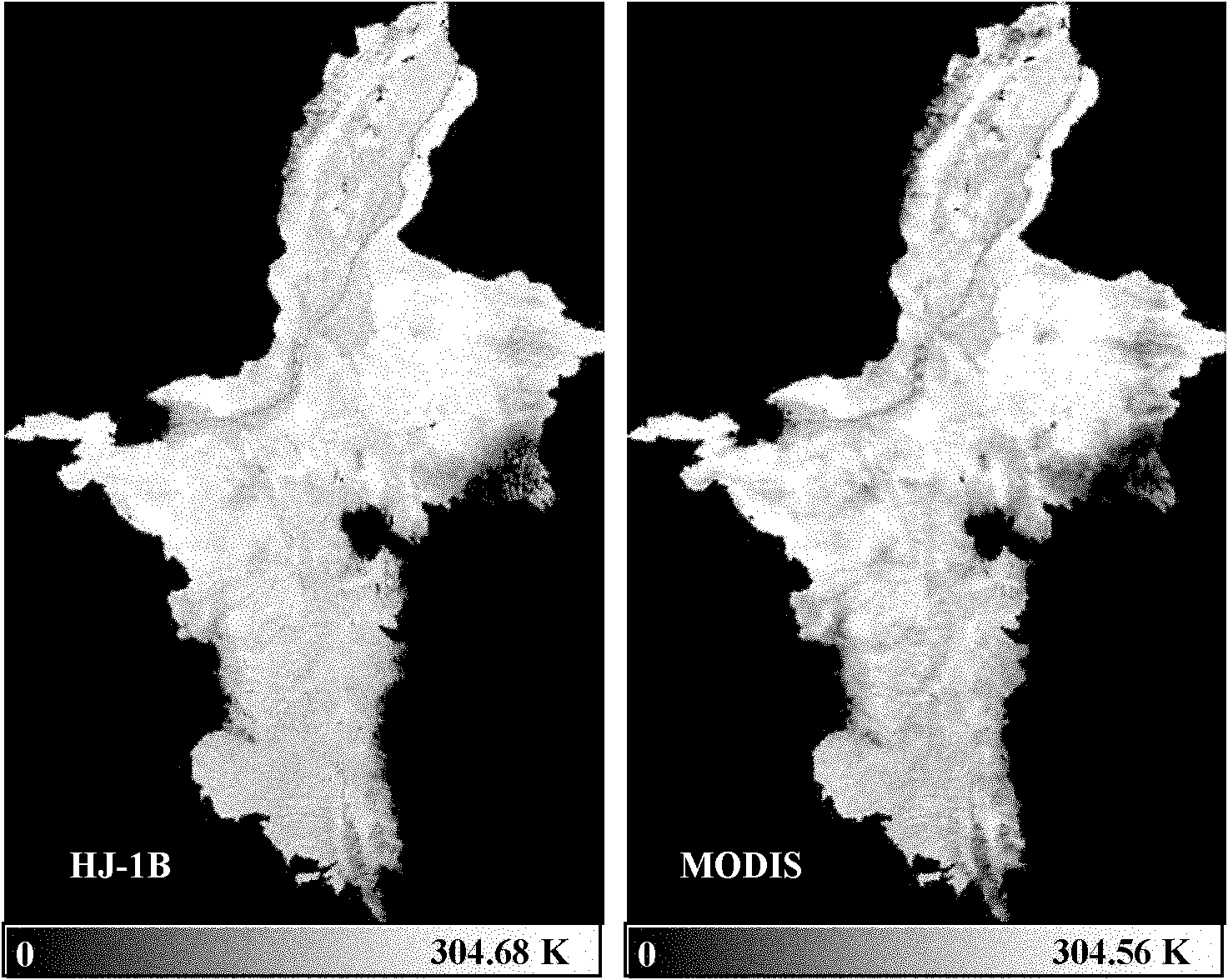
[0043] For the remote sensing data of the Ningxia research area (that is, the optical and thermal infrared image data of ...


PUM


Abstract

The invention discloses an environmental satellite 1-based surface temperature single-window inversion method. The method comprises the following steps of: 1, acquiring remote sensing data of an environmental satellite 1B, namely an HJ-1B satellite, of the surface of a region to be tested, preprocessing the remote sensing data to acquire image data and converting a pixel brightness digital number (DN) value of the image data into radiance; 2, performing atmospheric correction on the image data by using an image-based continental offshore stratigraphic test (COST) atmospheric correction model; 3, estimating emissivity epsilon of the surface of the region to be tested by a normalized difference vegetation index (NDVI) threshold method; and 4, inverting the surface temperature by a single-window algorithm according to calculation results obtained in the steps 1 to 3. In the method, the image-based COST model atmospheric correction method and the surface temperature single-window algorithm with no need of an atmospheric water vapor content parameter are applied to the HJ-1B satellite remote sensing data, so that the inversion of the surface temperature is realized.

Description

technical field [0001] The invention relates to the technical field of thermal infrared remote sensing, in particular to a single-window inversion method of surface temperature based on Environment-1 satellite. Background technique [0002] Land surface temperature is a key parameter of radiation and energy exchange between the land surface and the atmosphere, as well as regional and global surface physical processes. Thermal infrared remote sensing is an effective means to detect land surface temperature. Environment-1 Satellite A, B (HJ-A / B) is a brand new civil satellite launched in 2008 by our country after meteorological, oceanographic and land resources satellites. The thermal infrared band spatial resolution of the infrared camera (IRS) on the HJ-1B satellite is 300m. There are not many thermal infrared studies on this star, and they mainly focus on the early stage of model simulation, on-orbit evaluation, or relatively complex inversion process. For example, Duan Si...

Claims


Application Information

Patent Timeline
Patent Type & Authority Applications(China)
IPC IPC(8): G01S7/48G01J5/10
Inventor 王桥赵少华张峰杨海军聂忆黄刘思含李营
Owner SATELLITE ENVIRONMENT CENT MINIST OF ENVIRONMENTAL PROTECTION
Why Eureka
Try Eureka