Full-automatic method for precisely extracting regional impervious surface remote sensing information

A technology of information extraction and automatic extraction, which is applied in the direction of instruments, character and pattern recognition, computer components, etc., can solve the problems of lack of method automation and refinement, and achieve the effects of stable extraction accuracy, stable algorithm, and accurate information calculation

Inactive Publication Date: 2011-09-14
INST OF REMOTE SENSING & DIGITAL EARTH CHINESE ACADEMY OF SCI
View PDF1 Cites 10 Cited by
  • Summary
  • Abstract
  • Description
  • Claims
  • Application Information

AI Technical Summary

Problems solved by technology

[0004] In terms of remote sensing information extraction algorithms for regional impervious surfaces, there are currently many

Method used


Image

  • Full-automatic method for precisely extracting regional impervious surface remote sensing information
  • Full-automatic method for precisely extracting regional impervious surface remote sensing information
  • Full-automatic method for precisely extracting regional impervious surface remote sensing information

Examples


Embodiment Construction

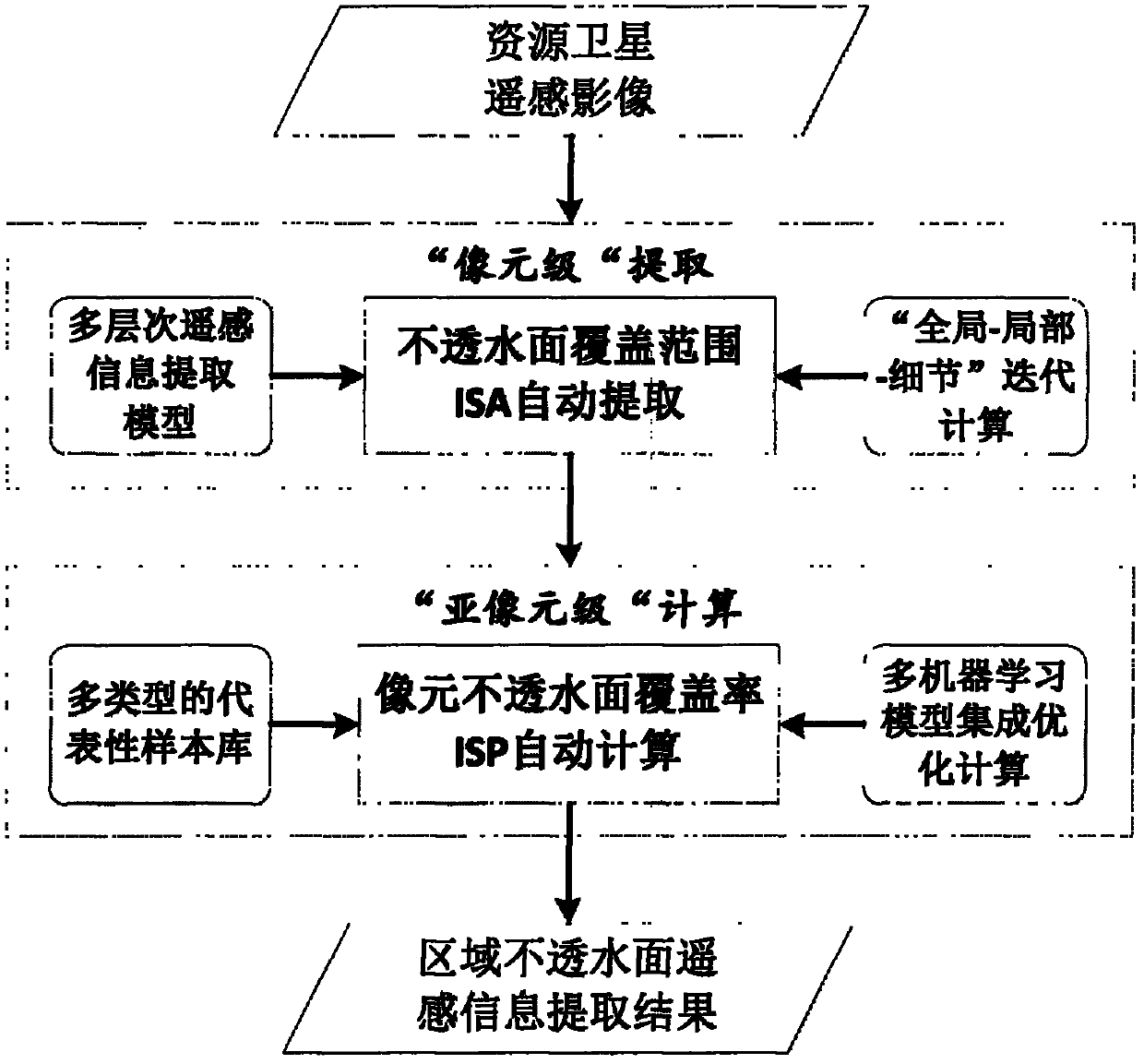
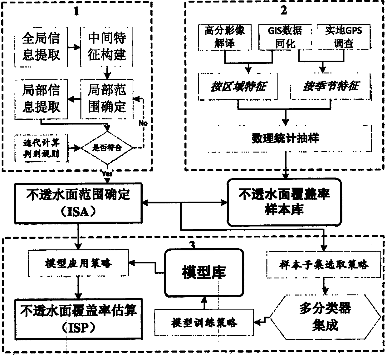
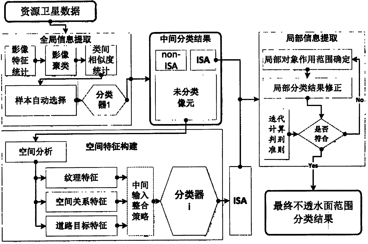
[0030]In the past, the impervious surface information extraction method including hybrid spectral decomposition and machine learning did not take the impervious surface area (ISA) extraction as a separate step, but directly solved the impervious surface coverage (ISP) in the entire image range , the disadvantage of this method is that the ISP value calculated by the model will also appear in some positions where there is no impermeable surface, and the existence of spectral confusion is also a problem that has always existed in this method. Therefore, the present invention first automatically extracts the ISA range from the remote sensing image, and then performs sub-pixel-level ISP calculation based on the sample library, which improves the stability and flexibility of the entire extraction process, and can effectively improve the operation of the algorithm. Efficiency, methods and technical processes such as figure 2 .

[0031] ISA range extraction is actually a binary cla...


PUM


Abstract

The invention provides a method for realizing automation of precise extraction of a regional impervious surface. Aiming at two key technical loops of division of an impervious surface area (ISA) and calculation of a pixel impervious surface percentage (ISP), a whole new technical framework is provided. The method comprises the following steps of: dividing extraction of regional impervious surface remote sensing information into two technical loops, namely pixel-level ISA division and sub-pixel-level ISA calculation, constructing a whole-partial-detail iterative extraction flow on a remote sensing image under the support of a multi-layer remote sensing information extraction model, automatically extracting a pixel space range possibly comprising impervious surface information, automatically and quantitatively calculating an ISP value of a sub-pixel in a pixel of the ISA under the support of a representative sample base and a non-linear machine model, and realizing automation and precision of the impervious surface remote sensing information extraction in the perspective of the technical method. The method is suitable for providing corresponding information support for relevant industries of land management, city planning, ecological environment and the like.

Description

technical field [0001] The present invention relates to a remote sensing image processing technology and a remote sensing image information extraction method, in particular to a method for automatically and accurately extracting multi-scale regional impervious surface (construction land) information from a medium-resolution remote sensing image, and an impermeable surface The establishment of the coverage rate sample library, the present invention can be applied to land management, urban planning, ecological environment and other related industries to provide corresponding information support. Background technique [0002] With the acceleration of human transformation of nature, the development of a large number of man-made objects has relatively reduced natural surface coverings such as vegetation and soil, and artificial coverings such as various types of buildings, roads and related facilities made of cement concrete and other materials will prevent water pollution. (and ...

Claims


Application Information

Patent Timeline
IPC IPC(8): G06K9/66
Inventor 沈占锋程熙骆剑承朱长明周亚男夏列钢
Owner INST OF REMOTE SENSING & DIGITAL EARTH CHINESE ACADEMY OF SCI
Why Eureka
Try Eureka