Precise plane coordinate correction method in laser radar scanning measurement

A technology of laser radar and measuring planes, which is applied in the directions of measuring devices, cross-section drawing, surveying and navigation, etc., can solve the problems of low positioning accuracy and achieve the effects of high accuracy, improved accuracy, and improved production efficiency

Active Publication Date: 2014-03-12
CCCC SECOND HIGHWAY CONSULTANTS CO LTD
View PDF1 Cites 0 Cited by
  • Summary
  • Abstract
  • Description
  • Claims
  • Application Information

AI Technical Summary

Problems solved by technology

[0010] The purpose of the method of the present invention is to address the relatively low plane positioning accuracy of laser radar scanning measurement, and the defects of the laser radar point cloud data plane coordinate refinement processing method based on digital orthophoto images and lane markings, and propose a direct method. Based on the control points of the road surface, the precision correction method of the laser radar scanning measurement plane coordinates is easy to implement and easy to operate, and can improve the plane positioning accuracy of the laser radar scanning measurement by nearly 2 times

Method used


Image

  • Precise plane coordinate correction method in laser radar scanning measurement
  • Precise plane coordinate correction method in laser radar scanning measurement
  • Precise plane coordinate correction method in laser radar scanning measurement

Examples


Embodiment Construction

[0031] The method of the present invention will be further described in detail below through specific implementation manners and in conjunction with the accompanying drawings.

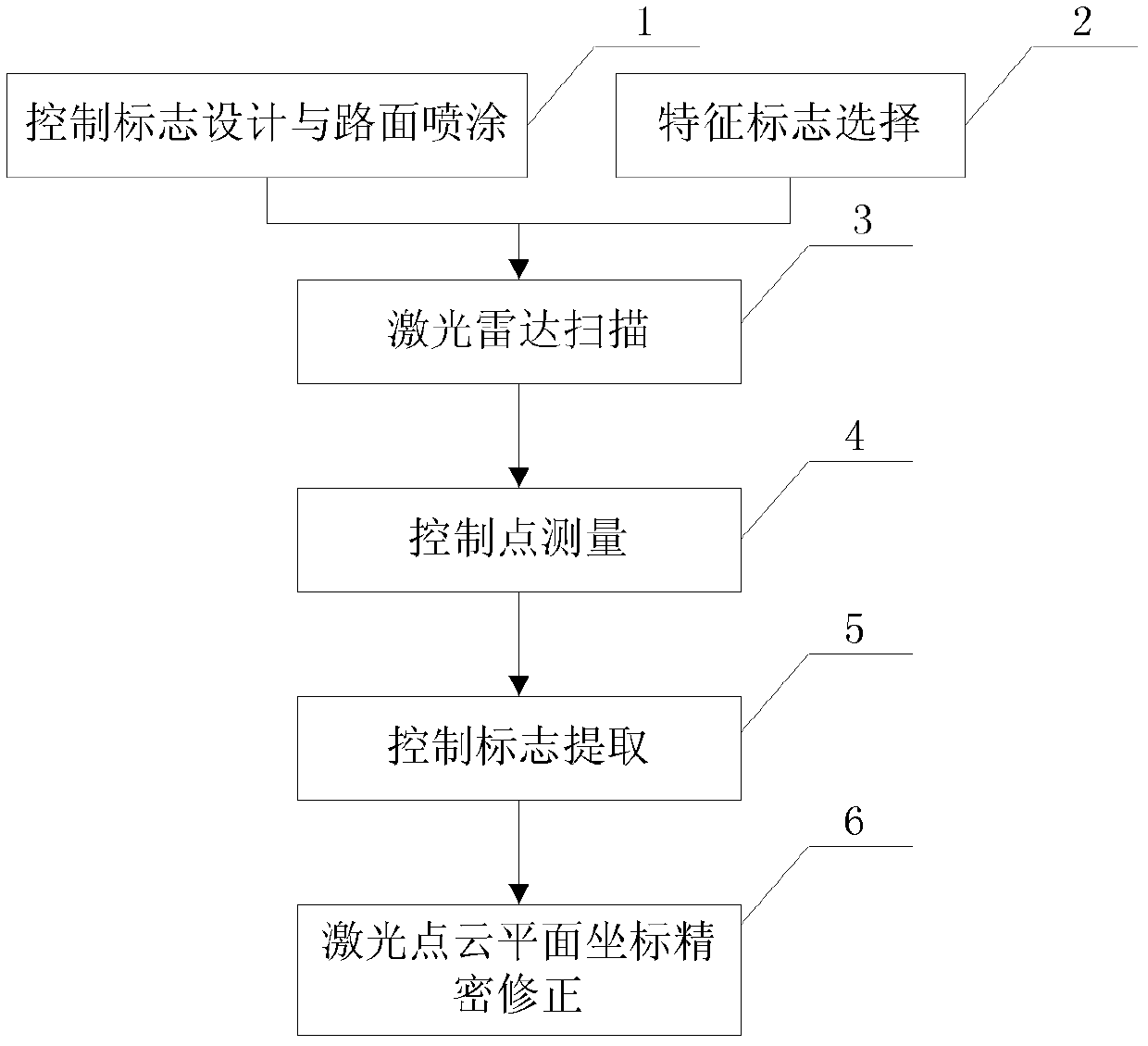
[0032] A precision correction method for laser radar scanning measurement plane coordinates, the flow chart of which is as follows figure 1 shown.

[0033] The specific steps are described in detail as follows:

[0034] The first step, control logo design and spraying 1;

[0035] Before lidar scanning, control signs need to be laid out along the existing road surface as control points. The specific layout method is as follows:

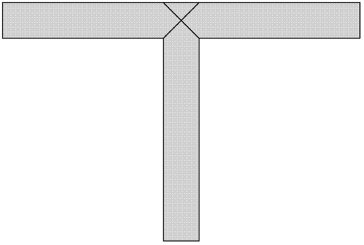
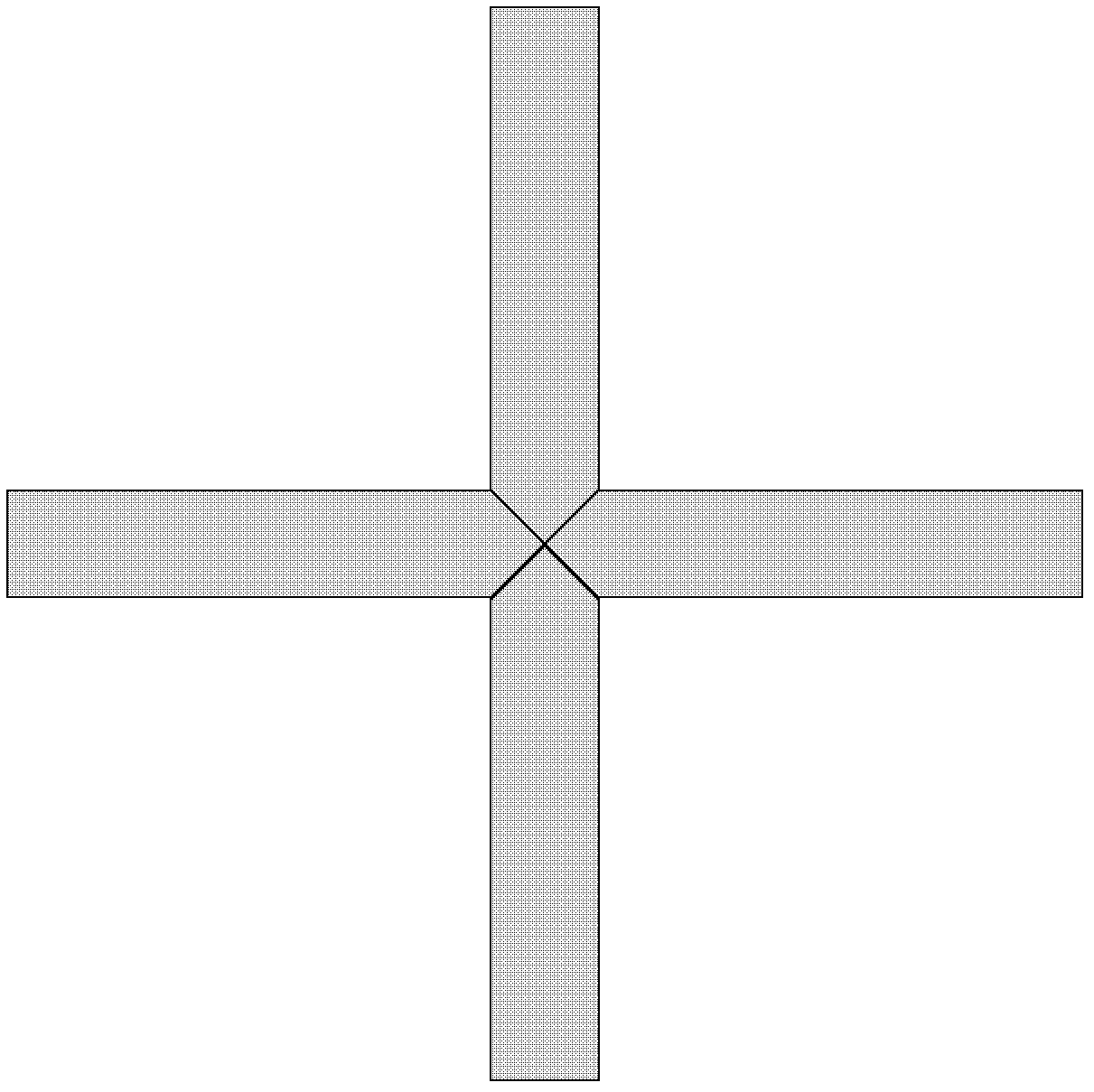
[0036] a. Control the shape of the sign. The shape of the control flag is "┳" or "╋". The width of each side of the "┳" control sign is 0.15m, the length of the long side is 1.5m, and the length of the short side is 1.0m; the width of each side of the "╋" control sign is 0.15m, and the length is 1.5m. The intersection point of the two oblique lines in the center of the con...


PUM


Abstract

The invention discloses a precise plane coordinate correction method in laser radar scanning measurement. The method comprises the following steps of: a, designing and spraying a control sign: arranging control signs along the path in a staggered form on the two sides of a highway; b, selecting a control point for the feature signs formed by two crossed straight lines along the existing road; c, laser radar scanning: determining the laser radar scanning measurement mode; d, measuring a control point, wherein the control point plane measurement adopts GPS (global position system) static positioning measurement, and a net structure is formed; e, controlling sign extraction: accurately extracting the position of the laser radar point cloud data plane of the control sign by use of the information of the laser radar point cloud data; and f, precisely correcting the laser radar point cloud plane coordinate: performing precise plane coordinate processing on the laser data according to the GPS measurement result at the control point and the laser radar point cloud extraction result of the control sign. The method has high precision, low cost and high efficiency, and is easy to implement, simple and convenient to operate and suitable for precise plane coordinate correction in the laser radar scanning measurement for road reconstruction and expansion.

Description

technical field [0001] The present invention relates to the technical field of highway survey and design, and more specifically relates to a precise correction method for laser radar scanning measurement plane coordinates. The construction of the expansion project requires accurate three-dimensional spatial information of the existing roads. Background technique [0002] Accurate acquisition of 3D information such as roads and their auxiliary structures is an important prerequisite for road reconstruction and expansion. For highway reconstruction and expansion projects, in order to maximize the use of existing roads and realize the precise splicing of bridges, roadbeds and other structures, compared with new road projects, it has higher requirements for measurement accuracy. The existing road reconstruction and expansion in my country mainly adopts the method of aerial photogrammetry supplemented by GPS RTK measurement and precision leveling, but this method is difficult to...

Claims


Application Information

Patent Timeline
Patent Type & Authority Patents(China)
IPC IPC(8): G01C7/04
Inventor 陈楚江赵喜安余绍淮明洋李海亮张霄王丽园余飞
Owner CCCC SECOND HIGHWAY CONSULTANTS CO LTD
Why Eureka
Try Eureka