Heterogeneous geospatial data management technique based on spatial object generalized model and grid body indexing
A technology of geospatial data and spatial objects, applied in the field of geographic information, to improve decentralized and independent management, ensure consistency and integrity, and improve management security
- Summary
- Abstract
- Description
- Claims
- Application Information
AI Technical Summary
Problems solved by technology
Method used
Image

Examples
Embodiment Construction
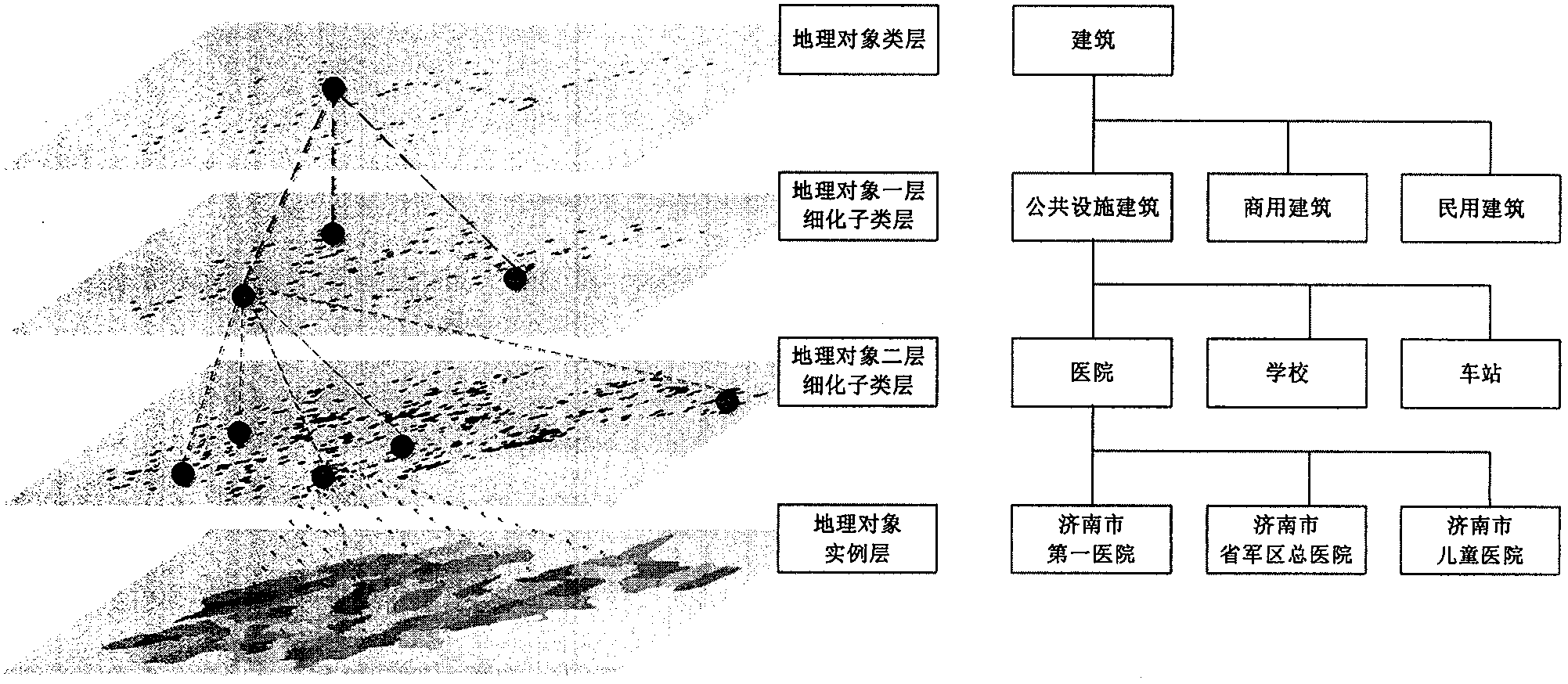
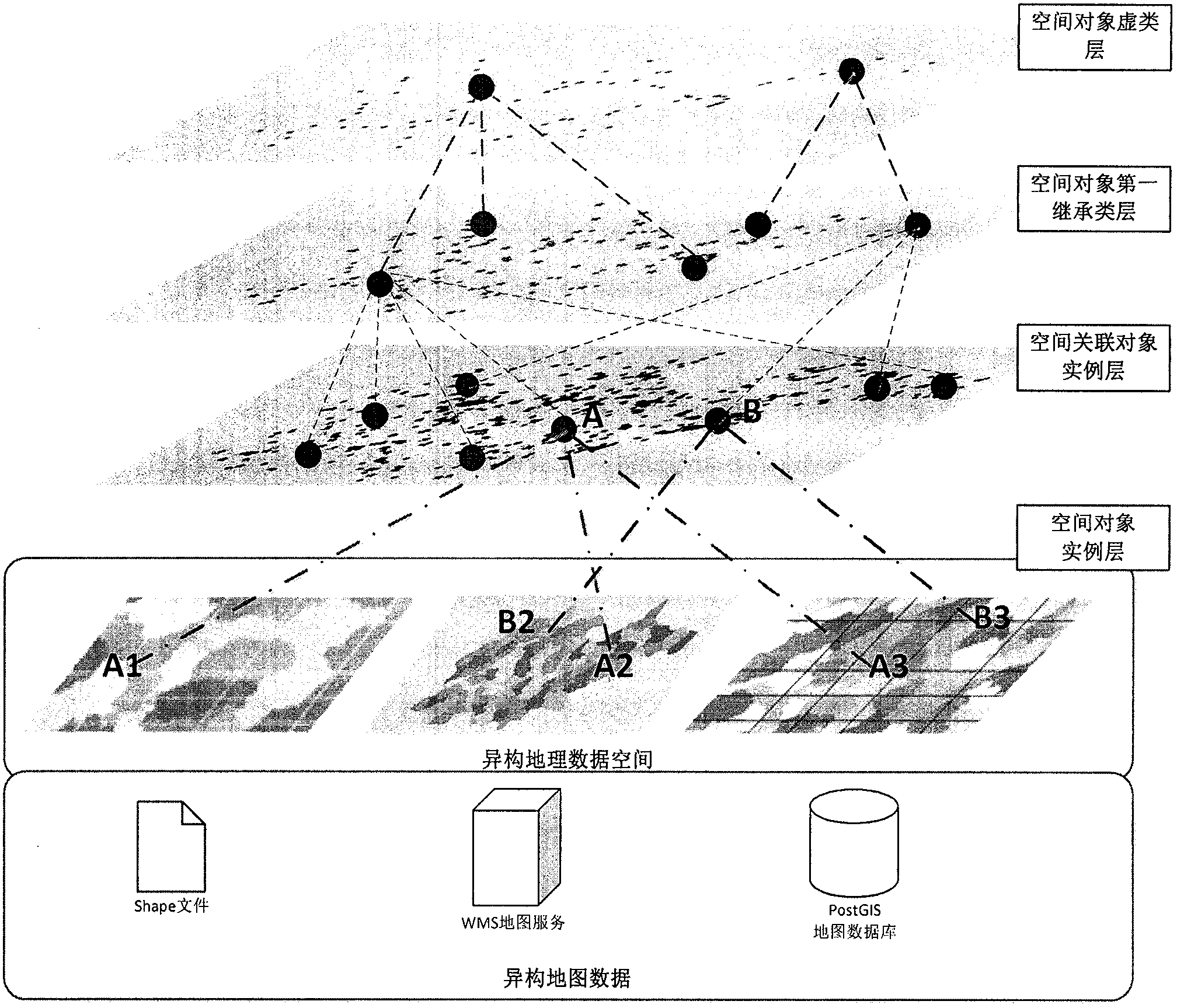
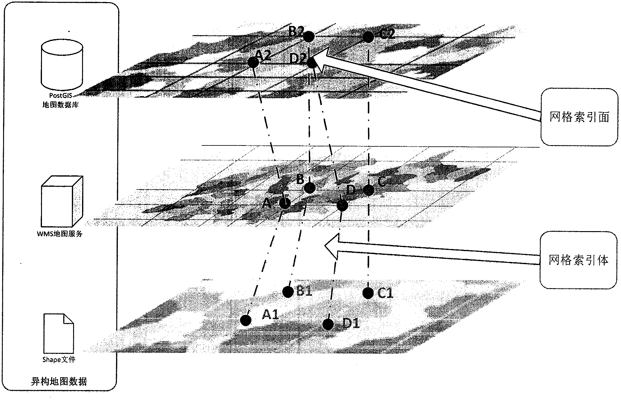
[0017] 1. Technical framework for heterogeneous geospatial data management based on spatial object classification model and grid index
[0018] figure 1 The basic framework of this heterogeneous geospatial data management technique is described. The unified management interface for heterogeneous spatial data (hereinafter referred to as "management interface") realizes the organizational management and efficient indexing of heterogeneous spatial data through two parts of work. On the one hand, the management interface unifies the classification model through spatial objects, and draws on ideas such as abstraction, inheritance, and instantiation of classes to integrate multi-source geospatial data (Shape files, ArcGrid files, GeoTiff files, PostGis and other spatial map databases, WMS map services, etc.) ) Classify and abstract according to the properties of spatial objects, and associate and merge objects according to their attributes such as longitude, latitude, and elevation...
PUM
 Abstract
Description
Claims
Application Information
 - Generate Ideas
- Intellectual Property
- Life Sciences
- Materials
- Tech Scout
- Unparalleled Data Quality
- Higher Quality Content
- 60% Fewer Hallucinations
Browse by: Latest US Patents, China's latest patents, Technical Efficacy Thesaurus, Application Domain, Technology Topic, Popular Technical Reports.
© 2025 PatSnap. All rights reserved.Legal|Privacy policy|Modern Slavery Act Transparency Statement|Sitemap|About US| Contact US: help@patsnap.com