

Method, relevant device and system of location and navigation of wireless sensor network nodes
A wireless sensor network and node positioning technology, which is applied in radio wave measurement systems, measurement devices, wireless communication, etc., can solve the problems of inability to meet the high-precision positioning of the blind navigation system, and the algorithm positioning accuracy is not high
- Summary
- Abstract
- Description
- Claims
- Application Information
AI Technical Summary
Problems solved by technology
Method used
Image

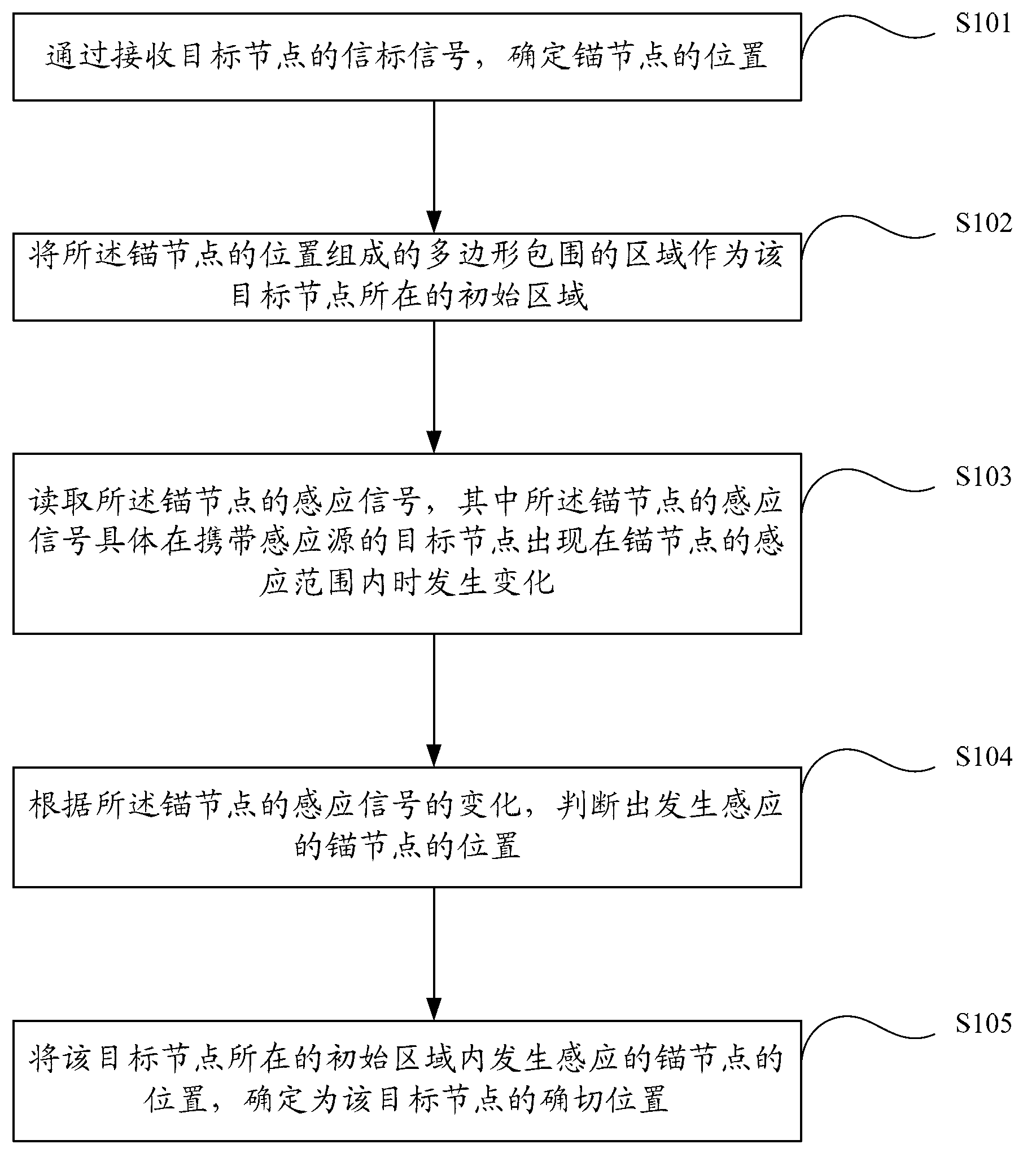
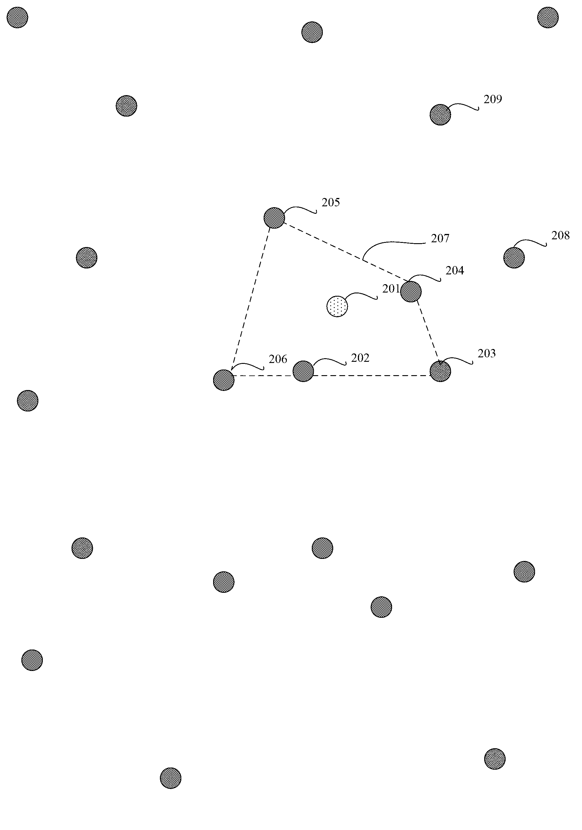
Examples
Embodiment 2
[0153] Corresponding to the above (embodiment 2): the method may also include:
[0154] receiving the sensing data of the ultrasonic sensor at the server end, the ultrasonic sensor and the target node are placed in the same user terminal;
[0155] The sensing data is analyzed on the server side, and if it is judged that an obstacle is sensed, the obstacle alarm information is sent from the server side to the user terminal through the network.
Embodiment 3
[0156]Corresponding to the above (embodiment three): the method may also include:
[0157] Receiving sensing data from a three-axis acceleration sensor at the server end, the three-axis acceleration sensor and the target node are placed in the same user terminal;
[0158] The sensing data is analyzed on the server side, and if it is judged that the three axial data fluctuations of the sensing data exceed the threshold, the fall alarm information is returned to the preset terminal on the server side.
[0159] For example, the fall alarm information may specifically be audio data of a fall alarm, the terminal preset at the server end may be an audio device at the server end, and the fall alarm information is returned to the terminal preset at the server end Specifically, returning the audio data of the fall alarm to the audio device preset on the server side and playing the audio data;
[0160] or,
[0161] The fall alarm information can specifically be a control instruction f...
Embodiment 4
[0165] Also includes:
[0166] receiving the input data received by the input device of the user terminal through the network at the server side;
[0167] On the server side, the output data is sent to the user terminal for output through the network.
[0168] For example, the input data may be destination location information. Correspondingly, the server side queries the route to the destination location according to the location of the target node. Specifically, when the server side receives the input data containing the destination location information, Executed on the server side, the input data may also be an emergency call number, and correspondingly, the server end may also dial an emergency call number according to the target number included in the input data.
[0169] For another example, the input data may specifically be video data of a wireless video device received at the server side through a network, and the wireless video device and the target node are placed ...
PUM
 Abstract
Description
Claims
Application Information