A GPS-based real-time navigation road condition system and navigation method

A technology of a navigation system and a navigation method, which is applied to the traffic control system, traffic control system, instruments and other directions of road vehicles, can solve problems such as driver's wrong guidance, driver misses the correct route, lag, etc., and achieves effective navigation information, Avoid untimely updates

Active Publication Date: 2015-07-29
天津爱迪尔软件开发有限公司
View PDF5 Cites 0 Cited by
  • Summary
  • Abstract
  • Description
  • Claims
  • Application Information

AI Technical Summary

Problems solved by technology

[0003] Due to the accuracy of GPS, the error is generally within tens of meters. For more complex intersections or overpasses, especially where there are several intersections or intersections with similar positions, this error can easily lead to fatal navigation errors.
Misleading drivers to miss the correct route
[0004] In addition, due to the rapid development of highways, there are often newly built routes, or due to other reasons, the road conditions in the city have undergone relatively large changes, but the electronic map built in GPS often needs to be updated for a period of time, which is somewhat different from the actual situation. A certain lag, easy to give wrong guidance to the driver

Method used


Image

  • A GPS-based real-time navigation road condition system and navigation method
  • A GPS-based real-time navigation road condition system and navigation method
  • A GPS-based real-time navigation road condition system and navigation method

Examples


Embodiment Construction

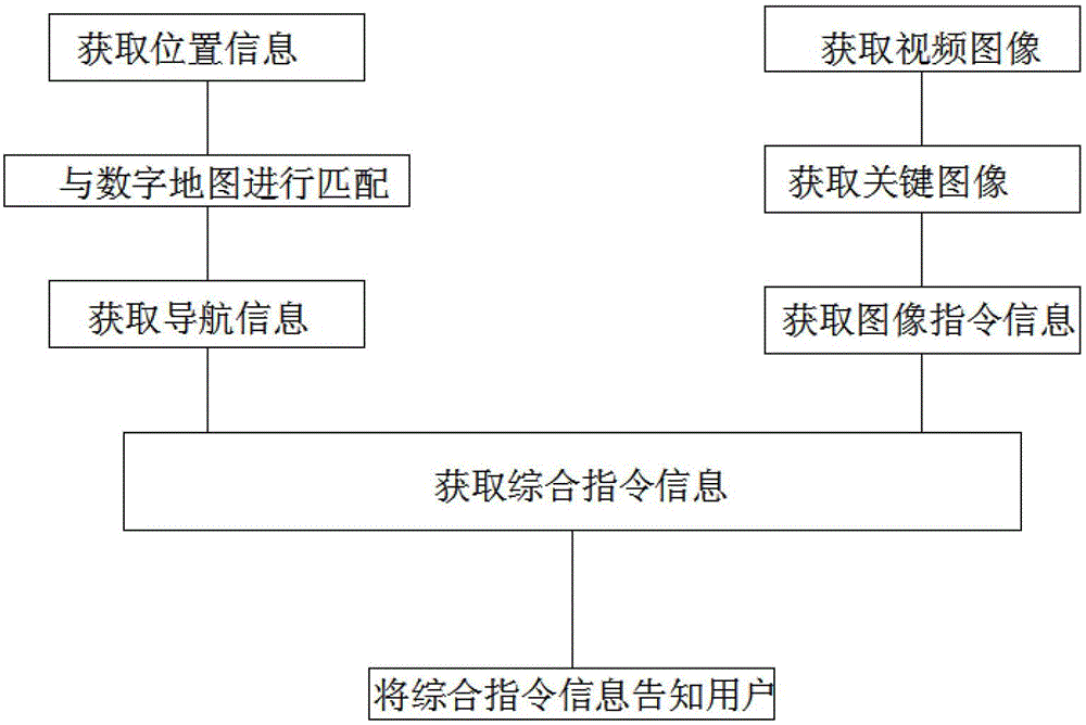
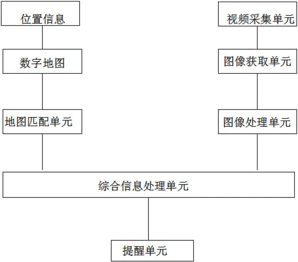
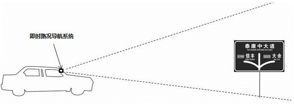
[0038] Such as figure 1 and figure 2 As shown, when the driver is driving the vehicle, the GPS positioning module receives the real-time location of the vehicle, combines the map matching unit with the electronic map, and combines the relevant information pre-stored on the electronic map to obtain the navigation information of the walking route. The video monitoring unit of this system starts to work to capture the instant changes of the surrounding road conditions. The image data unit samples the video images according to the set frequency. The frequency can be set according to the specific situation, and can be 1hz or higher Frequency, organize them into frame images with a certain time interval, and judge whether they belong to the key images predefined by the system according to the content in the frame images. Key images refer to images that may contain relevant visually visible traffic information such as road signs. The image processing unit processes the key image ob...


PUM


Abstract

The invention provides a real-time navigation road condition system based on global positioning system (GPS). The system comprises a positioning module, a digital map, a map matching unit and a reminding unit; the system is characterized by further comprising a video monitoring unit, an image acquiring unit, an image processing unit, an integrated information processing unit and the reminding unit, wherein the video monitoring unit is used for acquiring peripheral road condition videos; the image acquiring unit is used for acquiring key images from the videos obtained by the video monitoring unit; the image processing unit is used for obtaining the image command information from the key images; the integrated information processing unit is used for integrally processing GPS and image information and obtaining the final command information; and the reminding unit is used for informing users with the final command information. The system has the beneficial effects that more accurate and effective navigation information can be supplied for drivers more precisely, and conditions of conventional GPS navigation errors and the non-timely updated digital map are effectively avoided.

Description

technical field [0001] The invention belongs to the field of road condition navigation, in particular to a GPS-based real-time road condition navigation system and a navigation method. Background technique [0002] In recent years, under the background of maintaining rapid economic growth, automobiles have gradually entered ordinary households. The State Information Center predicts that my country will surpass the United States around 2015, and by then, the market capacity will exceed 17 million vehicles. At the same time, my country's road construction is also developing continuously, and tens of thousands of kilometers of roads are added every year. Drivers often need the assistance of a navigation system when passing through unfamiliar areas. The existing GPS navigation system relies on GPS and GIS. The system can accurately give the driver appropriate guidance. But the existing GPS navigation system mainly has the following problems: [0003] Due to the problem of GPS a...

Claims


Application Information

Patent Timeline
Patent Type & Authority Patents(China)
IPC IPC(8): G08G1/0969
Inventor 苏聪
Owner 天津爱迪尔软件开发有限公司
Why Eureka
Try Eureka