Optimizing method for overall transfer performance of public transport network based on gis-based maximum and shortest path length
A bus network and shortest path technology, applied in the field of network science and public transportation, can solve problems such as not many optimization algorithms, achieve the effect of improving service level, improving transfer performance, and improving performance
- Summary
- Abstract
- Description
- Claims
- Application Information
AI Technical Summary
Problems solved by technology
Method used
Image
Examples
Embodiment Construction
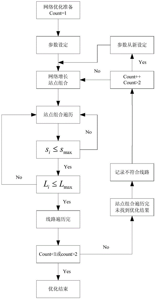
[0031] refer to figure 1 :
[0032] The method design is based on the shortest path length optimization method and characteristics of GIS, and the algorithm steps are described as follows:
[0033] Step 1: Sort the bus lines in the bus network from large to small according to the sum of the node degrees of the lines, and the network W to be optimized. Lines and stations are numbered and matched according to the original bus network data, and a SpaceL matrix is established according to the line sorting results.
[0034] Step 2: Set the maximum value L of the shortest path length of the bus network max , adjust the maximum distance s between the site and the alternative site max .
[0035] Step 3: Add the lines to the original bus network in order according to the line sorting results in step 1, and determine whether the maximum and shortest path length of the new original bus network is greater than the threshold L for each line added max , until the maximum shortest pat...
PUM
 Abstract
Description
Claims
Application Information
 - R&D
- Intellectual Property
- Life Sciences
- Materials
- Tech Scout
- Unparalleled Data Quality
- Higher Quality Content
- 60% Fewer Hallucinations
Browse by: Latest US Patents, China's latest patents, Technical Efficacy Thesaurus, Application Domain, Technology Topic, Popular Technical Reports.
© 2025 PatSnap. All rights reserved.Legal|Privacy policy|Modern Slavery Act Transparency Statement|Sitemap|About US| Contact US: help@patsnap.com

