Surface flow measurement method based on monostation shipborne high-frequency ground wave radar
A high-frequency ground wave radar and measurement method technology, applied in fluid velocity measurement, radio wave measurement system, measurement device, etc., can solve the problems of high measurement cost, small remote sensing area, difficult synchronization detection, etc. The effect of large remote sensing area and improving observation efficiency
- Summary
- Abstract
- Description
- Claims
- Application Information
AI Technical Summary
Problems solved by technology
Method used
Image
Examples
specific Embodiment approach 1
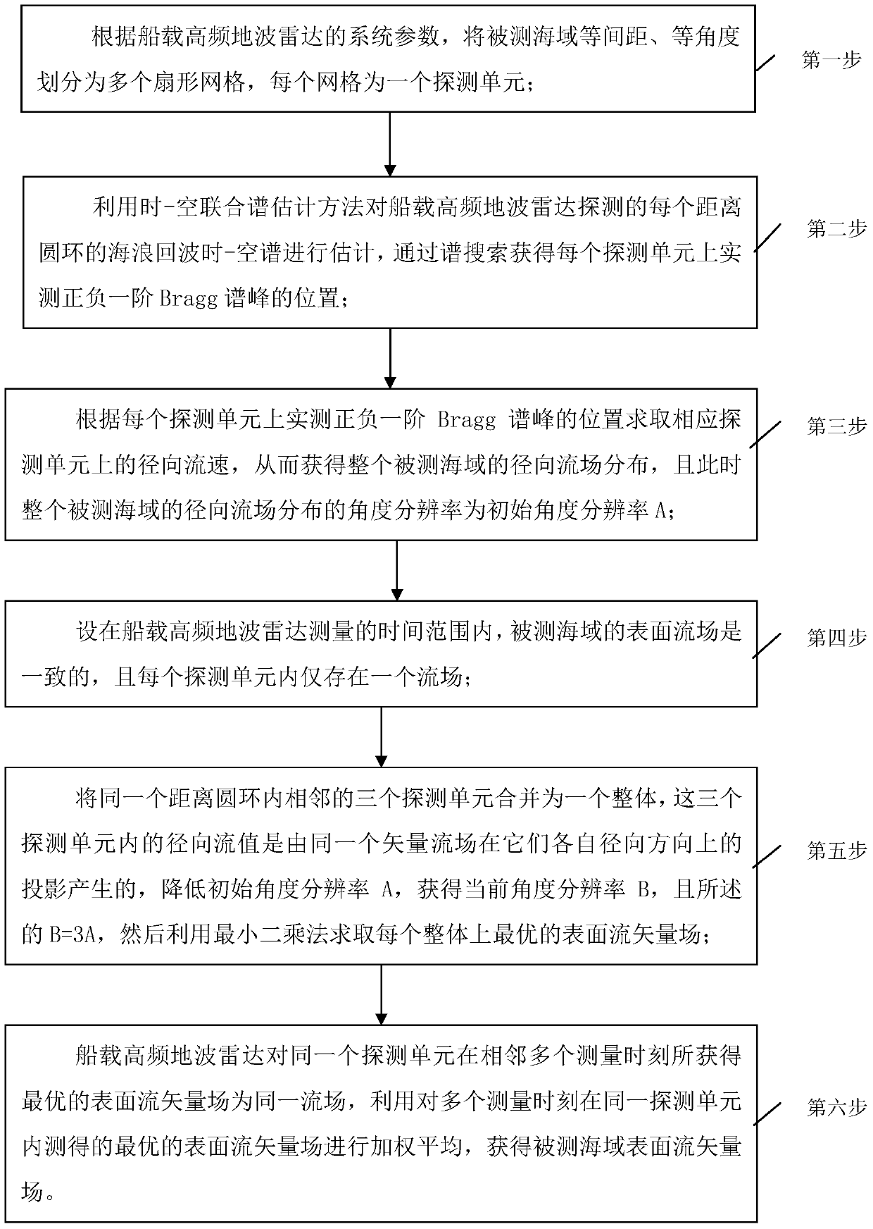
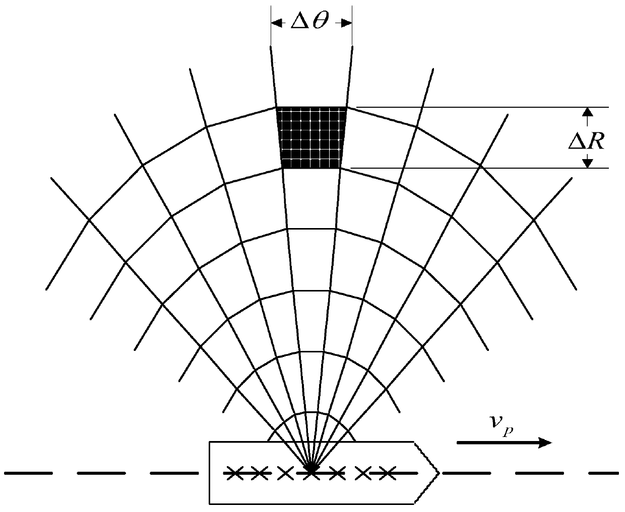
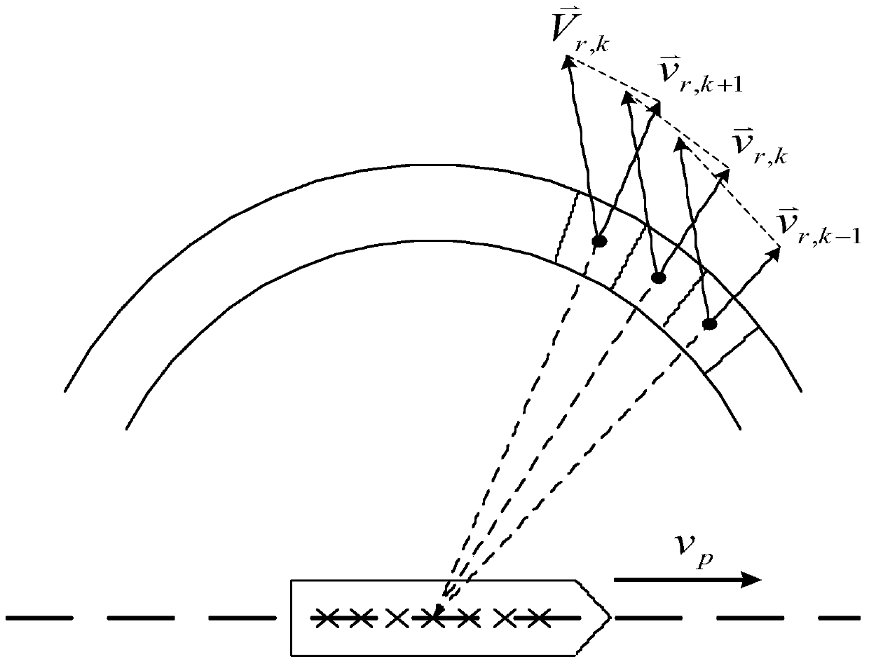
[0022] Specific implementation mode one: see figure 1 , 2 and 3 illustrate the present embodiment, a kind of surface flow measurement method based on single-station shipborne high-frequency ground wave radar described in the present embodiment, it comprises the following steps:
[0023] The first step is to divide the measured sea area into multiple fan-shaped grids with equal intervals and equal angles according to the system parameters of the ship-borne high-frequency ground wave radar, and each grid is a detection unit;
[0024] The second step is to use the time-space joint spectrum estimation method to estimate the time-space spectrum of the wave echo of each range ring detected by the ship-borne high-frequency ground wave radar, and obtain the measured positive and negative values on each detection unit through spectrum search. The position of the first-order Bragg spectrum peak;
[0025] The third step is to obtain the radial flow velocity on the corresponding detec...
specific Embodiment approach 2
[0030] Specific implementation mode two: see figure 1 , 2 and 3 illustrate this embodiment. The difference between this embodiment and the surface flow measurement method based on a single-station ship-borne high-frequency ground wave radar described in the first embodiment is that in the first step described, according to the ship-borne height The system parameters of the frequency surface wave radar, the specific process of dividing the measured sea area into multiple fan-shaped grids with equal intervals and equal angles is as follows:
[0031] Firstly, the measured sea area is divided into equal intervals according to the system distance resolution of the ship-borne high-frequency ground wave radar, and then the measured sea area is divided into equal angles by using the angular resolution obtained by the azimuth estimation algorithm at this time, so as to obtain the measured sea area All sector grids of .
specific Embodiment approach 3
[0032] Specific implementation mode three: see figure 1 , 2 and 3 illustrate this embodiment, the difference between this embodiment and the surface flow measurement method based on a single-station shipborne high-frequency ground wave radar described in the second embodiment is that in the second step, the time-space The joint spectrum estimation method estimates the space-time spectrum of the wave echo of each distance ring detected by the ship-borne high-frequency ground wave radar, and obtains the position of the positive and negative first-order Bragg spectrum peaks measured on each detection unit through spectrum search. The specific process is,
[0033] The second step, the wave echo covariance matrix R of each distance ring detected by the shipborne high-frequency ground wave radar oc Perform feature decomposition to get
[0034] R oc = Σ ...
PUM
 Abstract
Description
Claims
Application Information
 - R&D
- Intellectual Property
- Life Sciences
- Materials
- Tech Scout
- Unparalleled Data Quality
- Higher Quality Content
- 60% Fewer Hallucinations
Browse by: Latest US Patents, China's latest patents, Technical Efficacy Thesaurus, Application Domain, Technology Topic, Popular Technical Reports.
© 2025 PatSnap. All rights reserved.Legal|Privacy policy|Modern Slavery Act Transparency Statement|Sitemap|About US| Contact US: help@patsnap.com


