High-resolution remote sensing image vegetation index time sequence correcting method based on moderate resolution imaging spectroradiometer (MODIS) remote sensing image

A technology of time series and remote sensing images, applied in the field of geographic information systems, can solve problems such as instability of HJNDVI time series, inability to solve well, and inability to adjust

Inactive Publication Date: 2014-03-05
NANJING UNIV
View PDF3 Cites 11 Cited by
  • Summary
  • Abstract
  • Description
  • Claims
  • Application Information

AI Technical Summary

Problems solved by technology

However, the HJ NDVI time series still has the following problems: (1) The number of images acquired by HJ satellites per unit time is much smaller than that of MODIS, and the maximum value synthesis (MVC) method cannot be used to eliminate the influence of noise on the reduction of NDVI values; (2) HJ-1A / 1B remote sensing imagery does not provide products for pixel quality evaluation, and cannot adjust the generated NDVI time series according to its own platform to reduce the influence of noise-polluted phases
(3) The downloaded image has not undergone radiation correction and atmospheric correction, which also causes the instability of the HJ NDVI time series
But none of these can solve the above problems of HJ NDVI time series very well

Method used


Image

  • High-resolution remote sensing image vegetation index time sequence correcting method based on moderate resolution imaging spectroradiometer (MODIS) remote sensing image
  • High-resolution remote sensing image vegetation index time sequence correcting method based on moderate resolution imaging spectroradiometer (MODIS) remote sensing image
  • High-resolution remote sensing image vegetation index time sequence correcting method based on moderate resolution imaging spectroradiometer (MODIS) remote sensing image

Examples


Embodiment

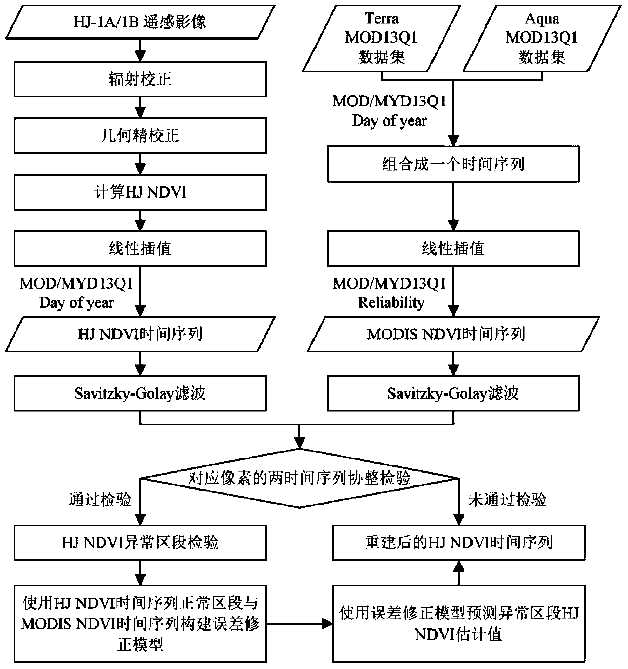
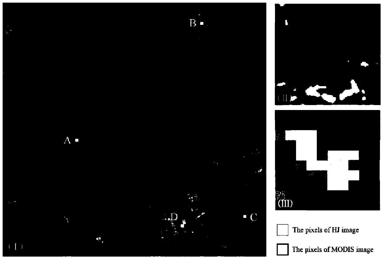
[0065] The coverage of remote sensing images used in this example is as follows: figure 2 As shown in , the study area is located in the Laoshan National Forest Park in Nanjing, China. The vegetation cover is a massive mixed forest where deciduous forest, evergreen broad-leaved forest and coniferous forest coexist. The rest of the area has land types such as bare land, reservoirs, and residential areas. This embodiment is realized by MATLAB R2012a.

[0066] Such as figure 1 As shown, the MODIS remote sensing image-based high-resolution remote sensing image vegetation index time series correction method of this embodiment includes the following steps:

[0067] 1) Obtain the HJ-1A / 1B remote sensing image data of the predetermined area and predetermined time period and the MODIS remote sensing data of the same time period in the area.

[0068] The MODIS remote sensing data in this embodiment include MODIS MOD13Q1 data and MODIS MYD13Q1 data, first obtained from NASA (website a...


PUM


Abstract

The invention discloses a high-resolution remote sensing image vegetation index time sequence correcting method based on a moderate resolution imaging spectroradiometer (MODIS) remote sensing image. The method comprises the four stages of construction of an HJ normalized difference vegetation index (NDVI) time sequence and a low-middle spatial resolution remote sending image NDVI time sequence, co-integration testing of an HJ time sequence and a time sequence of a corresponding pixel of a low-middle spatial resolution remote sensing image, testing of an abnormal section of the HJ NDVI time sequence, and correction of the abnormal section of the HJ NDVI time sequence. According to the method, the abnormity, caused by climate reasons, of a sequence curve form of the HJ NDVI time sequence can be corrected, the accuracy and the usability are improved, and effective data is provided for research on a biogeochemistry model under high temporal-spatial resolution. Meanwhile, the method is applied to the time sequence of a certain vegetation index from other high-middle-resolution remote sensing images.

Description

technical field [0001] The invention relates to a high-resolution remote sensing image vegetation index time series correction method based on MODIS remote sensing images, belonging to the technical field of geographic information systems. Background technique [0002] The time series of remote sensing images is an image sequence that uses a series of original images of remote sensing image data or their derived index images to arrange them in chronological order so that they can express the changing characteristics of remote sensing objects in time. It provides a data source for analyzing and using remote sensing images from the time dimension. [0003] Currently, the most widely used method is the vegetation index time series of remote sensing images with medium and low spatial resolution. The NDVI (normalized difference vegetation index, English is Normalized Difference Vegetation Index) time series product provided by the Moderate Resolution Imaging Spectroradiometer (M...

Claims


Application Information

Patent Timeline
Patent Type & Authority Applications(China)
IPC IPC(8): G06T7/00G01S7/497G01S17/88
Inventor 刘永学汪业成张群李满春王加胜程亮张荷霞孙超赵赛帅成王玉邹伟
Owner NANJING UNIV
Why Eureka
Try Eureka