
Method for automatically classifying satellite image scene based on morphological component analysis

A morphological component analysis, satellite image technology, applied in image analysis, image data processing, instruments, etc., to achieve the effect of easy implementation, high automatic recognition accuracy and recognition stability

Inactive Publication Date: 2014-07-30
FUDAN UNIV
View PDF2 Cites 4 Cited by
  • Summary
  • Abstract
  • Description
  • Claims
  • Application Information

AI Technical Summary

Problems solved by technology

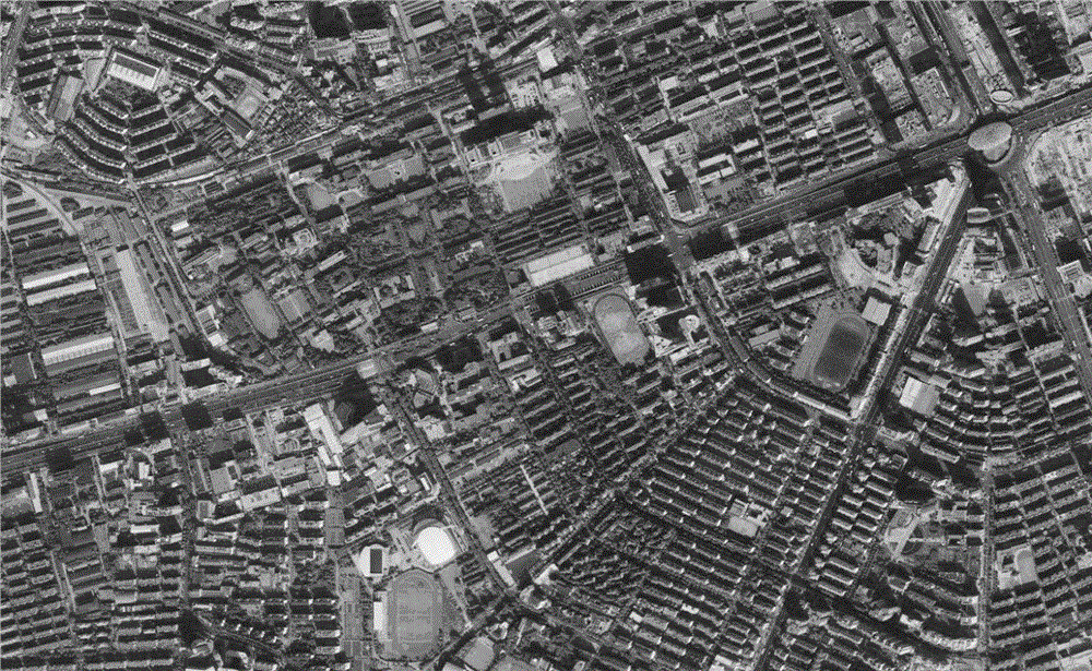
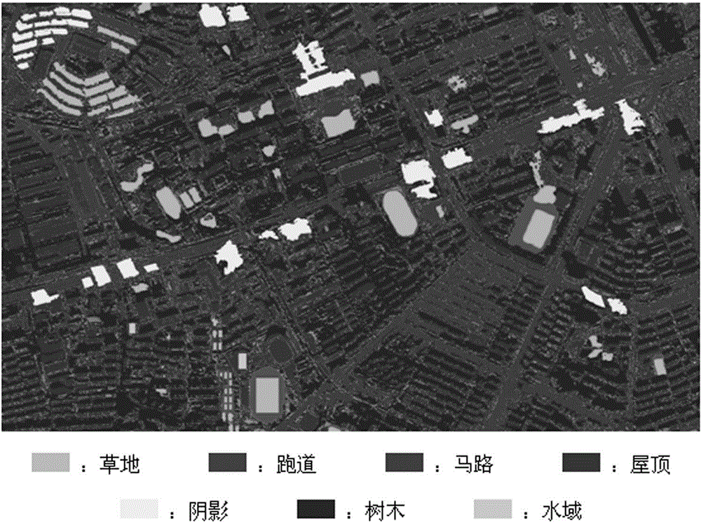
[0009] In order to overcome the deficiencies of the existing methods of manually identifying and marking satellite image training samples, the present invention provides a method for automatically classifying satellite image scenes based on morphological component analysis, which combines machine vision methods and is easy to implement on a computer , has high automatic recognition accuracy and recognition stability, and can effectively meet the challenges encountered in the existing high-resolution satellite image classification applications

Method used


Image

  • Method for automatically classifying satellite image scene based on morphological component analysis
  • Method for automatically classifying satellite image scene based on morphological component analysis
  • Method for automatically classifying satellite image scene based on morphological component analysis

Examples


Embodiment Construction

[0052] Below in conjunction with accompanying drawing and embodiment the present invention is described in further detail:

[0053] Step 1: Construct a dictionary matrix using independent meta-analysis

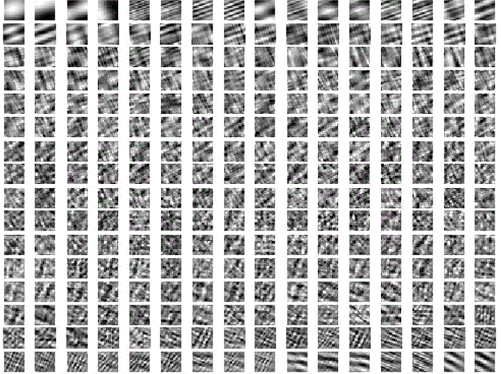
[0054] Classical independent element analysis is a signal processing method applied to blind source signal separation. The independent meta-analysis method can separate the mixed signal of multi-source signal into each independent component. An independent set of bases can be obtained by performing an independent meta-analysis of a satellite image for scene classification. These bases are eigenvectors of higher-order statistics, and the satellite image can be expressed as a linear combination of these independent bases. In the present invention, the dictionary matrix used for morphological component analysis is constructed by using the independent element analysis method .

[0055] Step 2: Morphological component decomposition of satellite imagery

[0056] In order t...


PUM


Abstract

The invention belongs to the technical field of remote sensing data application and satellite image processing and particularly relates to a method for automatically classifying a satellite image scene based on morphological component analysis. The method comprises the following steps of (1) constructing a dictionary matrix through an independent meta-analysis method; (2) decomposing morphological components of a satellite image based on the morphological component analysis theory; (3) decomposing the satellite image into a texture layer and a bottom layer; (4) performing quantitative calculation on the total probability of classification of an objective image scene according to a mechanism of maximum likelihood estimation with combination of features of the texture layer and the bottom layer, and automatically classifying the satellite image scene with the quantitative calculation on the total probability of classification of objective image scenes as the basis. The method combines with a machine vision method and can be applied to a computer easily. System construction is performed more quickly and accurately through the computer than through a manual method, artificial subjective factors are eliminated, and cost is reduced. Furthermore, the method has high automatic identification accuracy and identification stability.

Description

technical field [0001] The invention belongs to the technical field of remote sensing data application and satellite image processing, and in particular relates to a method for automatically classifying satellite image scenes based on morphological component analysis. Background technique [0002] In recent decades, remote sensing data applications and satellite image analysis have attracted widespread attention in many application fields, including mining, forestry, agriculture, military, surveying and mapping, urban planning, ocean monitoring, and disaster prevention and mitigation. Most of these applications can be attributed to a classification problem, which is equivalent to labeling different terrain regions for remote sensing imaging. In recent years, high-resolution satellite images have become easier and more convenient to obtain than ever before. At the same time, the extremely rich and valuable information contained in satellite images has enabled people to perfor...

Claims


Application Information

Patent Timeline
Patent Type & Authority Applications(China)
IPC IPC(8): G06K9/62G06T7/00
Inventor 余翀
Owner FUDAN UNIV
Learn More