Eureka AIR delivers breakthrough ideas for toughest innovation challenges, trusted by R&D personnel around the world.

Method and system of target immediate location and map establishing

A target and map technology, applied in the field of indoor target positioning and map construction, can solve the problems of manpower consumption, poor real-time performance, and large amount of calculation, etc., and achieve the effect of reducing costs

Active Publication Date: 2014-09-03
上海益航网络科技有限公司
View PDF10 Cites 30 Cited by
  • Summary
  • Abstract
  • Description
  • Claims
  • Application Information

AI Technical Summary

Problems solved by technology

However, when the number of landmark positions increases and the moving range of the robot becomes larger, the corresponding calculation amount of this method will increase, and the real-time performance will deteriorate.
In addition, this method needs to deploy the environment in advance and arrange the landmarks, which consumes manpower and material resources

Method used


Image

  • Method and system of target immediate location and map establishing
  • Method and system of target immediate location and map establishing
  • Method and system of target immediate location and map establishing

Examples


Embodiment Construction

[0026] Below in conjunction with accompanying drawing, invention is described in further detail.

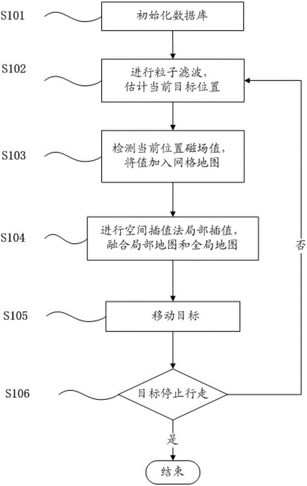
[0027] figure 1 It is a schematic diagram of the steps of the method for instant target location and map construction of the geomagnetic field in an embodiment of the present invention. Such as figure 1 As shown, the steps of the real-time target positioning and map construction method of an embodiment of the present invention include:

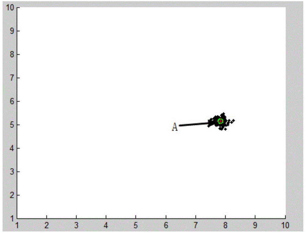
[0028] Step S101: Carry out on-the-spot measurement of the activity area where the target to be positioned is located (in this example, an activity room is taken as an example), obtain an indoor plan, and initialize the plan with a simulated grid map. The target to be positioned is combined with the data of the internal sensor of the target (l i , θ i ) among them, l i is the moving distance of the ith time, θ i is the deflection angle of the i-th movement. Determine its position in the simulation's initialization grid map. figure 2 The ...


PUM


Abstract

The invention discloses a method and a system of a target immediate location and map establishing. The method comprises the following steps of (1) carrying out immediate location on a moving target in a moving range; (2) immediately updating a geomagnetic field map of the movable range of the target according to the location of the moving target; (3) locating the next movable position of the target according to the updated geomagnetic field map; and repeatedly executing the step (2) and (3) to until the target stops to move. The method provided by the invention can achieve the purpose of immediate target location and accurate geomagnetic field map establishing of the indoor target under the condition that a magnetic field map cannot be detected indoors.

Description

technical field [0001] The invention relates to the field of indoor positioning and map construction, in particular to a method and system for combining indoor target positioning and map construction. Background technique [0002] The problem of simultaneous positioning and map construction is that the target uses noisy sensor data to construct the distribution of objects in the environment and determine its own position at the same time. A solution to the problem of simultaneous localization and mapping enables truly autonomous navigation of objects. In the past ten years, the problem of simultaneous localization and map construction has gradually become a research hotspot in the field of mobile robotics. A common practice is to use EKF (Extended Kalman Filter: Extended Kalman Filter) to simultaneously estimate the robot position and landmarks. However, when the number of landmark positions increases and the moving range of the robot becomes larger, the corresponding calc...

Claims


Application Information

Patent Timeline
IPC IPC(8): G01C21/08
CPCG01C21/08G01C21/206G01C21/12G01C21/383G01C21/3859
Inventor 王新珩张聪聪贾尚杰
Owner 上海益航网络科技有限公司
Why Eureka
Eureka Blog
Learn More