
A Method for Remote Sensing Quantitative Estimation of Forest Site Quality
A quality, woodland technology
- Summary
- Abstract
- Description
- Claims
- Application Information
AI Technical Summary
Problems solved by technology
Method used
Image

Examples
Embodiment 1
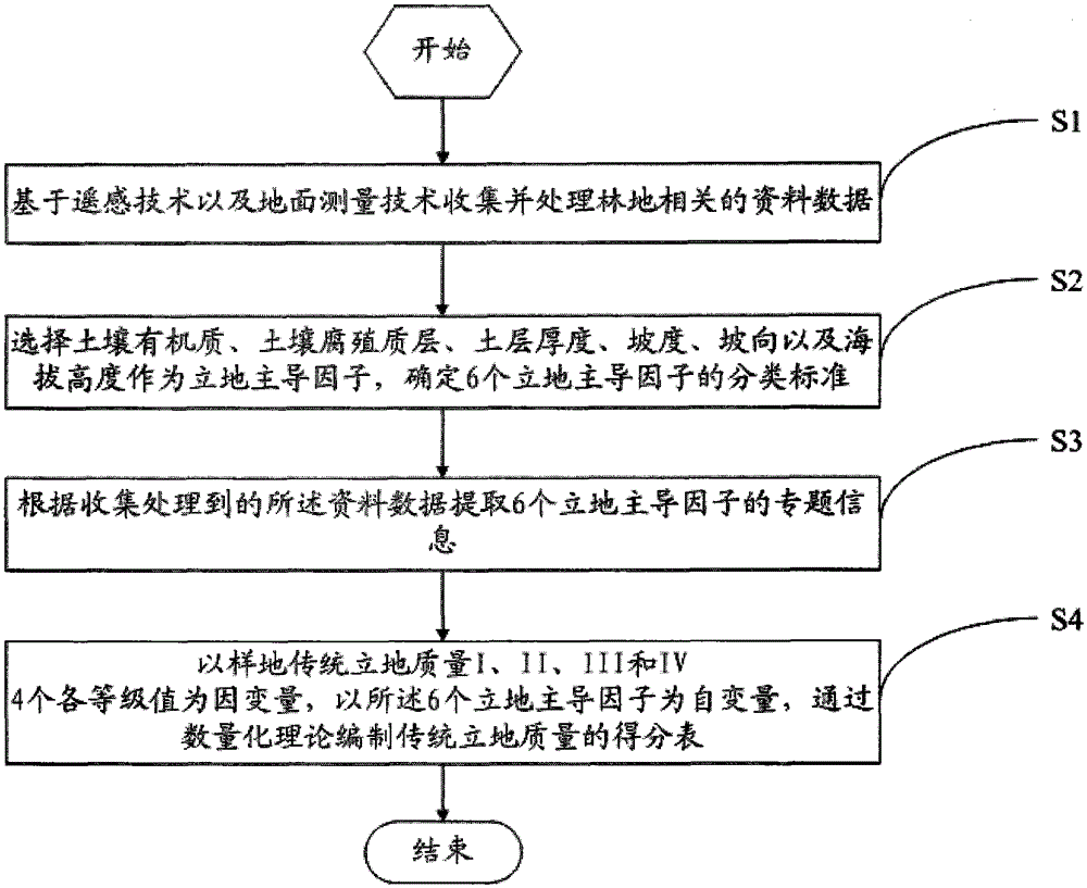
[0037] A method for remote sensing quantitative estimation of forest site quality, such as figure 1 shown, including the following steps:
[0038] S1. Collect and process woodland-related data based on remote sensing technology and ground measurement technology
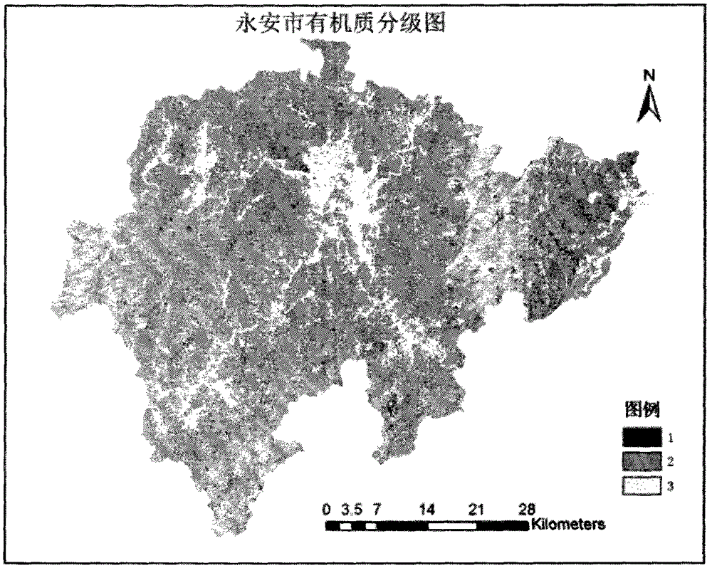
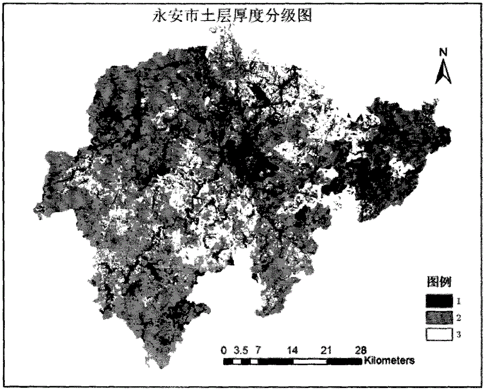
[0039] In step S1, the data includes: the organic matter content of soil sample points, the data of the second-class survey fixed sample plots, the 1:10000 digital elevation model, the 1:10000 topographic map, the regional ALOS remote sensing image map, and the light energy utilization of the vegetation in the region. Rate and the monthly precipitation distribution map and monthly average temperature distribution map of the remote sensing image over the same period. Among them, the specific sources of data acquisition are: 118 soil sample points in the field survey in 2008. The soil samples were collected at each sample point, and the organic matter content of each point was measured by the potassium bisulfate oxidat...
Embodiment 2
[0070] The 6 models of the model formed by the quantitative site grade score table in Table 3 in the above-mentioned embodiment 1 are tested, specifically including the following process:
[0071] (1) F test of multiple correlation coefficient R
[0072] The larger the multiple correlation coefficient is, the better the prediction of y is, otherwise the opposite is true. However, the size of the multiple correlation coefficient is related to the number of items, categories and sample plots. After passing the F test, the minimum F test value of each correlation coefficient is 6 independent variable items, F is 38.3766, the largest is one independent variable item, F is 65.7990, all greater than the specified F 0.05 , indicating that the six prediction equations are closely related.
[0073] (2) Partial correlation coefficient r u T test
[0074] Partial correlation coefficient r u is to deduct X u X u with Y i The correlation of , calculated with the partial correlation ...
Embodiment 3
[0077] Example 3 Accurate Analysis of Site Quality Remote Sensing Judgment
[0078] Utilize and refer to Table 2 "site quality grade evaluation table" in embodiment 1, can realize the evaluation of each site quality of Yong'an forest stand. First check the algebraic sum (i.e. "total score") of the score value of a certain site type in Table 3 "quantitative site quality score table" in Example 1, and then look for its "score value" in the "evaluation table". The location where the "total value" falls can determine the level of its site type quality. For example, the site conditions for transferring a small class from the small class survey database are:
[0079] Tree species: altitude 1500cm, slope 30, aspect grade 3, humus layer thickness 5cm, soil layer thickness 39cm, organic matter 14.2202. Check the quantitative site quality score table, and the algebraic sum of the scores is:
[0080] 0+0+0.1816-0.455-1.5722-0.1387=1.9843
[0081] This algebraic sum is the score value...
PUM
 Abstract
Description
Claims
Application Information