Water level response estimation method of river bed evolutions in different areas under hydrodynamism

A hydrodynamic and river bed technology, applied in water conservancy projects, water conservancy engineering equipment, buildings, etc., can solve problems such as damage, impact on farmland irrigation, urban drinking water safety, economic losses, etc.

Active Publication Date: 2014-09-17
FUJIAN PROVINCIAL INVESTIGATION DESIGN & RES INST OF WATER CONSERVANCY & HYDROPOWER
View PDF2 Cites 13 Cited by
  • Summary
  • Abstract
  • Description
  • Claims
  • Application Information

AI Technical Summary

Problems solved by technology

The influence of riverbed evolution involves a wide range of areas, and "one hair affects the whole body". Due to riverbed evolution, Shuikou Hydropower Station, the largest hydropower station in East China on the Minjiang River in Fujian Province, the Jinji large-scale sluice on the Jinjiang River, the Beiyin large-scale sluice on the Jiulong River, and the Xixi River Some of the functions of important water conservancy facilities such as large sluices have been lost, or have been severely damaged, or even rebuilt, causing huge economic losses; not only that, due to the evolution of the riverbed, there are Wanshou Bridge, Hongshan Ancient Bridge, and Jiangdong Ancient Bridge with hundreds of years of history on the Minjiang and Jiulong Rivers and Shiwuhubei were destroyed one after another. The evolution of the river bed also changed the hydrodynamic conditions. The estuary shrinks, the wetland disappears, and the salt tide goes up. Some water intakes in Fuzhou, the capital city of Fujian Province, change the flow conditions due to the evolution of the river bed. Chloride ions The concentration once exceeded ten times the standard, Zhangzhou Baoxin Water Diversion Project and Zhangzhou No. 2 Waterworks were scrapped due to changes in hydrodynamic conditions, seriously affecting farmland irrigation and urban drinking water safety

Method used


Image

  • Water level response estimation method of river bed evolutions in different areas under hydrodynamism
  • Water level response estimation method of river bed evolutions in different areas under hydrodynamism
  • Water level response estimation method of river bed evolutions in different areas under hydrodynamism

Examples


Embodiment Construction

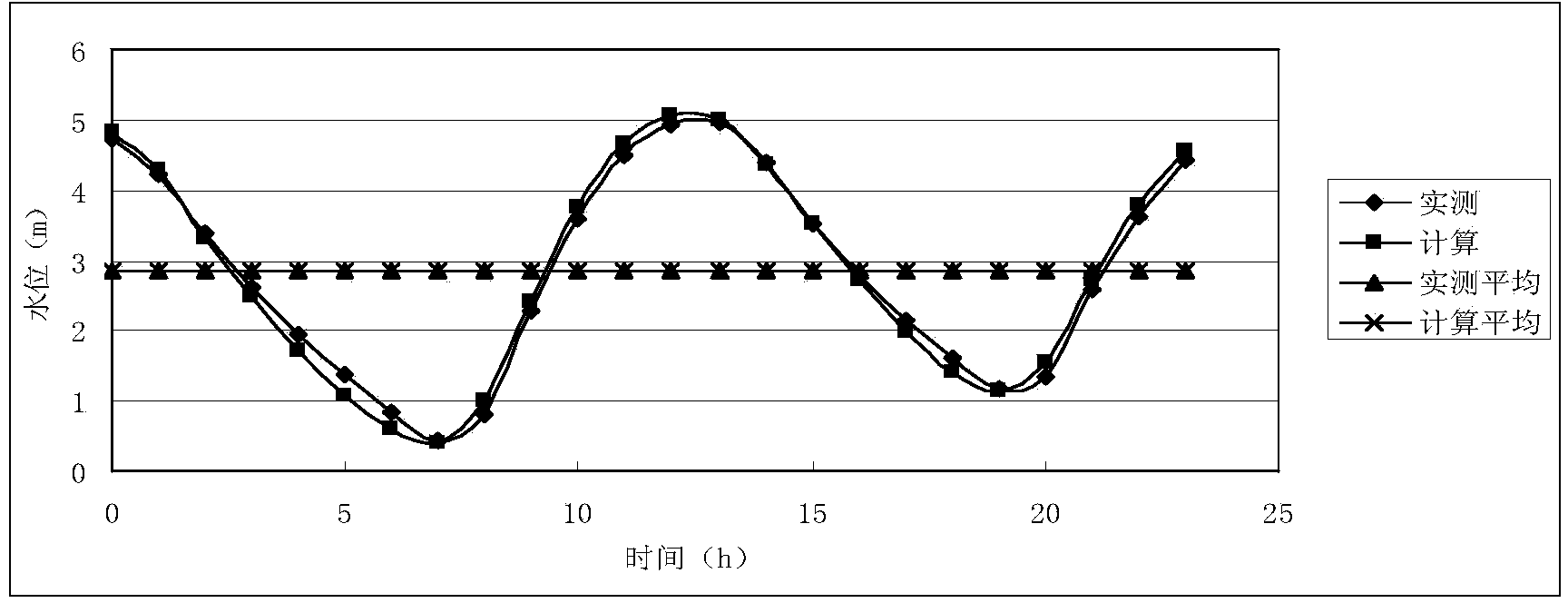
[0046] The water level response evaluation method of river bed evolution in different regions under the action of hydrodynamics is described below with a specific embodiment, comprising the following steps:

[0047] Step 1: Collect runoff data for 5,750 days from January 1995 to November 2010 after the completion of Shuikou Hydropower Station, the largest hydropower station in East China on the Minjiang River in Fujian Province, and determine the bed-making flow as the peak flow of 30,600m in 2005 3 / s and the peak discharge in 2006 was 29400m 3 / s; tidal pattern selection bed-making runoff occurrence day measured tidal level process at Guantou hydrological station in the Minjiang Estuary.

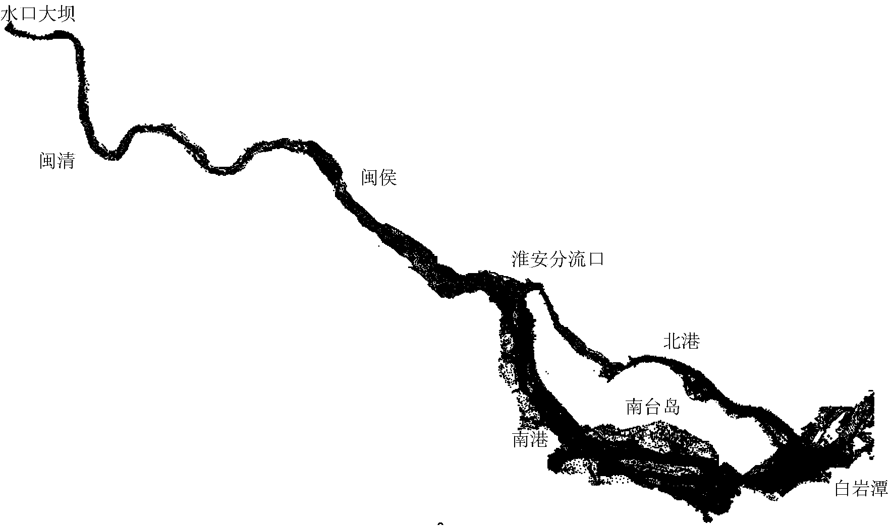
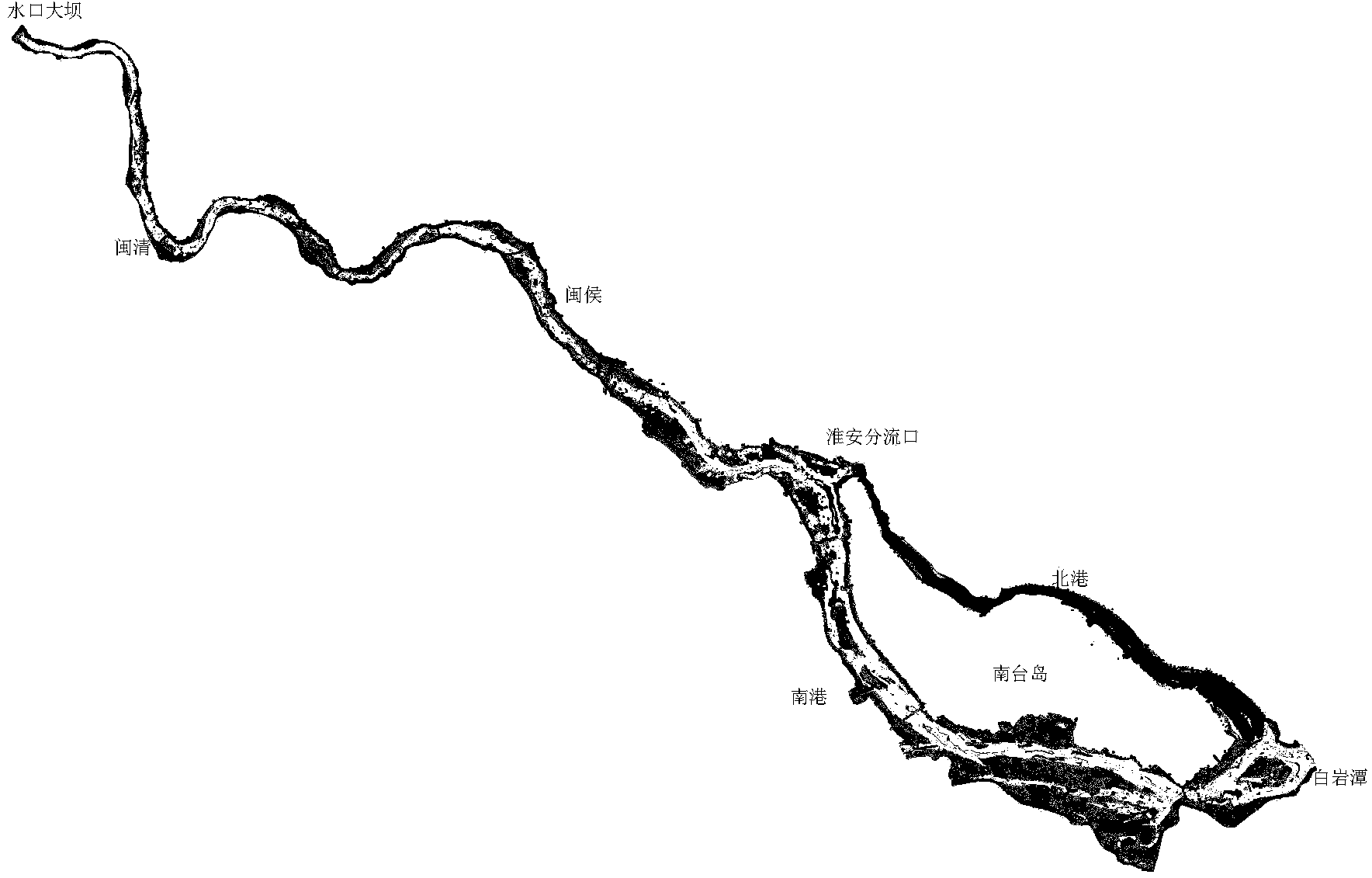
[0048] Step 2: Collect the year 2003 before the bed-forming runoff in the lower reaches of the Minjiang River (such as figure 1 shown) and the measured digital topographic map of the natural riverbed in 2008 after the bed-making runoff occurred (such as figure 2 shown).

[0049] Step 3...


PUM


Abstract

A water level response estimation method of river bed evolutions in different areas under hydrodynamism comprises the following steps: collecting runoff data of riverway areas to be estimated since hydrologic records, determining dominant discharge, and selecting a dominant formative runoff date according to the type of a tide to actually measure the tide level process at the river mouth; acquiring an actually measured natural river bed topographic map before and after the dominant formative runoff date; acquiring the geological data of the natural river bed, and determining the burial depth and the width of sand beds on cross sections; determining the characteristic parameters of bed load and suspended load through a soil test; establishing a flow and sediment mathematics calculation model according to the basis data; determining the roughness of the natural river bed through the water level verification, the sand content verification of the suspended load, and erosion-siltation verification of a terrain; analyzing the evolution property of the natural river bed under the common effect of dominant formative runoff and the tideway, and classifying the evolution property of the river bed in three groups under hydrodynamism; forecasting the future riverway water level change rule under hydrodynamism.

Description

【Technical field】 [0001] The invention relates to the technical development field of hydraulics and river dynamics, in particular to a water level response evaluation method for river bed evolution in different regions under hydrodynamic action. 【Background technique】 [0002] The natural phenomenon that the natural riverbed is deformed under the action of natural hydrodynamic forces such as runoff and ocean tide, or due to human intervention such as dredging and damming, is called riverbed evolution. The influence of riverbed evolution involves a wide range of areas, and "one hair affects the whole body". Due to riverbed evolution, Shuikou Hydropower Station, the largest hydropower station in East China on the Minjiang River in Fujian Province, the Jinji large-scale sluice on the Jinjiang River, the Beiyin large-scale sluice on the Jiulong River, and the Xixi River Some of the functions of important water conservancy facilities such as large sluices have been lost, or have ...

Claims


Application Information

Patent Timeline
Patent Type & Authority Applications(China)
IPC IPC(8): E02B1/00
Inventor 杨首龙林琳吴时强何承农叶丽清黄梅琼胡朝阳夏厚兴薛泷辉
Owner FUJIAN PROVINCIAL INVESTIGATION DESIGN & RES INST OF WATER CONSERVANCY & HYDROPOWER
Why Eureka
Try Eureka