

Bathymetric surveying method without tide observation based on quasigeoid refinement
A technology of geoid and measurement method, which is applied in the directions of measuring devices, surveying of open-air water sources, measuring the depth of open-air water sources, etc., can solve the problem of higher accuracy of water level, and achieve the goals of saving investment, wide application range, and improving accuracy and efficiency Effect
- Summary
- Abstract
- Description
- Claims
- Application Information
AI Technical Summary
Problems solved by technology
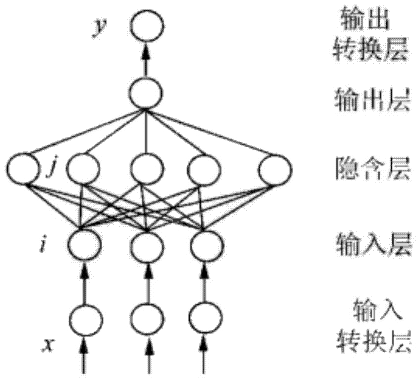
Method used
Image

Examples
example
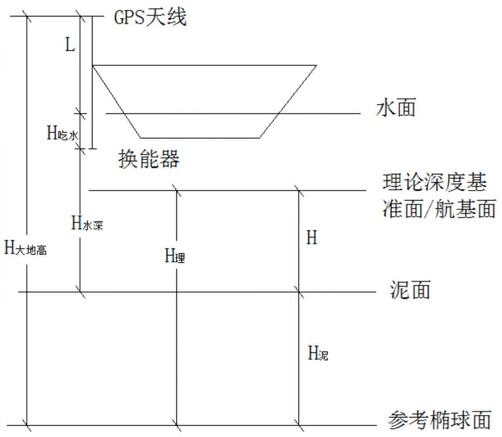
[0089] The following calculation example takes a water depth test as an example. The test location is on a typical river surface of the Yangtze River. The test instruments are Hi-Target V30 receiver (connected to JSCORS system) and HD-310 depth sounder. According to the non-tide bathymetry technology of the Changjiang section based on the refinement of the quasi-geoid proposed in this patent, the data is collected in the field, and then processed in-house.
[0090] The elevation of the mud surface relative to the reference ellipsoid is:
[0091] h 泥 =H 大地高 -L-H 吃水 -H 水深 (9)
[0092] The elevation of the mud surface relative to the theoretical depth datum is:
[0093] H=H 理 -H 泥 =H 理 -(H 大地高 -L-H 吃水 -H 水深 )
[0094] =(H 理 -H 大地高 )+L+H 吃水 +H 水深 (10)
[0095] If the theoretical depth datum in formula (10) is regarded as quasi-geoid, H 理 is the elevation difference between the quasi-geoid and the ellipsoid, that is, the elevation anomaly ζ, so f...
PUM
 Abstract
Description
Claims
Application Information