Construction method of an integrated urban dynamic traffic simulation platform
A traffic simulation and simulation platform technology, applied in the field of virtual simulation, can solve problems such as limited model flexibility and description ability, unsuitability for large-scale road network simulation, and insufficient simulation accuracy of key nodes, so as to reduce repetitive modeling work and Waste of data resources, strong path analysis function, and the effect of reducing manual participation
- Summary
- Abstract
- Description
- Claims
- Application Information
AI Technical Summary
Problems solved by technology
Method used
Image
Examples
no. 1 example
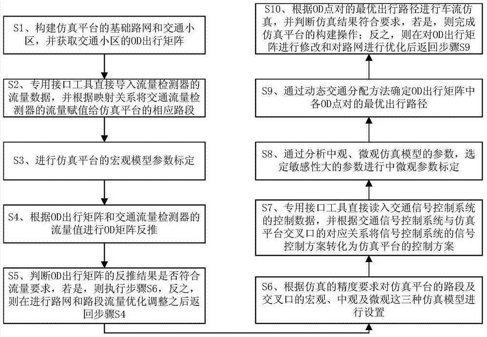
[0105] The specific implementation steps of a construction method of an integrated urban dynamic traffic simulation platform in this embodiment are as follows:
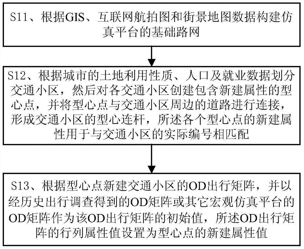
[0106] Step 1: Combining the city's GIS data, Internet aerial photos and street view maps to draw the city's traffic simulation road network, where the road network includes the city's entry and exit passages, urban expressways, main and secondary arterial roads and some branch roads, etc. The simulated road network of the embodiment needs to be detailed to the lanes and turns of each road section and intersection (including the channelization of the intersection, the traffic organization scheme of the road section and the intersection, etc.).
[0107] Step 2: Combining the data of the city's land use, population, and employment, the city is divided into traffic areas. The divided traffic areas should conform to the characteristics of residents' traffic trips; then establish the centroid points of each traffic area in ...
no. 2 example
[0142] Taking Guangzhou City as an example, adopt the method of the present invention to establish such as in TransModeler simulation software Figure 11 The specific process of the integrated dynamic traffic simulation platform based on multi-source heterogeneous data is as follows:
[0143]Firstly, the road network of Guangzhou is exported and saved as a .shp file through the GIS geographic information system, and the .shp file is imported into the TransModeler software as a new layer (that is, the road layer), and then the simulated road network is drawn according to the line shape of the road layer, and the completion Simulate the construction of the road network. Among them, the scope of the road network includes high-speed expressways, main and secondary arterial roads and some branch roads within the ring expressway, as well as the main passages in and out of the city connected with the ring expressway. Set with reference to aerial pictures and street view maps on the ...
PUM
 Abstract
Description
Claims
Application Information
 - R&D
- Intellectual Property
- Life Sciences
- Materials
- Tech Scout
- Unparalleled Data Quality
- Higher Quality Content
- 60% Fewer Hallucinations
Browse by: Latest US Patents, China's latest patents, Technical Efficacy Thesaurus, Application Domain, Technology Topic, Popular Technical Reports.
© 2025 PatSnap. All rights reserved.Legal|Privacy policy|Modern Slavery Act Transparency Statement|Sitemap|About US| Contact US: help@patsnap.com


