

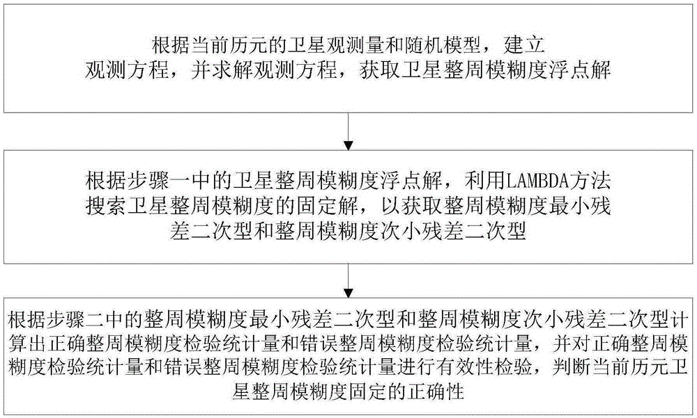
Integer ambiguity validity check method in satellite navigation system
A satellite navigation system, a technology of whole-week ambiguity, applied in the field of information processing, can solve the problems of affecting positioning accuracy, difficult to ensure the correctness of ambiguity fixation, poor ratio reliability, etc., to achieve the effect of improving reliability
- Summary
- Abstract
- Description
- Claims
- Application Information
AI Technical Summary
Problems solved by technology
Method used
Image

Examples
Embodiment 1
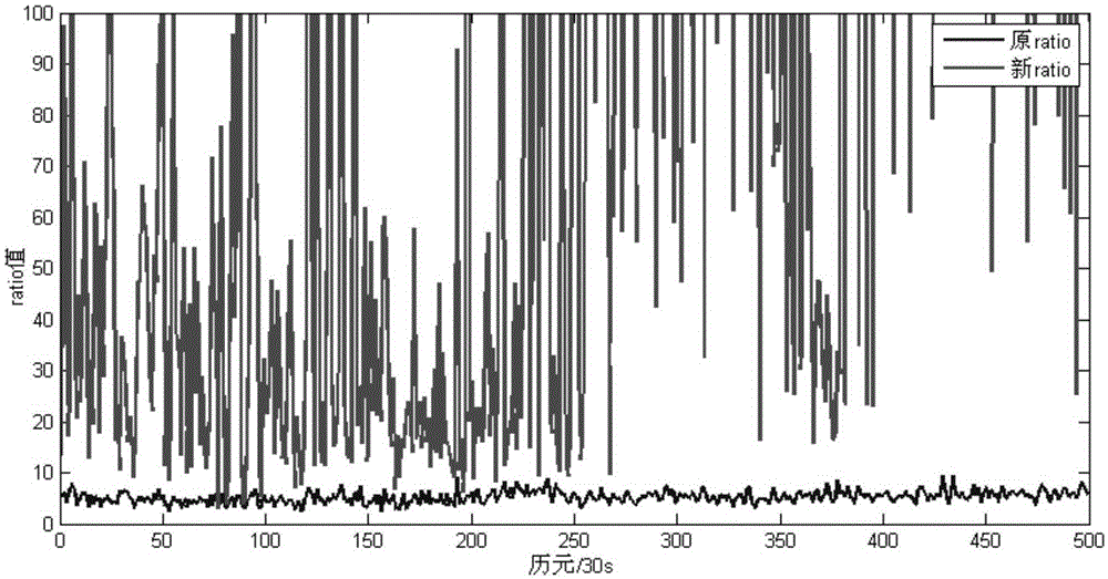
[0072] Example 1: Select an open area of the campus of China University of Petroleum, two measuring stations separated by 200 meters form a baseline, select 500 epochs in August 2, 2015, the sampling interval is 0.05s, and the data has no cycle slip phenomenon after detection . Dual-frequency GPS and Beidou satellites are used for multi-system fusion relative positioning, and the traditional F-ratio test method and the validity test method of the present invention are respectively used for validity test.
[0073] like figure 2 As shown, all the ambiguities of the whole week in Example 1 can be fixed correctly, from figure 2 It can be clearly seen from the figure that for the ambiguity that can be fixed correctly, the new ratio is larger than the original ratio, which shows that compared with the traditional F-ratio test method, the validity test of the present invention has been improved, thereby increasing the error correction. The discriminative degree of week ambiguit...
Embodiment 2
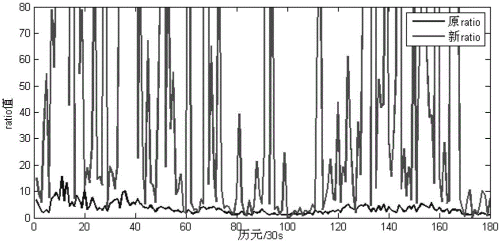
[0074] Example 2: Using an open area on the campus of Curtin University in Australia, two measuring stations separated by 4 meters form a baseline, and select from 0:00:00 on January 1, 2014 to 1:29 on January 1, 2014 The time period data of 30 seconds, the sampling interval is 30s, a total of 180 epochs, the data has no cycle slip phenomenon after testing. The dual-frequency GPS satellites are used for relative positioning, and then the LAMBDA method is used to fix the double-difference integer ambiguity in a single epoch, and the original ratio under the traditional quadratic statistic and the new ratio of the effectiveness testing method of the present invention are counted respectively.
[0075] In Example 2, from image 3 Select 10 epochs to count the success rate of the whole week ambiguity fixation, and take the whole week ambiguity static solution result as the true value. The statistical results are shown in Table 1. The new ratio of most epochs is larger than the ori...
PUM
 Abstract
Description
Claims
Application Information