

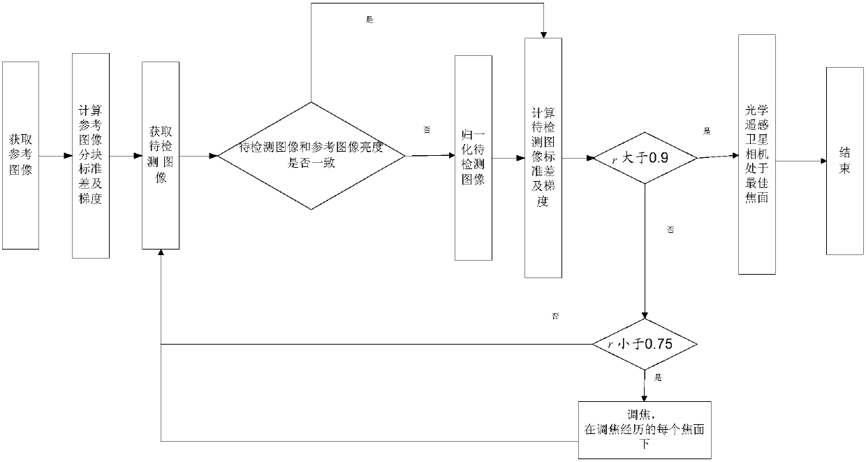
A method for determining the best focal plane of a high-resolution optical remote sensing satellite camera
An optical remote sensing and best focal plane technology, applied in the field of aerospace remote sensing image processing, can solve the problem of reducing the reliability of the comparison result between the reference image and the image to be detected, cannot accurately reflect the real texture characteristics of ground objects, and reduce the accuracy of the best focal plane. To eliminate the influence of sunlight, the brightness is consistent, and the reliability is guaranteed.
- Summary
- Abstract
- Description
- Claims
- Application Information
AI Technical Summary
Problems solved by technology
Method used
Image

Examples
Embodiment
[0101] The Gaofen-1 satellite is the first satellite of my country's high-resolution earth observation system. It has broken through the optical remote sensing technology combining high-resolution, multi-spectrum and wide coverage. The spatial resolution reaches 2 meters. It was launched on April 26, 2013. Launched successfully. The Gaofen-2 satellite was launched on August 19, 2014, with a resolution better than 1 meter, marking that my country's remote sensing satellites have entered the sub-meter "high score era". The two high-resolution satellites have been put into the on-orbit test phase, and have undergone multiple focusing experiments to ensure that the cameras work at the best focal plane and obtain high-resolution images.
[0102] The method provided by the present invention is used for daily quality monitoring of high-resolution satellites in orbit, and the image index scale factor of the image to be detected and the reference image is determined mainly through the b...
PUM
 Abstract
Description
Claims
Application Information