
A method of converting bim entity model into multi-level-of-detail gis standardized model

A technology with multiple levels of detail and solid models, applied in the field of geospatial information systems, can solve problems such as the difficulty in realizing the conversion and mapping between IFC format and CityGML format, and does not consider the screening and classification of indoor element information, so as to facilitate practical promotion and application, and facilitate Geometric Semantic Information Interoperability and Effect of Improving Transformation Quality

Inactive Publication Date: 2019-02-12
SOUTHWEST JIAOTONG UNIV +1
View PDF3 Cites 2 Cited by
  • Summary
  • Abstract
  • Description
  • Claims
  • Application Information

AI Technical Summary

Problems solved by technology

In addition, although software products such as IFCExplorer, BIMServer, and FeatureManipulation Engine (FME) have also developed the function of converting the IFC model to a multi-level CityGML model, they only extract all the information in the building interior, and do not consider the relationship between floors and rooms. Screening and classification of indoor element information makes it difficult to achieve complete conversion and mapping between IFC format and CityGML format

Method used


Image

  • A method of converting bim entity model into multi-level-of-detail gis standardized model
  • A method of converting bim entity model into multi-level-of-detail gis standardized model
  • A method of converting bim entity model into multi-level-of-detail gis standardized model

Examples


Embodiment 1

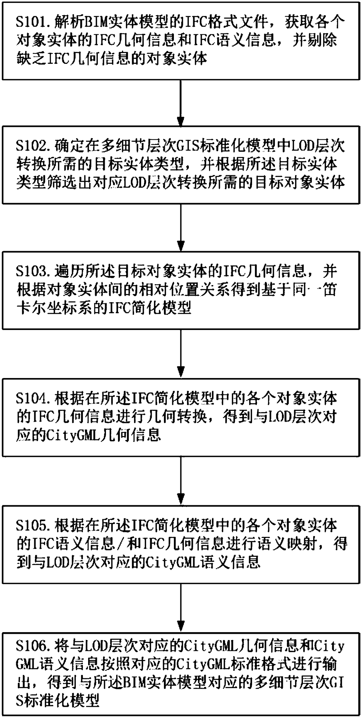
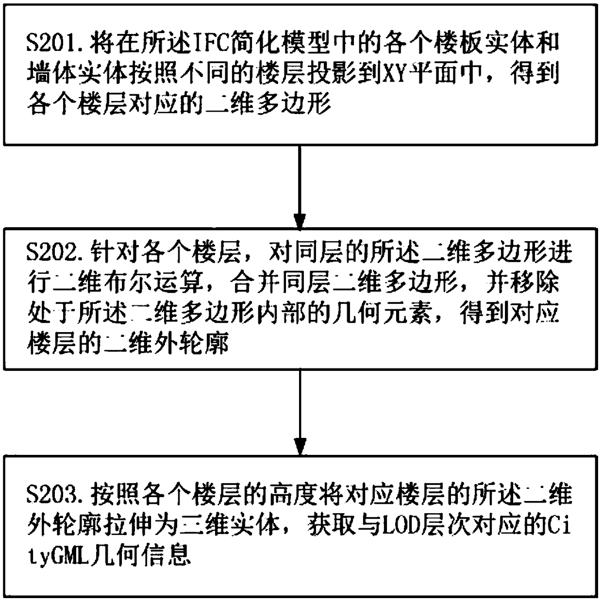
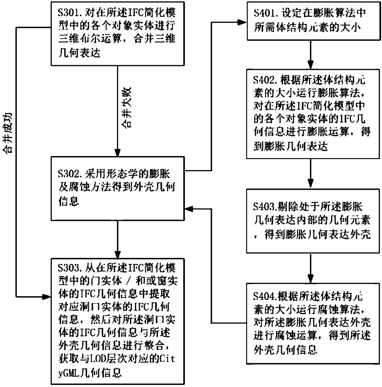
[0035] figure 1 Shows the flow chart of the method for converting the BIM entity model into a multi-level-of-detail GIS standardized model provided by the present invention, figure 2 It shows a schematic diagram of the geometric transformation process of the LOD1 or LOD2 level for the IFC simplified model provided by the present invention, image 3 It shows a schematic diagram of the geometric transformation process of the LOD3 level for the IFC simplified model provided by the present invention, Figure 4 It shows a schematic diagram of the geometric conversion process of the LOD4 level for the IFC simplified model provided by the present invention, Figure 5 It shows a schematic flow chart of semantic mapping according to the IFC semantic information and IFC geometric information of each object entity provided by the present invention, Figure 6 A schematic diagram showing the semantic information structure of the main IFC object entities in the existing IFC format, Fig...


PUM


Abstract

The present invention relates to the technical field of geospatial information systems and discloses a method for converting a BIM entity model into a multiple levels of details (LOD) GIS standardized model. Through a method of converting the BIM entity model into the multiple levels of details (LOD) GIS standardized model, the automatic conversion from the BIM entity model to the multiple levels of details (LOD) GIS standardized model is realized, a computer can conveniently execute the geometric semantic information interoperability between two models, the complete conversion and mapping between an IFC format and a CityGML format is realized, and the conversion quality is improved. In addition, the conversion method has the advantages of fast conversion speed and high conversion accuracy, and the practical promotion and application are facilitated.

Description

technical field [0001] The invention relates to the technical field of geographic spatial information systems, in particular to a method for converting a BIM entity model into a multi-level-of-detail GIS standardized model. Background technique [0002] With the increasing complexity of urban construction and management, higher requirements are put forward in terms of refinement, standardization and scientificity, and challenges from different fields are faced in engineering technology and scientific research. Relying on a single technical means has been difficult to meet the current There are needs. Multi-field information exchange, information sharing and collaborative work will become an important driving force for the development and construction of smart cities. Building Information Modeling (Building Information Modeling, BIM) is one of the most promising technologies in the Architecture, Engineering and Construction (AEC) industry. Through BIM technology, buildings ...

Claims


Application Information

Patent Timeline
Patent Type & Authority Patents(China)
IPC IPC(8): G06T17/05G06T19/20
CPCG06T17/05G06T19/20G06T2210/36
Inventor 朱庆汤圣君李佩瑶
Owner SOUTHWEST JIAOTONG UNIV
Learn More