Testing method for geographic information system software
A software testing method and geographic information system technology, applied in software testing/debugging, etc., can solve problems that are not suitable for geographic information system software
- Summary
- Abstract
- Description
- Claims
- Application Information
AI Technical Summary
Problems solved by technology
Method used
Image
Examples
Embodiment Construction
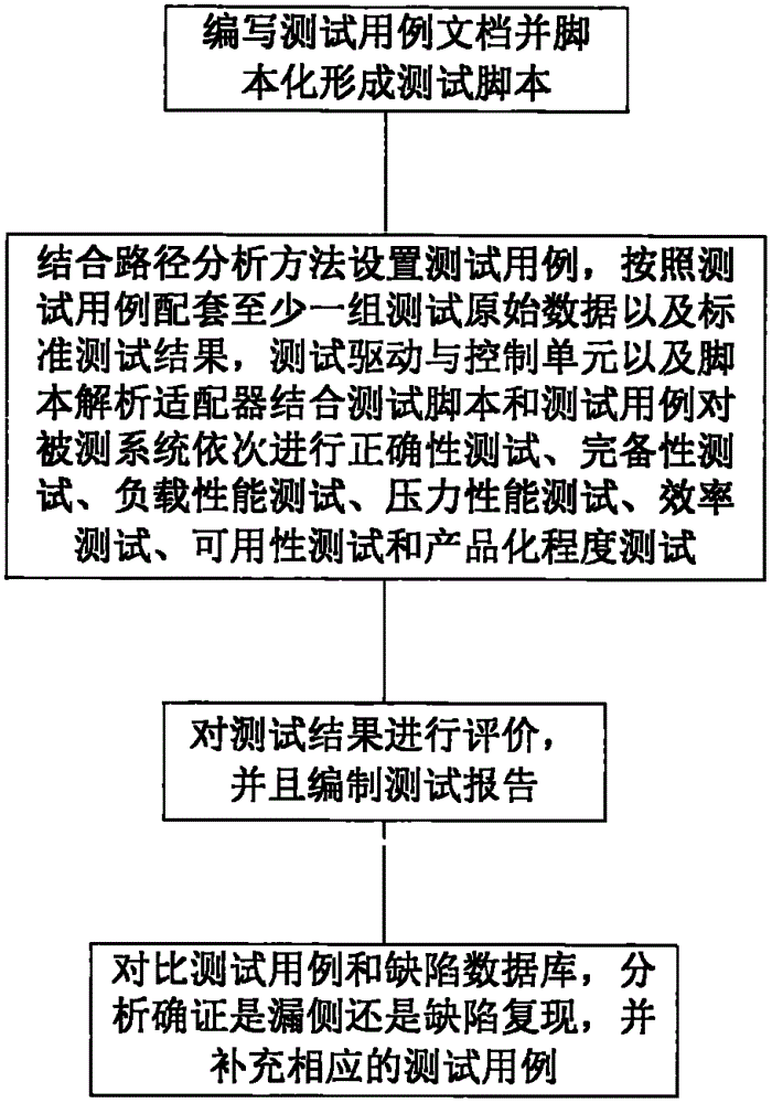
[0052] The present invention will be further described in detail below in conjunction with the accompanying drawings, so that those skilled in the art can implement it with reference to the description.
[0053] It should be understood that terms such as "having", "comprising" and "including" as used herein do not entail the presence or addition of one or more other elements or combinations thereof.
[0054] The functional completeness of basic geographic information software includes six categories, including data processing, establishment and management of geographic spatial databases, spatial analysis, 3D terrain models, visualization and mapping, and geographic information network services. Each category is divided into several subcategories. , and each subclass contains several functional items.
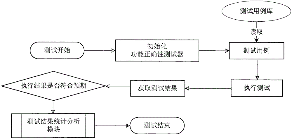
[0055] When implementing the test, the test case is used as the standard of software testing. Testers must strictly follow the test items and test steps of the test case to impl...
PUM
 Abstract
Description
Claims
Application Information
 - R&D
- Intellectual Property
- Life Sciences
- Materials
- Tech Scout
- Unparalleled Data Quality
- Higher Quality Content
- 60% Fewer Hallucinations
Browse by: Latest US Patents, China's latest patents, Technical Efficacy Thesaurus, Application Domain, Technology Topic, Popular Technical Reports.
© 2025 PatSnap. All rights reserved.Legal|Privacy policy|Modern Slavery Act Transparency Statement|Sitemap|About US| Contact US: help@patsnap.com


