Infrared ray positioning and illuminating type unmanned aerial vehicle for highway surveying

An infrared and unmanned aerial vehicle technology, applied in satellite radio beacon positioning systems, unmanned aircraft, radio wave measurement systems, etc., can solve the problems of unusable and little improvement in survey efficiency, and achieve convenient construction and labor. Effect of measurement error reduction

Pending Publication Date: 2017-05-10
苏州曾智沃德智能科技有限公司
View PDF0 Cites 9 Cited by
  • Summary
  • Abstract
  • Description
  • Claims
  • Application Information

AI Technical Summary

Problems solved by technology

[0003] The purpose of the present invention is to provide a highway survey drone with infrared positioning and lighting to solve the problems that the survey efficiency of the usual highway survey drone proposed in the above background technology is not greatly improved and cannot be used at night.

Method used


Image

  • Infrared ray positioning and illuminating type unmanned aerial vehicle for highway surveying
  • Infrared ray positioning and illuminating type unmanned aerial vehicle for highway surveying
  • Infrared ray positioning and illuminating type unmanned aerial vehicle for highway surveying

Examples


Embodiment Construction

[0017] The following will clearly and completely describe the technical solutions in the embodiments of the present invention with reference to the accompanying drawings in the embodiments of the present invention. Obviously, the described embodiments are only some, not all, embodiments of the present invention. Based on the embodiments of the present invention, all other embodiments obtained by persons of ordinary skill in the art without making creative efforts belong to the protection scope of the present invention.

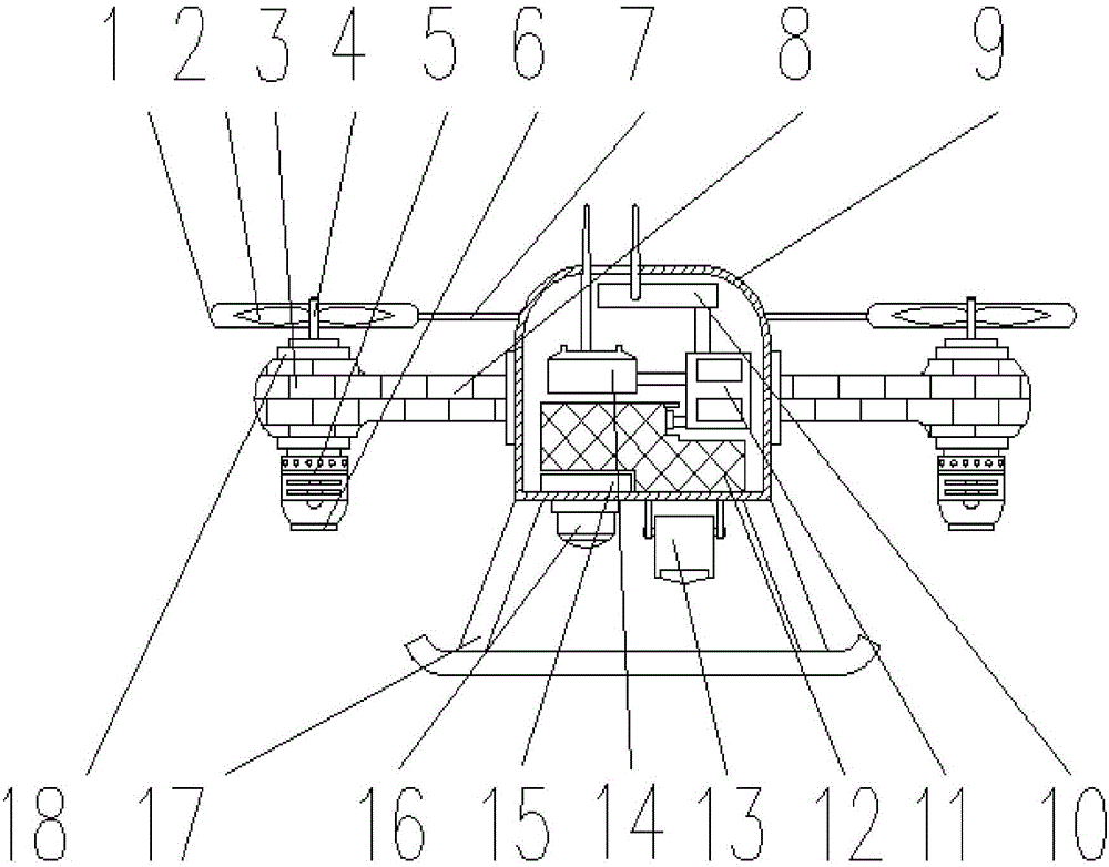
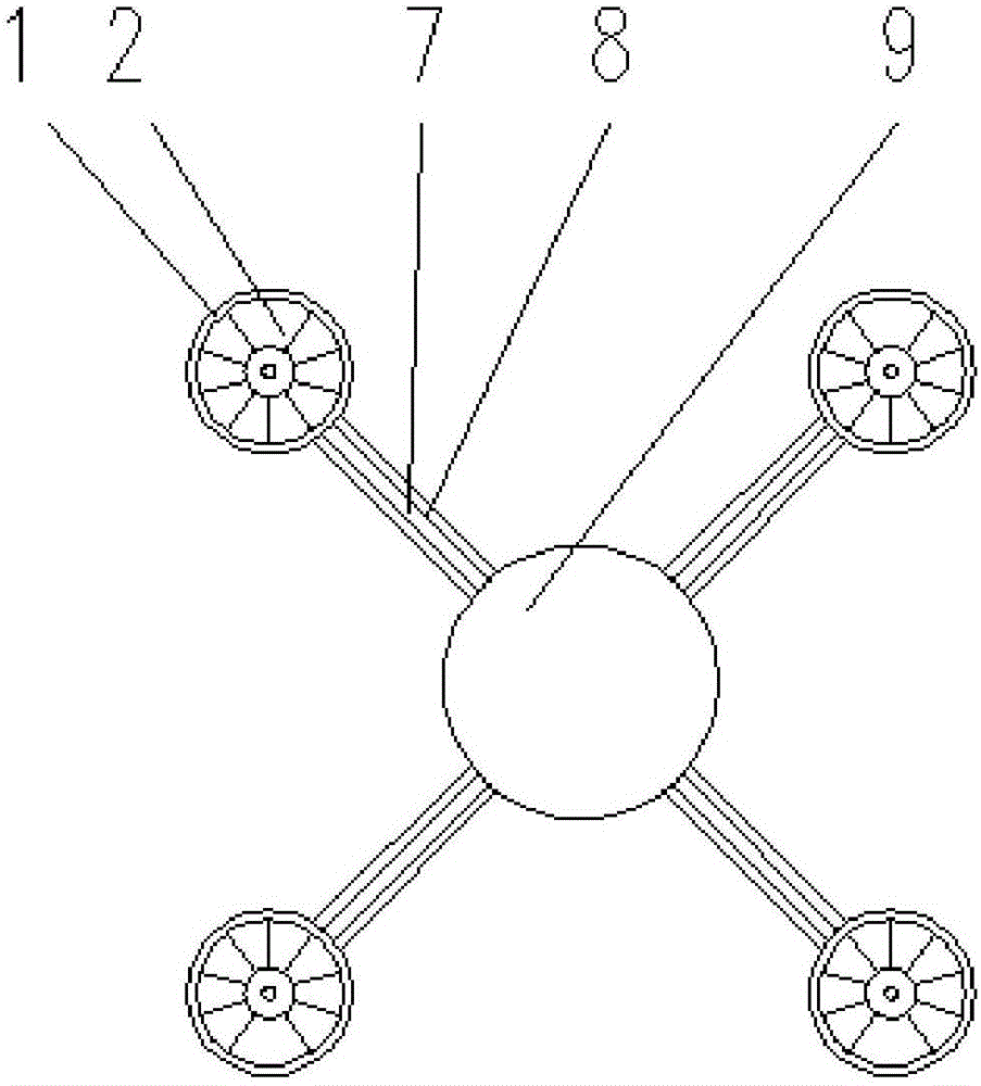
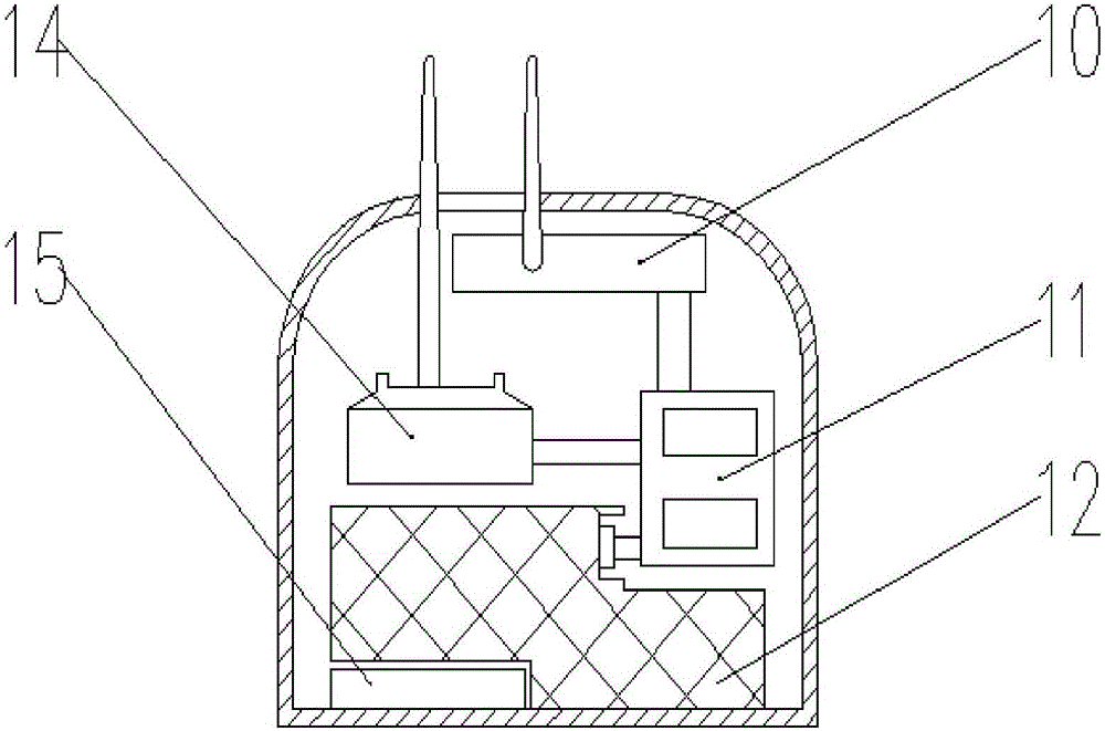
[0018] see Figure 1-3 , the present invention provides a technical solution: a UAV for highway surveying with infrared positioning and lighting, including a UAV main body 9 and a GPS locator 14, and also includes a protective frame 1, a lighting lamp 5, a coordinate glass plate 6, The image processing device 15 and the infrared laser lamp 16, the propeller blade 2 is arranged in the protective frame 1, the shape of the protective frame 1 is circular, and the ...


PUM


Abstract

The invention discloses an infrared ray positioning and illuminating type unmanned aerial vehicle for highway surveying. The unmanned aerial vehicle comprises an unmanned aerial vehicle body and a GPS (global positioning system) positioner, propeller blades are arranged in protecting frames, a rotating shaft is connected in each propeller blade, the protecting frames are connected with the unmanned aerial vehicle body through fixing rods, a controller is connected below a wireless signal receiver, a camera is fixed below a battery, an image processing device is mounted below the GPS positioner, an infrared ray laser lamp is connected below the image processing device, and an underframe is mounted below the infrared ray laser lamp. The infrared ray positioning and illuminating type unmanned aerial vehicle for highway surveying has the advantages that the unmanned aerial vehicle is provided with the protecting frames, and the internal diameter of each protecting frame is 2 mm longer than the external diameter of each propeller blade, so that the unmanned aerial vehicle cannot fall and be damaged due to direct collision between trees or mountains and the propeller blades during flying, and a 2-mm gap can also guarantee that no friction occurs between each propeller blade and the corresponding protecting frame when the propeller blades rotate at a high speed.

Description

technical field [0001] The invention relates to the technical field of highway survey equipment, in particular to an infrared positioning and lighting unmanned aerial vehicle for highway survey. Background technique [0002] In road surveying, many construction teams will choose to use UAVs for surveying. This kind of UAVs just install GPS devices and cameras on ordinary UAVs. The functionality is relatively simple. After surveying and mapping, manual work is still required The distance measurement and fixed point did not improve the survey efficiency, and this kind of UAV has poor vision at night, which affects the survey progress. Contents of the invention [0003] The purpose of the present invention is to provide a road surveying UAV with infrared positioning and lighting to solve the problems that the general road surveying UAV proposed in the above background technology has little improvement in survey efficiency and cannot be used at night. [0004] In order to ach...

Claims


Application Information

Patent Timeline
Patent Type & Authority Applications(China)
IPC IPC(8): B64C27/00B64D47/02B64D47/04G01S19/42
CPCG01S19/42B64C27/006B64D47/02B64D47/04B64U2101/00
Inventor 不公告发明人
Owner 苏州曾智沃德智能科技有限公司
Why Eureka
Try Eureka