Evaluation method of real-time operation level of large-scale urban bus network based on bus GPS data
A technology of GPS data and urban public transport, applied in traffic flow detection, traffic control system, traffic control system of road vehicles, etc., can solve problems such as inability to reflect real feelings, and achieve the effect of improving accuracy and speed
- Summary
- Abstract
- Description
- Claims
- Application Information
AI Technical Summary
Problems solved by technology
Method used
Image
Examples
Embodiment Construction
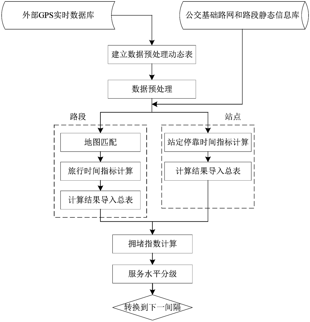
[0014] A method for evaluating the real-time operation level of a large-scale urban bus network based on bus GPS data, including the following steps:
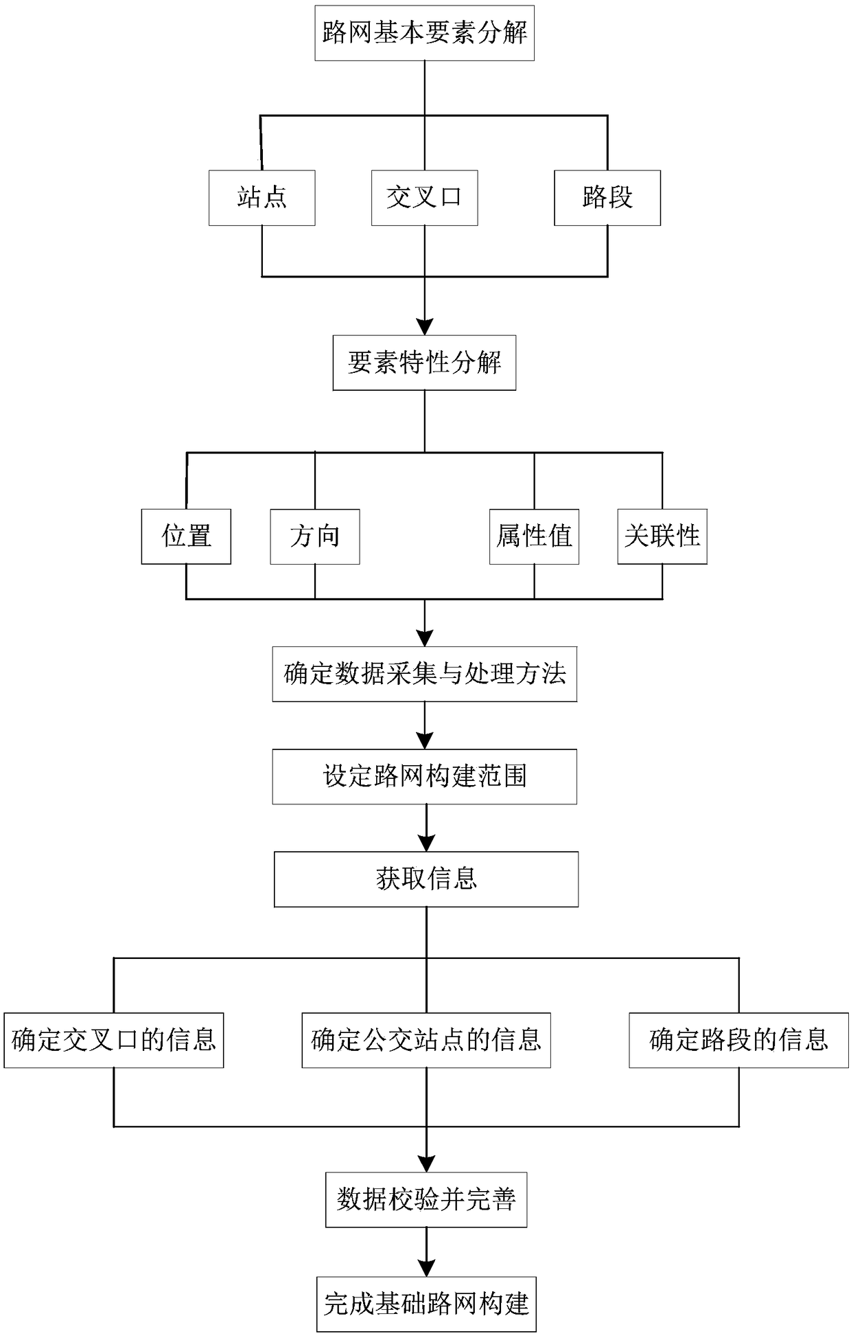
[0015] (1) Establish a standardized static road network basic information database and bus line network basic information database. The establishment of the bus line network basic information database includes: defining road sections, defining sub-road sections, defining road section polylines, determining bus stop information, and determining bus line information , Matching site and section information;
[0016] The road between two adjacent intersections is a road section, and the information of the road section includes the starting number of the intersection, the end number of the intersection, the number of the road section, the name of the road section, the length of the road section, the direction of the road section, the name of the road where the road section is located, and the grade of the road where the road section ...
PUM
 Abstract
Description
Claims
Application Information
 - R&D
- Intellectual Property
- Life Sciences
- Materials
- Tech Scout
- Unparalleled Data Quality
- Higher Quality Content
- 60% Fewer Hallucinations
Browse by: Latest US Patents, China's latest patents, Technical Efficacy Thesaurus, Application Domain, Technology Topic, Popular Technical Reports.
© 2025 PatSnap. All rights reserved.Legal|Privacy policy|Modern Slavery Act Transparency Statement|Sitemap|About US| Contact US: help@patsnap.com


