Unmanned aerial vehicle and method for monitoring coalfield fire area distribution and combustion situation

A technology of unmanned aerial vehicle and fire zone, applied in the field of unmanned aerial vehicle, it can solve problems such as incompleteness, inaccuracy and insecurity

Inactive Publication Date: 2017-09-29
CHINA UNIV OF MINING & TECH +1
View PDF10 Cites 7 Cited by
  • Summary
  • Abstract
  • Description
  • Claims
  • Application Information

AI Technical Summary

Problems solved by technology

[0004] The object of the present invention is to provide an unmanned aerial vehicle (UAV) for monitoring the distribution of coalfield fire areas and the combustion situation, and its unmanned aerial vehicle (UAV). method to achiev

Method used


Image

  • Unmanned aerial vehicle and method for monitoring coalfield fire area distribution and combustion situation
  • Unmanned aerial vehicle and method for monitoring coalfield fire area distribution and combustion situation

Examples


Embodiment Construction

[0011] An example of the present invention will be further described below in conjunction with accompanying drawing:

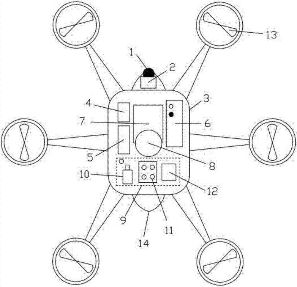
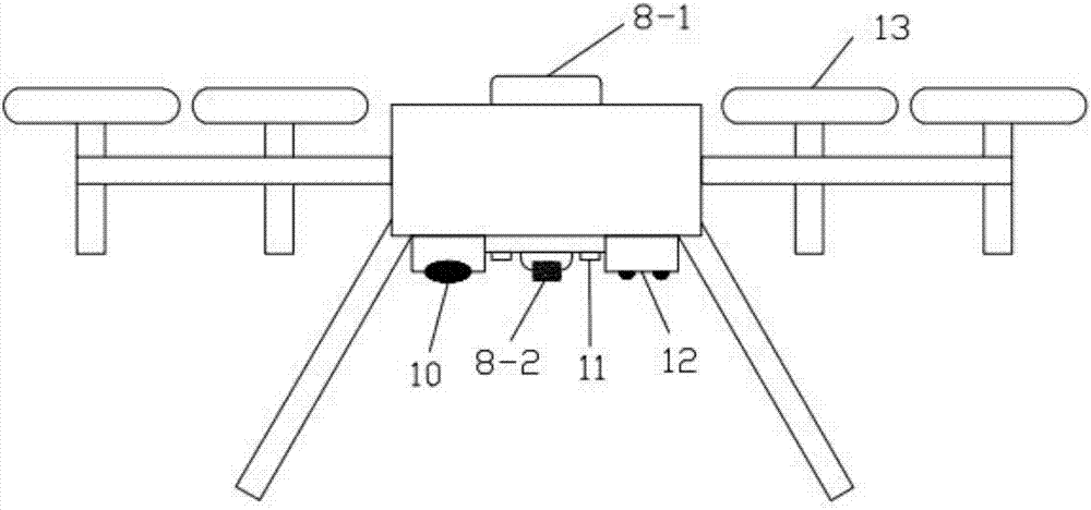
[0012] An unmanned aerial vehicle and its method for monitoring the distribution and combustion situation of coalfield fire areas. The unmanned aerial vehicle mainly includes a wireless communication module 2, a control system 4, a data storage module 5, a power supply 6, an inertial navigation system 7, and a space positioning module 8. The data monitoring module 9 and the wireless communication module 2 are installed in the cabin 1 of the nose. The control system 4, the data storage module 5, the power supply 6, the inertial navigation system 7, and the data monitoring module 9 are designed and installed in the cabin 3 of the fuselage in sequence. The spatial positioning module 8 is designed to be installed in the middle of the fuselage 3 .

[0013] The UAV is designed with 6 rotors 13 to realize the stable hovering and precise monitoring of the UAV, and the...


PUM


Abstract

The invention discloses an unmanned aerial vehicle (UAV) and a method for monitoring coalfield fire area distribution and combustion situation. The UAV is composed of a wireless communication module, a control system, a data storage module, a power supply, an inertial navigation system, a space positioning module and a data monitoring module. The main operation method comprises: the control system of the UAV receives an instruction of a ground host to start flight, the inertial navigation system, the space positioning module and the data monitoring module acquire and synchronize exterior orientation attitude information in real time, and the ground host simulates and fits coalfield fire area geomorphic characteristics by using orientation information and geomorphic image information acquired by the UAV, and integrates infrared thermal imaging information, hybrid index gas proportion indexes (e.g., CO/CO2) and atmospheric temperature and humidity to predict coalfield fire area surface temperature distribution characteristic and corresponding fire combustion situation. The UAV and the method can quickly and safely simulate the geomorphic characteristics and surface temperature field distribution of a large-range coalfield fire area and predict the fire combustion situation.

Description

technical field [0001] The invention relates to an unmanned aerial vehicle and a method thereof for monitoring the distribution and combustion situation of coalfield fire areas, which are suitable for judging the distribution of coalfield fire areas and the combustion situation, and provide important information support for coal fire prevention and utilization. Background technique [0002] As a common global disaster in the world, coal fire has greatly caused the direct and indirect waste of coal resources, the destruction of the ecological environment, and the threat to human health and safety. Coalfield fires are a common global disaster in the world, among which coal fires in China are the largest, followed by the United States, India, South Africa and Australia, causing serious loss of coal resources, soil, water and atmospheric pollution, ecological damage and geological disasters . therefore. It is essential for the prevention and control of existing and potential c...

Claims


Application Information

Patent Timeline
IPC IPC(8): G01D21/02B64C27/08
CPCG01D21/02B64C27/08B64U2101/00
Inventor 苏贺涛李金石齐海宁靳昊史波波
Owner CHINA UNIV OF MINING & TECH
Why Eureka
Try Eureka