
Satellite remote sensing image physical color uniformity method

A technology of satellite remote sensing images and physics, which is applied in the field of aerospace remote sensing satellites to achieve the effect of fast processing speed and simple color uniform method

Active Publication Date: 2017-10-03
INST OF REMOTE SENSING & DIGITAL EARTH CHINESE ACADEMY OF SCI
View PDF4 Cites 6 Cited by
  • Summary
  • Abstract
  • Description
  • Claims
  • Application Information

AI Technical Summary

Problems solved by technology

[0005] Aiming at the fact that the existing algorithm cannot meet the requirement of not destroying the original radiation information of the satellite image, the present invention proposes a method for physical color uniformity of the image based on cross-radiation calibration. This method does not change the radiation information of the original image. At the same time, it can effectively reduce the problem of radiation inconsistency in overlapping areas of adjacent camera images, and realize physical color uniformity of images

Method used


Image

  • Satellite remote sensing image physical color uniformity method
  • Satellite remote sensing image physical color uniformity method
  • Satellite remote sensing image physical color uniformity method

Examples


Embodiment Construction

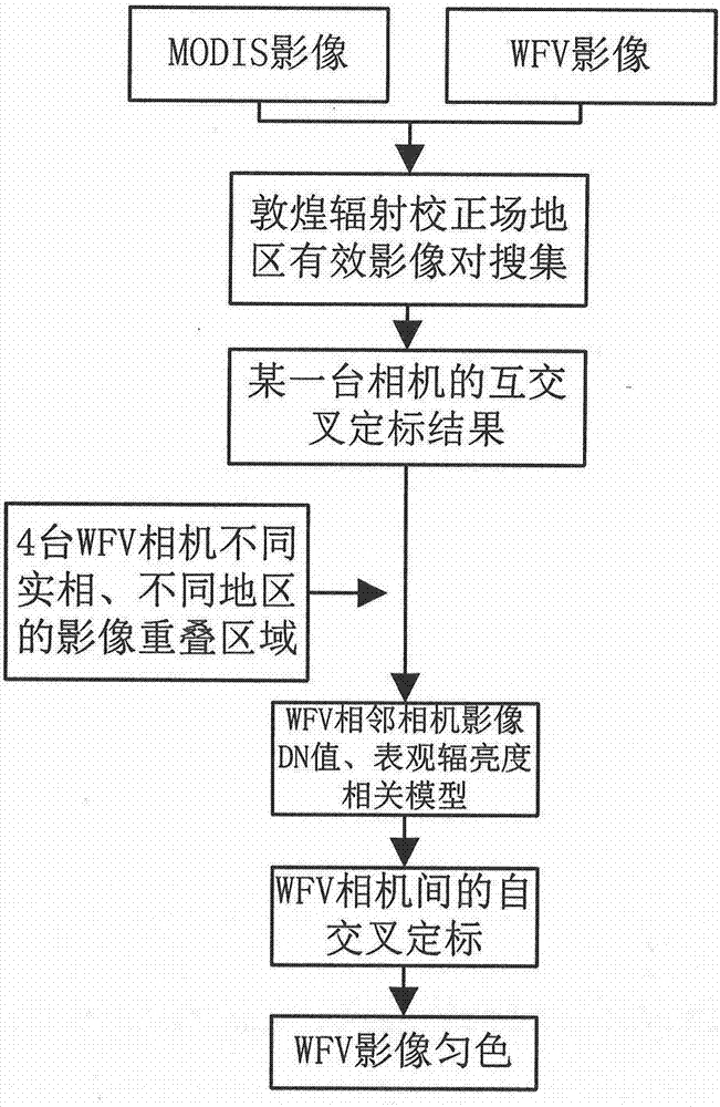
[0027] Such as figure 2 A method for physical color uniformity of satellite remote sensing images shown in the present invention includes traditional cross-radiation calibration, adjacent camera image DN correlation statistics, adjacent camera image apparent radiance correlation simulation, self-cross radiation calibration and physical Uniform color. The present invention takes WFV3 and WFV4 as examples to illustrate the process of physical color uniformity of images.

[0028] 1) Cross-radiometric calibration of a certain WFV camera based on MODIS images, taking WFV4 camera as an example. First, collect synchronous or quasi-synchronous image pair data in the Dunhuang area, and use data filtering constraints to obtain effective image pairs. The data screening conditions include: a) The transit time difference between MODIS and WFV images in the Dunhuang radiation correction field is less than 1h; b) When the satellite transits, there must be no cloud cover above the test are...


PUM


Abstract

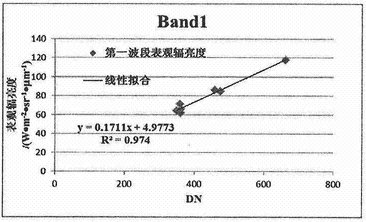
The invention provides a satellite remote sensing image physical color uniformity method. The method comprises the steps that 1) a cross calibration method is used, and a Dunhuang radiation correction field is used as a transmission platform and a MODIS image is used as a reference standard to acquire the absolute radiation calibration factor of a certain camera of a GF-1 satellite WFV sensor; 2) a statistical analysis method is used to establish the correlation model of the adjacent camera image DN value; 3) a simulation method is used to establish the correlation model of the adjacent camera image apparent radiance; 4) a self-radiation calibration calibration model is established to realize absolute radiation calibration of another camera; and 5) each camera calibration coefficient is used to convert the image DN value to the apparent radiance to realize image physical color uniformity. Compared with the traditional color uniformity method, physical color uniformity between cameras is realized without destroying the original image radiation information.

Description

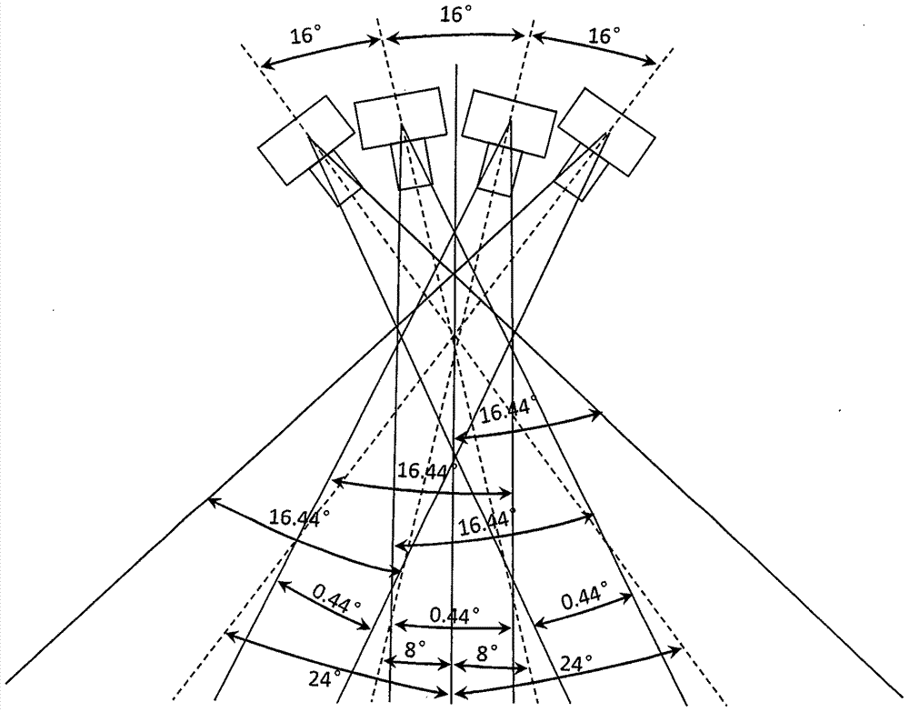
technical field [0001] The invention relates to the field of aerospace remote sensing satellites, in particular to a method for physically uniforming the color of satellite remote sensing images. Background technique [0002] In order to ensure that satellite sensors can not only acquire high spatial resolution satellite images, but also have wide-coverage earth observation capabilities, people often use the method of multi-camera stitching to achieve this goal. For example, the wide-coverage WFV sensor carried by the GF-1 satellite uses 4 camera stitching imaging technology, such as figure 1 As shown, the overall development goal of combining high resolution and large field of view has been achieved, and it can acquire satellite images with a spatial resolution of 16m and a width better than 800km. However, due to the differences in the relevant parameters of each camera (camera observation angle, camera spectral response function, etc.), there is a more obvious problem of...

Claims


Application Information

Patent Timeline
Patent Type & Authority Applications(China)
IPC IPC(8): G06T5/00G06T3/40G01C11/00
CPCG06T3/4038G01C11/00G06T2207/10032G06T2207/30181G06T5/70
Inventor 谢勇韩杰顾行发余涛高海亮刘其悦孙源
Owner INST OF REMOTE SENSING & DIGITAL EARTH CHINESE ACADEMY OF SCI
Learn More