
Multisource data-based place name and address data integration method and system

A technology of address data and multi-source data, applied in the field of geographic information services, can solve the problems of restricting the application and sharing of city address and place name information management systems, the inability to realize data sharing, and poor database compatibility, so as to reduce the process of manual participation and save Data integration time, solve the effect of rapid update

Inactive Publication Date: 2017-12-29
SPEED SPACE TIME INFORMATION TECH CO LTD
View PDF3 Cites 30 Cited by
  • Summary
  • Abstract
  • Description
  • Claims
  • Application Information

AI Technical Summary

Problems solved by technology

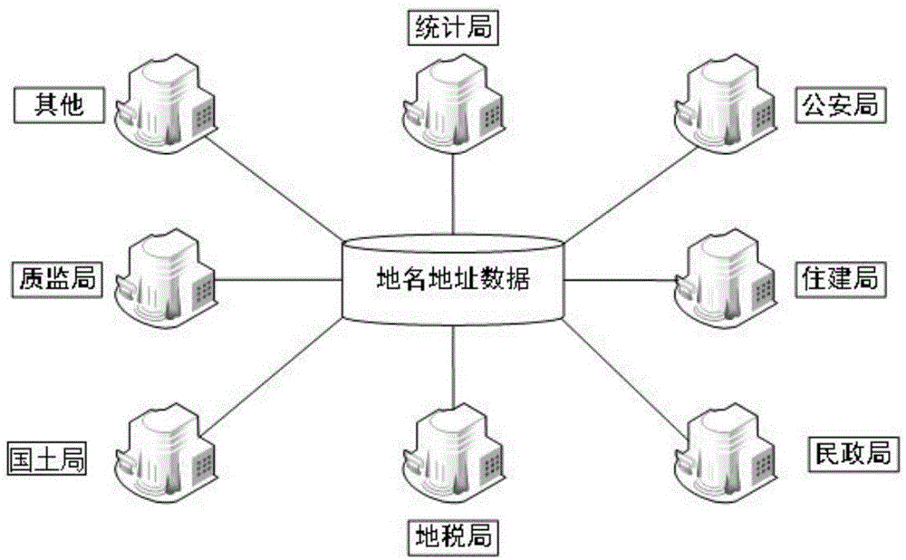
For example, the data of place names and addresses of land departments come from topographic map DWG format, and the data of industrial and commercial departments come from registration data in EXCEL format; 3) lack of spatial data: among the collected place names and addresses data of various functional departments, only Civil Affairs Bureau, Public Security Bureau and Surveying and Mapping Bureau The house number and place name data belong to GIS spatial data, and the place name and address data of other departments are all non-spatial data. There is only simple address description information, and coordinates need to be assigned to it; 4) Poor compatibility, data sharing cannot be realized; because there is no unified place name The technical standards and specifications for address database construction, the compatibility between different databases is very poor, and the sharing of data resources cannot be realized, which limits the application and sharing of the urban address and place name information management system

Method used


Image

  • Multisource data-based place name and address data integration method and system
  • Multisource data-based place name and address data integration method and system
  • Multisource data-based place name and address data integration method and system

Examples


Embodiment

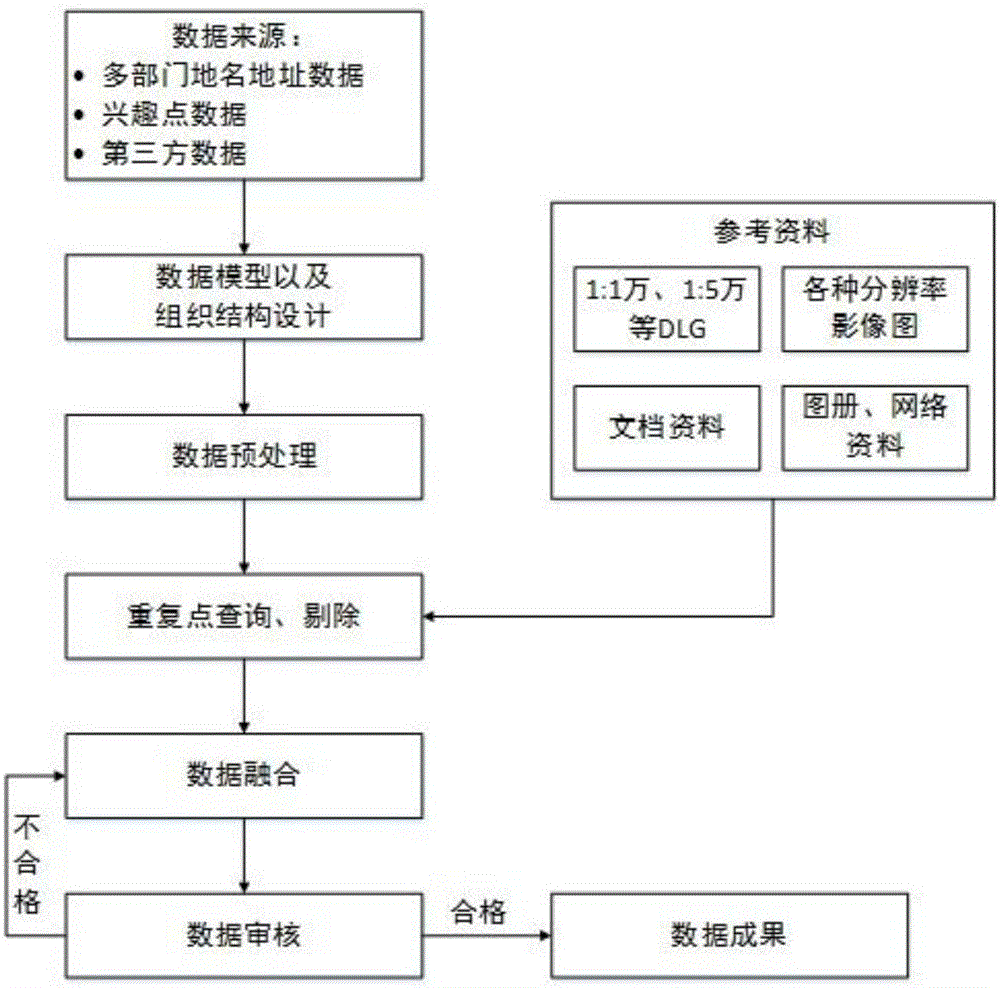
[0040] Embodiment: The method for integrating place name and address data based on multi-source data includes the following steps:

[0041] (1) Collect data, select data models and design organizational structures: integrate place names, addresses and POI data structures, attribute fields, and spatial references from different sources into a set of data, select data models, and design organizational structures;

[0042] (2) Data preprocessing: standardize the multi-source place name address data format and unify it into a format that can be processed;

[0043] (3) Duplicate data query and elimination: Duplicate point query is performed on multi-source place name and address data. There are two main methods for duplicate point query: Method 1 is to combine the spatial location and connect data from different sources according to the name field to find out For the points with the same name, export them and filter the reference materials; the second method is to use FME software ...


PUM


Abstract

The invention relates to a multisource data-based place name and address data integration system. The system comprises the following steps of: (1) data collection, data model selection and organization structure design: referencing and integrating place names, addresses, interest point data structures, attribute fields and spaces from different sources into a set of data, selecting a data model and designing an organization structure; (2) data preprocessing: standardizing formats of the multisource place name and address data into a uniform processable format; (3) repeated data query and removal: carrying out repeated point query on the multisource place name and address data; (4) data fusion: matching and integrating the multisource data; and (5) data audition: carrying out batched audition on the fused data by utilizing GIS software by adoption of an automatic audition and manual audition combined manner, if the data is audited to be qualified, storing the data to a database and constructing a data result, and if the data is audited to be unqualified, returning to the data fusion step to carry out data fusion again until the data is audited to be qualified.

Description

technical field [0001] The invention relates to the technical field of geographic information services, in particular to a system and method for integrating place name and address data based on multi-source data. Background technique [0002] With public security, emergency linkage, intelligent transportation, urban management, environmental improvement, earthquake prevention and disaster reduction and other urban management tasks constantly putting forward new requirements for the guarantee capability of spatial information infrastructure, building a unified, authoritative, and current place name and address database will not only be able to It will greatly improve the level of development and utilization of basic spatial data, and has important reference and reference value for the application of other information resource sharing services among government departments and different industries, and will help create a new model of basic spatial database sharing, service and a...

Claims


Application Information

Patent Timeline
Patent Type & Authority Applications(China)
IPC IPC(8): G06F17/30G06Q50/26
CPCG06F16/215G06F16/29G06Q50/26
Inventor 孙海峰徐忠建朱必亮李俊陈朴
Owner SPEED SPACE TIME INFORMATION TECH CO LTD
Learn More