Intelligent navigation method for weak-signal region based on topological map

A topological map and intelligent navigation technology, applied in the field of navigation, can solve problems such as getting lost, unavailable positioning and navigation, and inability to provide reliable navigation services for users

Inactive Publication Date: 2018-02-09
GUANGDONG UNIV OF TECH
View PDF10 Cites 17 Cited by
  • Summary
  • Abstract
  • Description
  • Claims
  • Application Information

AI Technical Summary

Problems solved by technology

[0003] However, the GPS signal will be severely weakened after passing through buildings or other obstacles, and the positioning and navigation will be inaccurate or unavailable when the mobile phone cannot receive GPS information
In addition, the navigation map is limited by the update frequency of satellite images and the geographical information of the cartographers, so it cannot provide reliable navigation services for users in small areas and remote areas.
In particular, for some

Method used


Image

  • Intelligent navigation method for weak-signal region based on topological map
  • Intelligent navigation method for weak-signal region based on topological map
  • Intelligent navigation method for weak-signal region based on topological map

Examples


Embodiment 1

[0099]The intelligent navigation method for weak signal areas based on topological maps of the present embodiment includes the following steps:

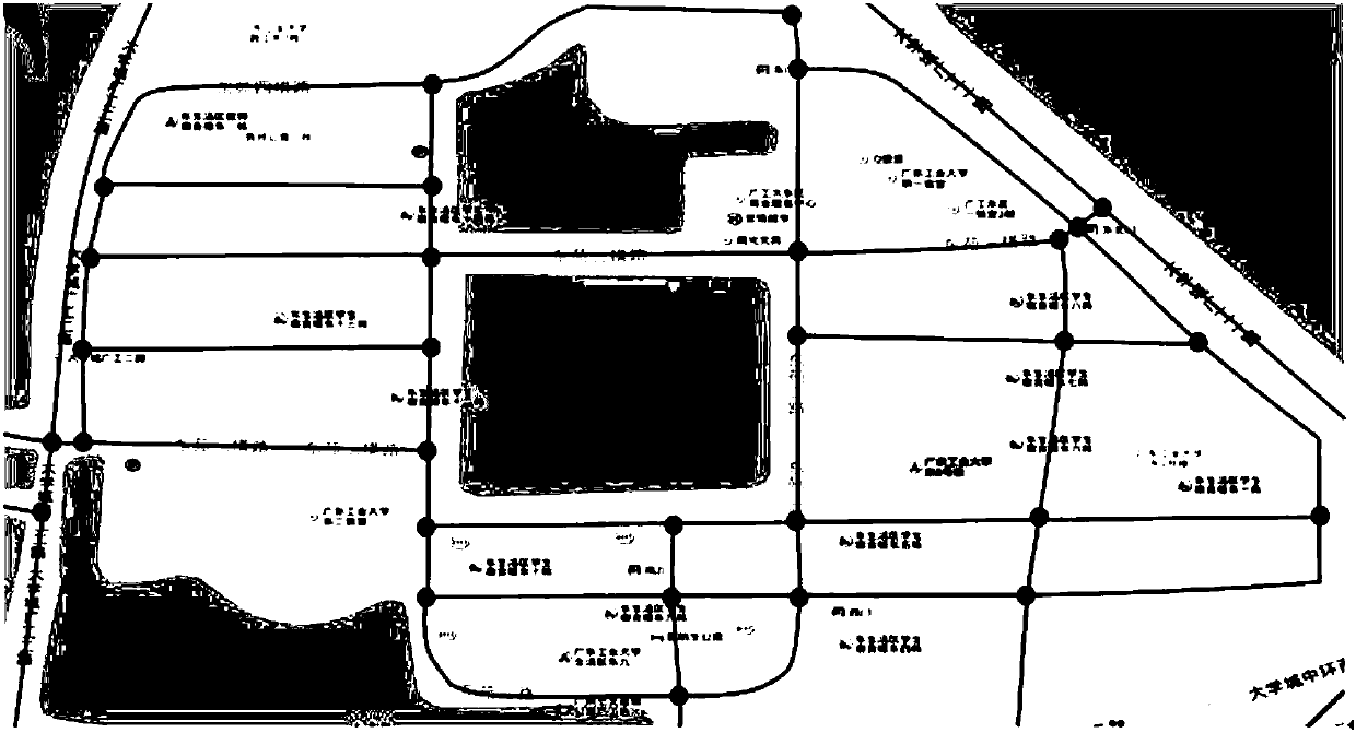
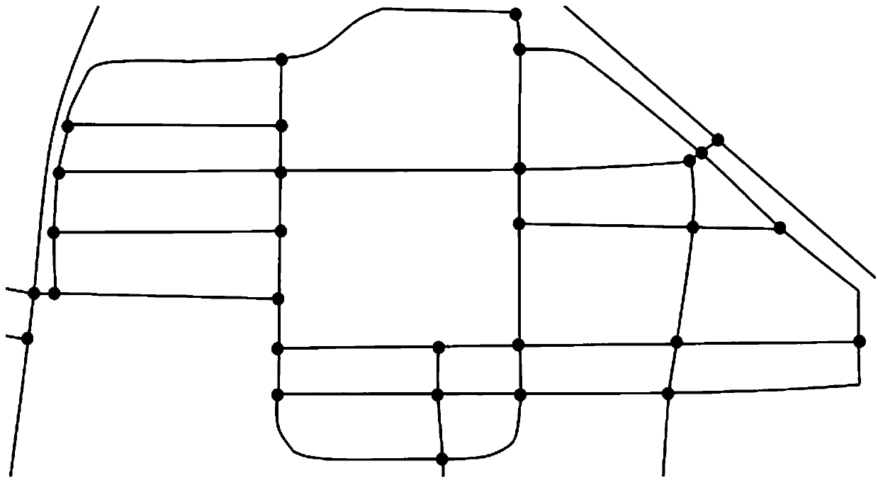
[0100] Step A, the mobile terminal obtains the grid map of the required navigation area and converts it into a topological map, such as figure 1 , figure 2 shown;

[0101] Step B, the user marks the starting node P and the target node Q on the topological map;

[0102] Step C, selecting a navigation path planning mode on the mobile terminal, and generating a corresponding optimal navigation path;

[0103] Step D, the user inputs driving parameters to the mobile terminal, and the mobile terminal navigates the user to the target node Q according to the driving parameters and the navigation route planning method.

[0104] Preferably,

[0105] Said step D comprises:

[0106] "Drive" navigation mode:

[0107] Step D11, the user inputs driving parameters to the mobile terminal: average driving speed N1;

[0108] The mobile terminal...

Embodiment 2

[0194] The intelligent navigation method for weak signal areas based on topological maps of the present embodiment includes the following steps:

[0195] S10: The mobile terminal obtains the grid map of the required navigation area and converts it into a topological map.

[0196] S20: The user marks the starting node P (ie, the current location) and the target node Q (ie, the destination) on the topological map.

[0197] S30: Select a navigation route planning method on the mobile terminal.

[0198] S40: The user inputs driving parameters to the mobile terminal, and the mobile terminal navigates the user to the target node Q according to the driving parameters and the navigation route planning method.

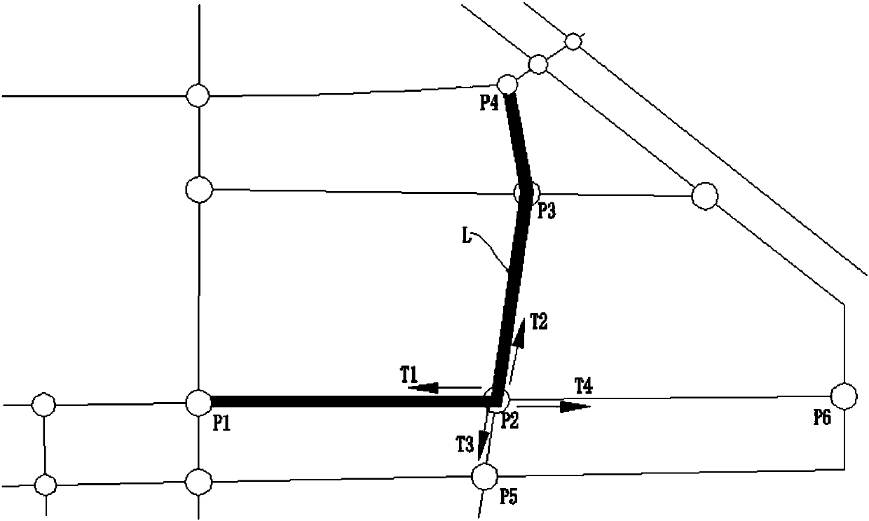
[0199] like image 3 As shown, the node P1 is the starting node P, the node P4 is the target node Q, and the navigation path planning method is selected as automatically planning the shortest path, and the path L is the best path from the node P1 to the node P4 according to t...


PUM


Abstract

The invention discloses an intelligent navigation method for a weak-signal region based on a topological map. The intelligent navigation method comprises the following steps that a mobile terminal acquires a grid map of a region needing navigation and converts the grid map into a topological map; a user marks a start node P and a goal node Q on the topological map; the mobile terminal selects a navigation path planning mode; and the user inputs a driving parameter into the mobile terminal, and the mobile terminal navigates the user to the goal node Q according to the driving parameter and thenavigation path planning mode. According to the invention, the grid map of the region needing navigation is acquired in advance and converted into the topological map, so continuous updating of map information via a network is not needed during navigation, and thus, real-time map displaying is realized in a region without signals; and the current location of the user is acquired by calculating theproportion of a path which the user has walked through, so location of the region without signals is realized, the user can clearly learn about his location in the region without signals, and positioning accuracy is continuously improved in the process of navigation.

Description

technical field [0001] The invention relates to the field of navigation, in particular to an intelligent navigation method for weak signal areas based on topological maps. Background technique [0002] With the rapid development of modern wireless communication technology and the popularization of smart phones, mobile phone navigation is increasingly required by the public for travel. The traditional GPS outdoor navigation and positioning technology has gradually matured after decades of development. The existing mobile phone navigation software also basically has functions such as map viewing, map zooming, hotspot search, positioning and navigation, and some products even rely on smart phones. The acceleration sensor, direction sensor, NFC and indoor WI-FI in the car can realize indoor navigation. [0003] However, the GPS signal will be severely weakened after passing through buildings or other obstacles, and the mobile phone will cause inaccurate or unavailable positioni...

Claims


Application Information

Patent Timeline
IPC IPC(8): G01C21/20G01C21/34
CPCG01C21/20G01C21/3407
Inventor 陈达权黄运保李海艳
Owner GUANGDONG UNIV OF TECH
Why Eureka
Try Eureka