Temporary road arrangement method for mountainous buildings based on BIM
A technology of temporary roads and layout methods, which is applied in the direction of instruments, electrical digital data processing, data processing applications, etc., and can solve problems such as inability to plan temporary roads
- Summary
- Abstract
- Description
- Claims
- Application Information
AI Technical Summary
Problems solved by technology
Method used
Image
Examples
Embodiment
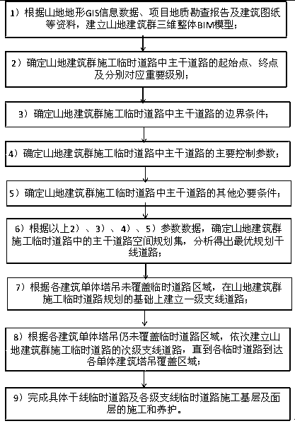
[0030] Such as figure 1 As shown, the process of the present invention is as follows:
[0031] A BIM-based temporary road layout method for mountain building group construction includes:
[0032] Step 1. According to the mountain terrain GIS information data and the project geological survey report, establish a three-dimensional BIM model of the mountain building complex site;
[0033] Step 2. Establish three-dimensional BIM models of individual mountain buildings according to the architectural drawings;
[0034] Step 3. Integrate the site model with the single three-dimensional BIM model of the mountain building to obtain the overall BIM model of the mountain building group;
[0035] Step 4. Determine the starting point and end point of the main road in the temporary road construction of the mountain building group according to the area on the four sides of the outer wall of the mountain building group, such as the top east side and the bottom west side of the mountain building group ...
PUM
 Abstract
Description
Claims
Application Information
 - R&D
- Intellectual Property
- Life Sciences
- Materials
- Tech Scout
- Unparalleled Data Quality
- Higher Quality Content
- 60% Fewer Hallucinations
Browse by: Latest US Patents, China's latest patents, Technical Efficacy Thesaurus, Application Domain, Technology Topic, Popular Technical Reports.
© 2025 PatSnap. All rights reserved.Legal|Privacy policy|Modern Slavery Act Transparency Statement|Sitemap|About US| Contact US: help@patsnap.com

