Ground-based high-precision regional positioning navigation system and method
A regional positioning and navigation system technology, applied in the field of satellite navigation and radio positioning, can solve the problems of increasing the complexity of pseudolite system construction, being susceptible to interference, and affecting the application of ground-based navigation systems, etc.
- Summary
- Abstract
- Description
- Claims
- Application Information
AI Technical Summary
Problems solved by technology
Method used
Image
Examples
Embodiment Construction
[0075] The technical solutions in the embodiments of the present invention will be clearly and completely described below in combination with the accompanying drawings in the embodiments of the present invention, and further detailed descriptions will be given, but the embodiments of the present invention are not limited thereto.
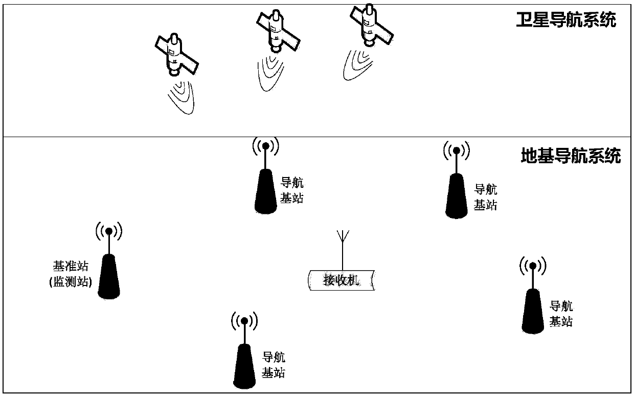
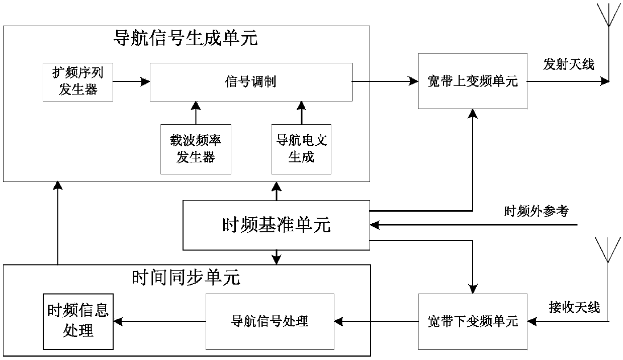
[0076] refer to figure 1 , figure 1 It is a schematic diagram of a ground-based high-precision regional positioning and navigation system of the present invention. The present invention includes user receivers and navigation base stations and reference stations installed in the service area. Multiple navigation base stations are set up in the service area. The establishment of multiple navigation base stations can Realize that after the user receiver enters the service area, it can receive signals from more than N navigation base stations at any position in the service area at the same time, N≥4; each navigation base station is equipped with a trans...
PUM
 Abstract
Description
Claims
Application Information
 - R&D
- Intellectual Property
- Life Sciences
- Materials
- Tech Scout
- Unparalleled Data Quality
- Higher Quality Content
- 60% Fewer Hallucinations
Browse by: Latest US Patents, China's latest patents, Technical Efficacy Thesaurus, Application Domain, Technology Topic, Popular Technical Reports.
© 2025 PatSnap. All rights reserved.Legal|Privacy policy|Modern Slavery Act Transparency Statement|Sitemap|About US| Contact US: help@patsnap.com


