Scenic region aerial photography flight system and control method therefor
A control method and aerial photography technology, applied in the field of aircraft, can solve the problem of no aerial photography aircraft, etc., and achieve the effects of simple structure, reduced control difficulty, and reduced burden
- Summary
- Abstract
- Description
- Claims
- Application Information
AI Technical Summary
Problems solved by technology
Method used
Image
Examples
Embodiment Construction
[0042] The following describes the specific embodiments of the present invention to facilitate those skilled in the art to understand the present invention, but it should be clear that the present invention is not limited to the scope of the specific embodiments, for those of ordinary skill in the art, as long as various changes These changes are obvious within the spirit and scope of the present invention defined and determined by the appended claims, and all inventions and creations using the concept of the present invention are protected.
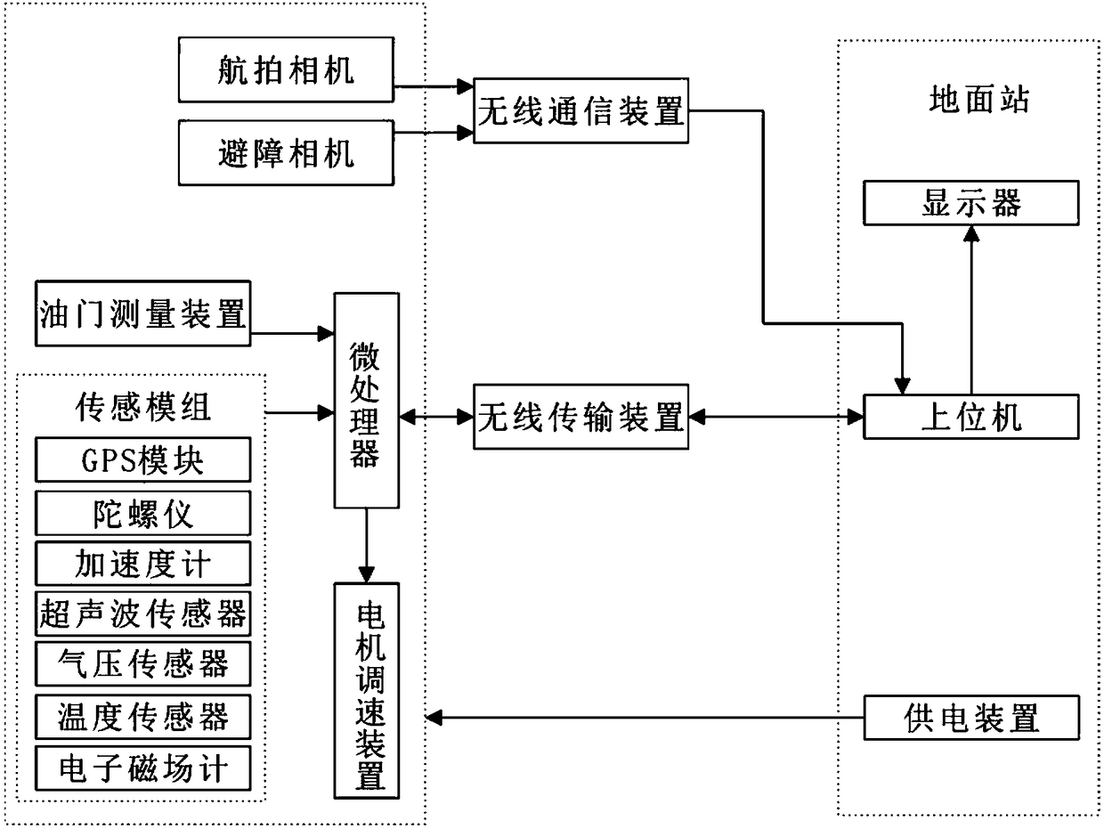
[0043] Such as figure 1 As shown, the aerial photography flight system of the scenic spot includes a ground station and an aerial vehicle connected to the ground station. The aerial vehicle includes an aerial camera, an obstacle avoidance camera, and a microprocessor, and a sensor module connected to the microprocessor and throttle measurement. Device, motor speed control device and wireless data transmission device, as well as wireless comm...
PUM
 Abstract
Description
Claims
Application Information
 - R&D
- Intellectual Property
- Life Sciences
- Materials
- Tech Scout
- Unparalleled Data Quality
- Higher Quality Content
- 60% Fewer Hallucinations
Browse by: Latest US Patents, China's latest patents, Technical Efficacy Thesaurus, Application Domain, Technology Topic, Popular Technical Reports.
© 2025 PatSnap. All rights reserved.Legal|Privacy policy|Modern Slavery Act Transparency Statement|Sitemap|About US| Contact US: help@patsnap.com


