
Underground communicated roadway elaborated modeling method based on string course data actual measurement

A modeling method and roadway technology, applied in the direction of electrical digital data processing, special data processing applications, instruments, etc., can solve the problems of large amount of data, time-consuming, and poor reflection of the overall spatial shape of the roadway, etc., to achieve Solve the sparse problem of data and reduce the effect of workload

Active Publication Date: 2018-07-06
XIANGTAN UNIV
View PDF4 Cites 6 Cited by
  • Summary
  • Abstract
  • Description
  • Claims
  • Application Information

AI Technical Summary

Problems solved by technology

[0003] The commonly used methods for data collection of underground roadway fragments can be divided into branch distance method, section method, etc. The branch distance method uses a simple structure of the measuring instrument, and the measured object needs to meet certain geometric characteristics, which seriously affects the measurement accuracy and The type of roadway is limited; the section method is to obtain the discrete point set of the roadway section at the corresponding position through laser scanning. The amount of data obtained by this method is large and there is disorder among the data, so it takes a lot of time to process the disorder of the data To construct the topological relationship of the section
For the expression of the mine roadway surface, the existing methods directly use the original measurement data, and do not consider the problem of partial distortion caused by the unevenness of the reconstructed surface caused by the sparse measurement point data; in addition, the connection modeling method of the roadway, mainly The job is to model the fork, which includes a large number of Boolean operations, smooth splicing, and section construction. The generated entities cannot well reflect the overall spatial shape of the roadway

Method used


Image

  • Underground communicated roadway elaborated modeling method based on string course data actual measurement
  • Underground communicated roadway elaborated modeling method based on string course data actual measurement
  • Underground communicated roadway elaborated modeling method based on string course data actual measurement

Examples


Embodiment Construction

[0054] The present invention will be further described below in conjunction with the accompanying drawings and embodiments.

[0055] A fine modeling method for underground connected roadways based on measured waistline data, comprising the following steps:

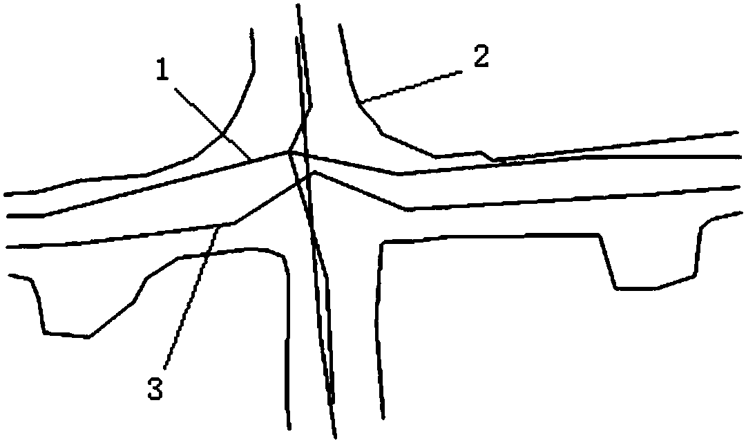
[0056] Step 1: Use the waistline method to measure the three-dimensional coordinates of points on the roof centerline 1, floor centerline 3, and waistlines 2 on both sides of the mine roadway, as well as the shape parameters of the mine roadway section width, height, and radius, such as figure 1 shown.

[0057] Step 2: Adjust the elevation of the measured three-dimensional coordinates of points on the waist line according to the center line of the floor to obtain the closed floor boundary line of the roadway;

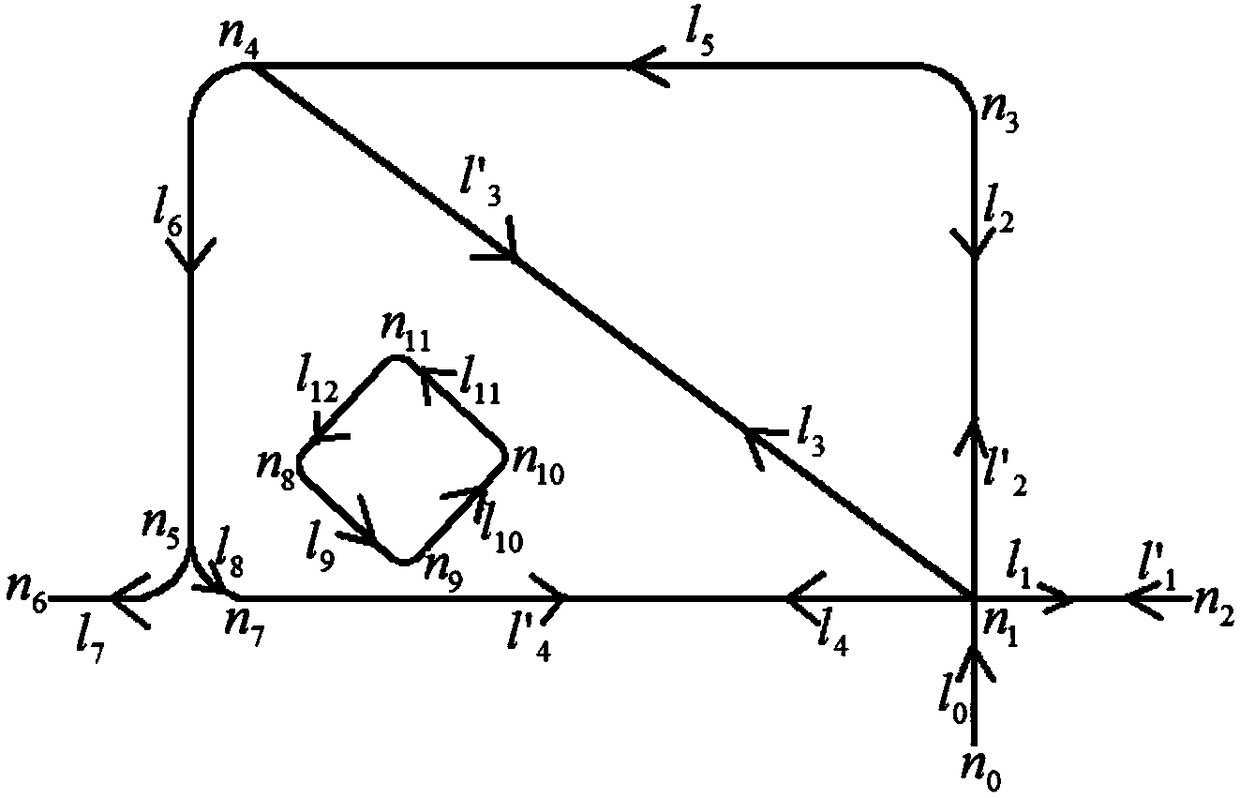
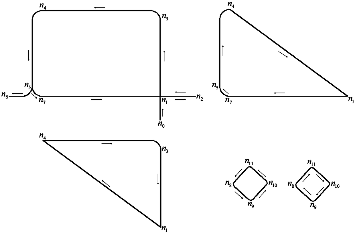
[0058] Step 3: According to the roof centerline obtained in Step 1, establish a node-path network topology diagram, such as figure 2 Shown; Extract the connected path in the node-path network topology diagram; Be...


PUM


Abstract

The invention discloses an underground communicated roadway elaborated modeling method based on string course data actual measurement. The method comprises the following steps that a top, a bottom slab center line and point three-dimensional coordinates on two side string courses of a mine roadway are measured; a closed bottom slab border line of the roadway is constructed; a node-path network topological relation graph is constructed, communicated paths in the topological relation graph are extracted, and local fracture surface contour lines are constructed between the communicated paths andthe bottom slab border line; space gridding is extracted between two neighboring contour lines, data encryption is performed on the space gridding, transition contour lines are added, and hook face triangularization is performed on the space gridding; the closure bottom slab border lines are divided into a plurality of single polygons, and the triangularization is performed on each polygon; all local triangularization models are combined, and a solid model of the communicated underground roadway is obtained. According to the modeling method, a string course actual measurement method is adoptedto collect space data of the underground roadway, the workload of survey crew is reduced, and the roadway fracture surface designed parameters are combined, so that the fitting can be better carriedout on the roadway hook face.

Description

technical field [0001] The invention relates to the field of mine engineering, in particular to a fine modeling method for underground connected roadways based on measured waistline data. Background technique [0002] The underground roadway system model is the main component of digital mine engineering, which is characterized by criss-crossing roadways, complex spatial topological relations, and various cross-sectional shapes, cross-sectional parameters and support types. The traditional information management platform draws two-dimensional AutoCAD longitudinal section or horizontal section by using the data collected by underground survey, but this can only express the spatial form of the roadway from a local perspective. The three-dimensional information reflected in these drawings mainly depends on technicians The experience and subjective judgment of space imagination have greatly affected the schedule and quality of roadway excavation engineering. With the continuous ...

Claims


Application Information

Patent Timeline
Patent Type & Authority Applications(China)
IPC IPC(8): G06F17/50
CPCG06F30/13
Inventor 谭正华张进修孙超戴立平张又文
Owner XIANGTAN UNIV
Learn More