Method for realizing geographic calibration of commercial camera photo based on positioning and orientation data

A positioning and photo technology, applied in the field of image processing, can solve problems such as inability to meet flexible, efficient, simple and direct industry applications, inability to obtain images, and low cost performance

Inactive Publication Date: 2018-09-04
中国海监南海航空支队
View PDF8 Cites 6 Cited by
  • Summary
  • Abstract
  • Description
  • Claims
  • Application Information

AI Technical Summary

Problems solved by technology

Ordinary data camera systems can only load GPS data to obtain the location of image shooting, but cannot obtain the coordinates of each pixel on the image. With the improvement of user needs and the deepening of application levels, users not only need to obtain Location information, it is more necessary to obtain the location of the shooting target, the coverage of the scene range, and the coordinate information of each pixel on the image. The existing equipment and technology have not solved the above problems well.
In addition, although the oblique photogrammetry camera system mounted on manned or unmanned aerial vehicles is very mature, although the accuracy is high enough, it is mainly designed for digital production at the surveying and mapping level, requiring rigorous route planning in advance and strict compliance with the settings. Aerial photos with a fixed focus and angle can be obtained from a good route flight, and the data results can only be obtained after post-processing by professional-level software. For industry applications such as law enforcement and evidence collection, the cost performance of input and output is too low to meet the needs of flexibility and efficiency. , Simple and direct industry application

Method used


Image

  • Method for realizing geographic calibration of commercial camera photo based on positioning and orientation data
  • Method for realizing geographic calibration of commercial camera photo based on positioning and orientation data
  • Method for realizing geographic calibration of commercial camera photo based on positioning and orientation data

Examples


Embodiment Construction

[0049] In order to make the purpose, technical solutions and advantages of the embodiments of the present invention clearer, the technical solutions in the embodiments of the present invention will be clearly and completely described below in conjunction with the drawings in the embodiments of the present invention. Obviously, the described embodiments It is a part of embodiments of the present invention, but not all embodiments. Based on the embodiments of the present invention, all other embodiments obtained by persons of ordinary skill in the art without making creative efforts belong to the protection scope of the present invention.

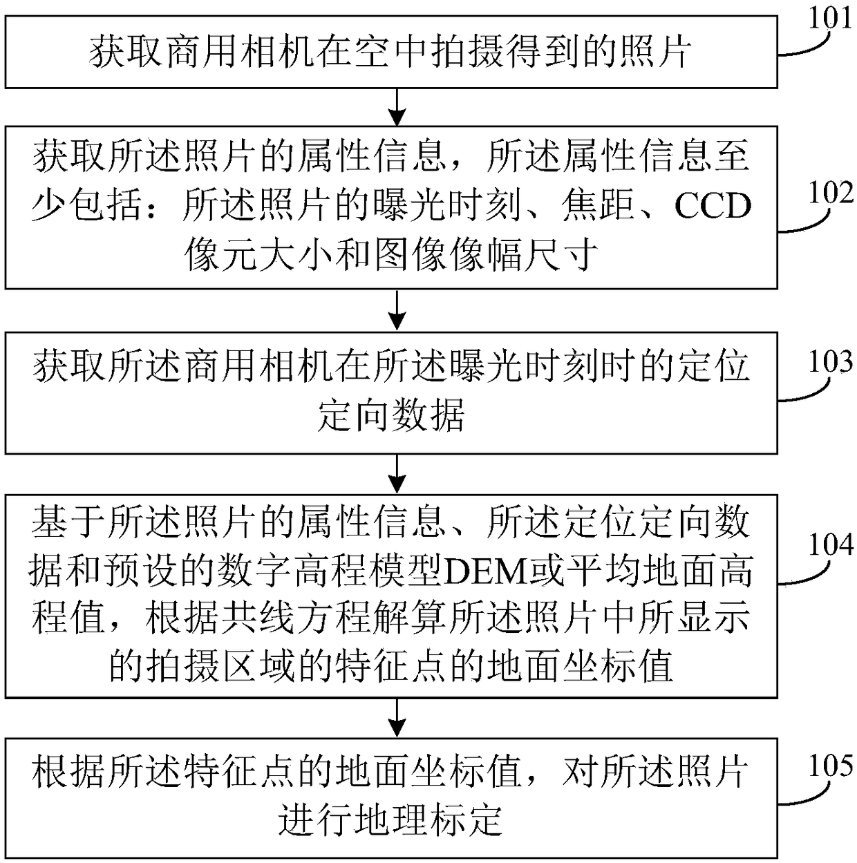
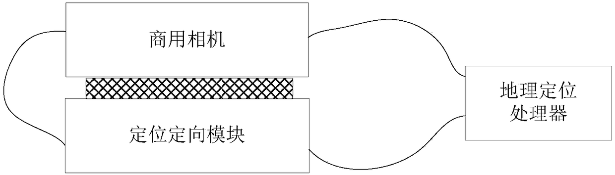
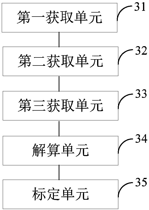
[0050] First aspect, such as figure 1 As shown, the embodiment of the present invention discloses a method for realizing geographical calibration of commercial camera photos based on positioning and orientation data, which may include the following steps 101-105:

[0051] 101. Obtain photos taken by commercial cameras in the air.

[0052] I...


PUM


Abstract

The invention relates to a method for realizing the geographic calibration of a commercial camera photo based on positioning and orientation data. The method comprises a step of acquiring a photo taken by a commercial camera in the air, a step of acquiring attribute information of the photo, wherein the attribute information includes an exposure time, a focal length, a CCD pixel size and an imageframe size, a step of obtaining the positioning and orientation data of the commercial camera at the exposure time, a step of solving a ground coordinate value of a characteristic point of a shootingarea displayed in the photo according to a collinearity equation based on the attribute information, the positioning and orientation data and a digital elevation model (DEM) or average ground elevation value, and a step of carrying out geographic calibration on the photo according to the ground coordinate value of the characteristic point. It can be seen that the geographic calibration of the photo is carried out through obtaining the positioning and orientation data of the commercial camera in taking the photo based on the photo attribute information, the positioning and orientation data, andthe DEM or average ground elevation value, and the position information of photo center point and corner point of the photo taken by the commercial camera, photo covering ground range information andactual location information of any target in the photo can be determined.

Description

technical field [0001] Embodiments of the present invention relate to the technical field of image processing, and in particular to a method and device for realizing geographical calibration of commercial camera photos based on positioning and orientation data. Background technique [0002] Law enforcement photography and evidence collection have strict requirements on the accuracy, reliability, and timeliness of on-site evidence. Having photo information that can reflect the real location of the target captured by law enforcement photos and the corresponding real scene coverage area will certainly strengthen the strength of law enforcement evidence. Early law enforcement photos can only reflect pure image information. With the popularization of GPS (Global Positioning System, Global Positioning System), law enforcement photos with geographic marks can be obtained. [0003] There are usually three ways to make photos with geotagging: one is to obtain them with a camera with ...

Claims


Application Information

Patent Timeline
Patent Type & Authority Applications(China)
IPC IPC(8): G06T7/80G06T17/05G06F17/30
CPCG06T17/05G06T2207/10032G06T7/80
Inventor 朱霞赵海涛杨忠雷英良刘辉尹国清宫宇蔡睿陈婷婷李强王智磊王永星朱云峰石先高赵远超罗勇范恒胜
Owner 中国海监南海航空支队
Why Eureka
Try Eureka