

Shallow sea water depth multi-spectral satellite remote sensing inversion method in waterless depth control point area
A satellite remote sensing and bathymetric inversion technology, applied in the field of satellite ocean remote sensing applications, can solve the problems of unreliable bathymetric inversion results, inability to carry out shallow water depth remote sensing inversion, and lack of bathymetry control points, and achieves the goal of eliminating the influence of bathymetry inversion. Effect
- Summary
- Abstract
- Description
- Claims
- Application Information
AI Technical Summary
Problems solved by technology
Method used
Image

Examples
Embodiment Construction
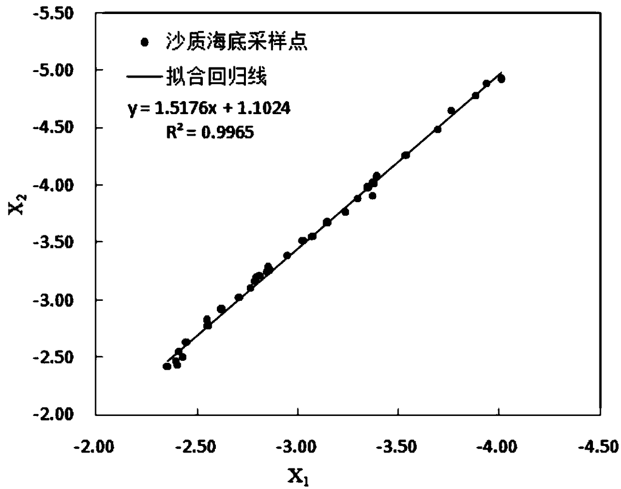
[0026] The invention aims at water depth multi-spectral satellite remote sensing in areas without water depth points, and obtains relevant parameters required for water depth inversion through the image itself, thereby realizing remote sensing inversion of shallow sea water depth in areas without water depth points.
[0027] Below in conjunction with accompanying drawing and embodiment, describe the specific implementation process of technical scheme of the present invention in detail:
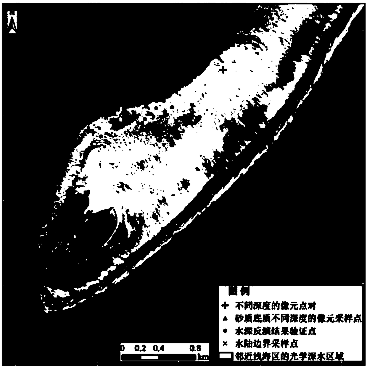
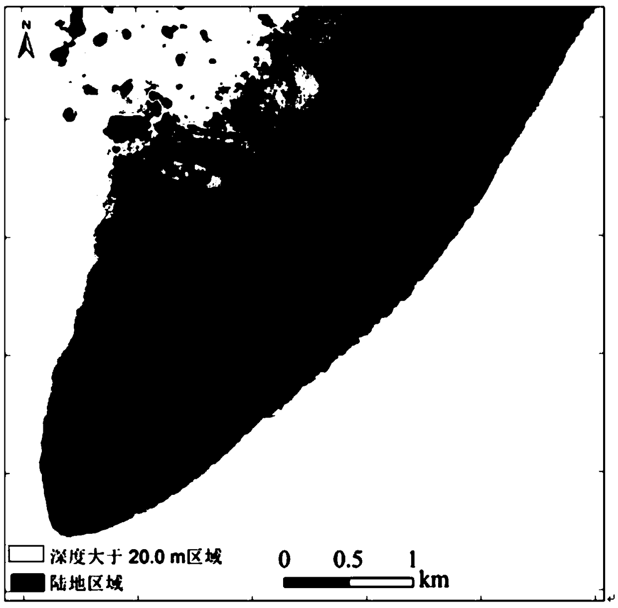
[0028] Step 1: Acquire high-resolution multispectral satellite images of the study area, carry out atmospheric correction to obtain albedo images, and convert albedo data into underwater remote sensing albedo data r w . When the positioning error of the satellite image is less than 6m, the geometric correction process needs to be carried out first; when there is obvious flare interference in the image, the flare correction process needs to be carried out;
[0029] Step 2: Through visual inter...
PUM
 Abstract
Description
Claims
Application Information