
Method and system using desert surface elevation data to calculate elevation of sand dune bottom surface

A surface elevation and data calculation technology, applied in the field of seismic exploration data data processing, can solve problems such as impact and low efficiency

Active Publication Date: 2019-04-19
CHINA PETROLEUM & CHEM CORP +1
View PDF7 Cites 2 Cited by
  • Summary
  • Abstract
  • Description
  • Claims
  • Application Information

AI Technical Summary

Problems solved by technology

In the existing technology, technicians manually select a series of measurement sample points that are considered to be the bottom of dunes, and use interpolation and extrapolation to calculate the bottom of the dunes in the entire work area. The efficiency is low, and the results are affected by human factors and the selected dune bottom. Influence of measurement samples

Method used


Image

  • Method and system using desert surface elevation data to calculate elevation of sand dune bottom surface
  • Method and system using desert surface elevation data to calculate elevation of sand dune bottom surface
  • Method and system using desert surface elevation data to calculate elevation of sand dune bottom surface

Examples


Embodiment

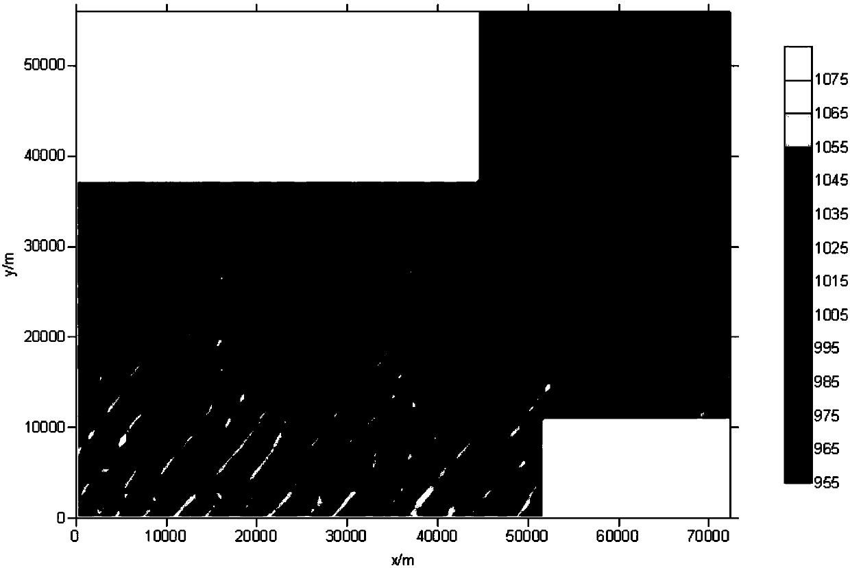
[0093] This example is the actual data of the three-dimensional work area in Xinjiang desert. figure 1 is the surface elevation of the measuring point. Input parameters R1=6000m, R2=3000m, R3=6000m, t=2, α=0.

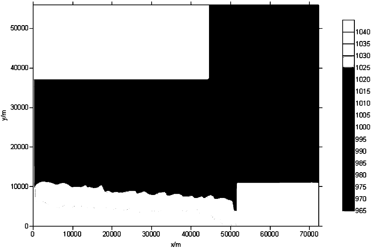
[0094] figure 2 is the terrain trend surface obtained by performing the step of "calculating terrain trend surface". by figure 1 The elevation attribute data of the measuring point shown is the input, and the terrain trend surface is calculated by point-by-point plane fitting. As far as the specific measuring point is concerned, all measuring points within the radius R1=6000m with this point as the center participate in plane fitting, construct a plane equation, and calculate the elevation of this point, that is, the elevation of the terrain trend surface at this point.

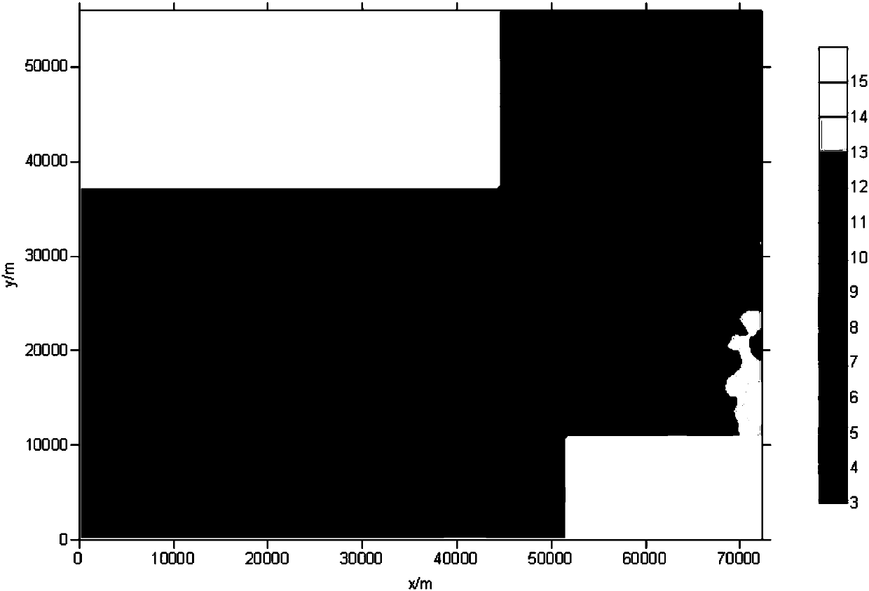
[0095] image 3 is the average elevation difference distribution function between the terrain trend surface and the dune valley bottom obtained by performing the step of "calculating the average ...


PUM


Abstract

The invention provides a method and a system using desert surface elevation data to calculate the elevation of a sand dune bottom surface. The method comprises the steps that coordinates and parameters of a measuring point of a working area are input; a topographic trend surface is calculated; an elevation difference function between the topographic trend surface and the bottom of a sand dune valley is calculated; an elevation interface belonging to the measuring point of the sand dune valley bottom is determined; and the sand dune valley bottom trend surface and the sand dune bottom surface are calculated. Compared with a conventional sand dune bottom surface determination method, the method has the advantages that the efficiency is significantly improved; the method is not affected by human factors; a result is stable and reliable; the acquired sand dune bottom surface is below a place near the sand dune valley bottom; and the overall trend is smooth. The method and the system, whichare provided by the invention, are widely used in actual data processing of desert areas in western China, and achieve a good result.

Description

technical field [0001] The invention belongs to the technical field of seismic exploration data data processing and the like, and in particular relates to a technique for calculating sand dune bottom surface elevation from desert surface elevation data in a static correction calculation technique for seismic exploration in a desert work area. Background technique [0002] In the processing of seismic exploration data in desert work areas, the elevation data of the bottom surface of sand dunes is needed when calculating the static correction by using the dune curve method related technology. In the seismic survey stage, only the surface elevation of the desert work area undulating with the sand dunes can be obtained, and the elevation data of the bottom surface of the sand dunes cannot be obtained directly. The elevation of the bottom surface of the dune is obtained through the analysis and processing of the surface elevation data. In the existing technology, technicians man...

Claims


Application Information

Patent Timeline
Patent Type & Authority Applications(China)
IPC IPC(8): G01V1/28G01C5/00
CPCG01C5/00G01V1/28
Inventor 林伯香
Owner CHINA PETROLEUM & CHEM CORP
Learn More