A method for inverting a field flood runoff process in a data-free area

A data-free, regional technology, applied to geographic information databases, complex mathematical operations, climate change adaptation, etc., to achieve high-precision results

Active Publication Date: 2019-05-28
CHINA THREE GORGES UNIV
View PDF5 Cites 16 Cited by
  • Summary
  • Abstract
  • Description
  • Claims
  • Application Information

AI Technical Summary

Problems solved by technology

[0005] The purpose of the present invention is to provide a method for inversion of flood runoff process in areas without data, so as to solve the aforementioned problems in the prior art

Method used


Image

  • A method for inverting a field flood runoff process in a data-free area
  • A method for inverting a field flood runoff process in a data-free area
  • A method for inverting a field flood runoff process in a data-free area

Examples


specific Embodiment

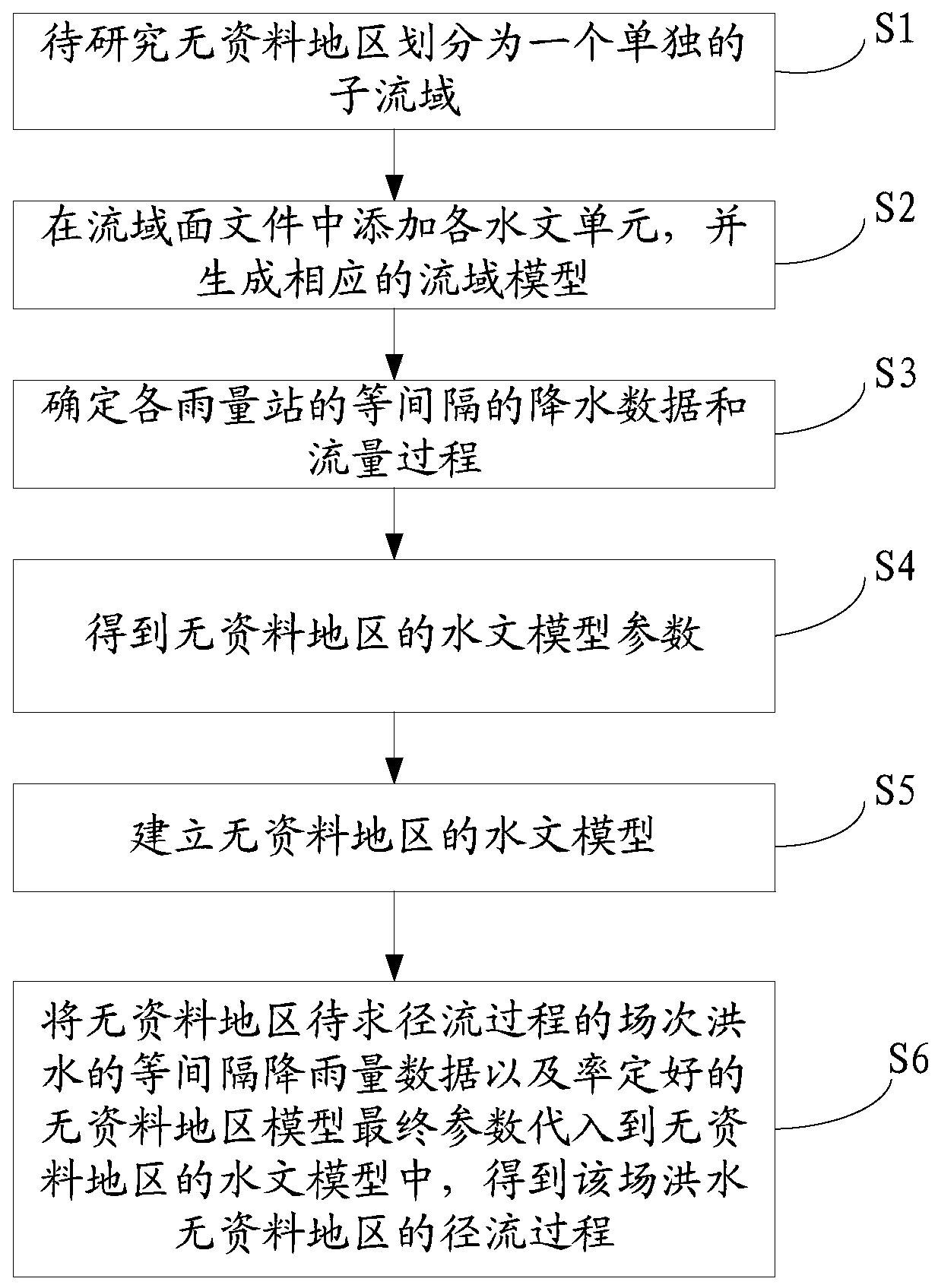
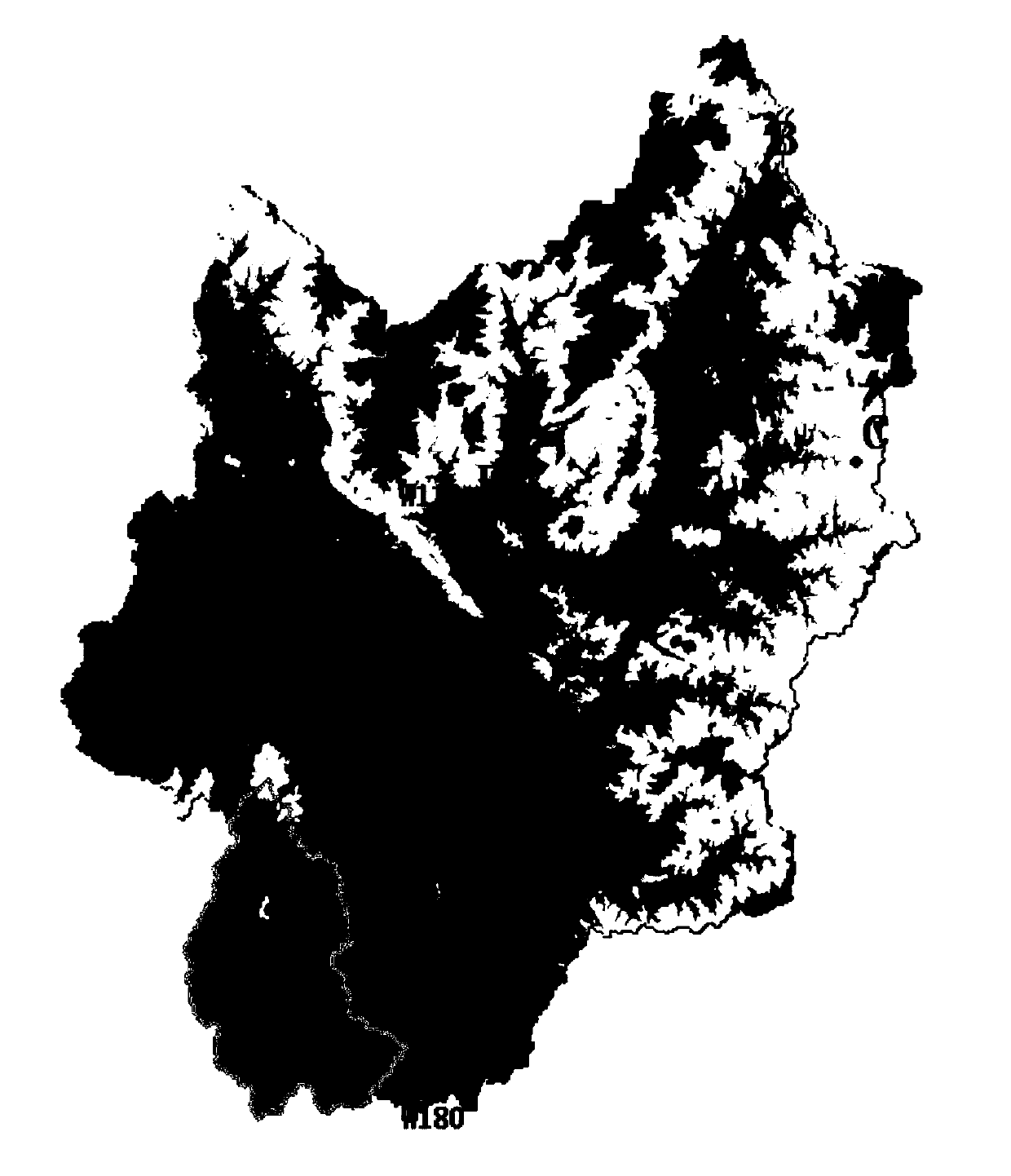
[0045] This embodiment takes the W160 flood rainfall and runoff process in the area without data above the Huayuan Hydrological Station in the Lihe River Basin of Hubei Province as an example to show the effect achieved by the present invention.

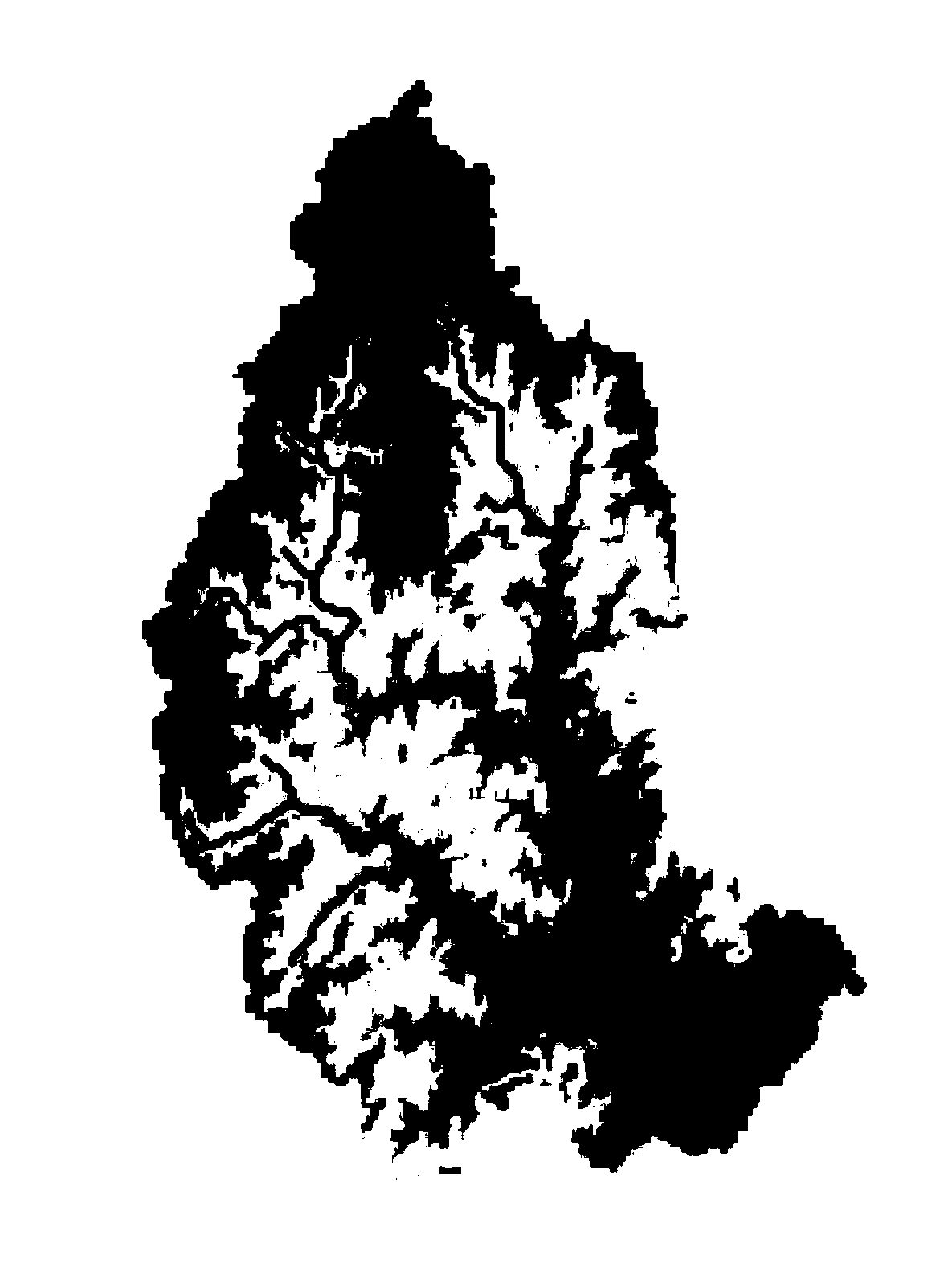
[0046] The Li River Basin is located in the north of the Yangtze River in Hubei Province, the southern foot of the Dabie Mountains, and the Xiaogan City area in the northern part of the Jianghan Plain. The total length of the main stream is 8km, and the drainage area is 2590.88km 2 . The terrain of the basin is high in the northeast and low in the southwest, and low eroded mountains and cutting hills are interspersed with each other. The landform is dominated by hills and mountains, with low mountainous areas in the northeast, with an altitude of 500-1000 meters and a relative height of 100-300 meters, and low and gentle hills in the southwest, with an altitude of 100-500 meters. There are 7 rainfall stations in the basin, which ar...


PUM


Abstract

The invention discloses a method for inverting a field flood runoff process in a data-free area, and relates to the technical field of hydrological data arrangement. The method comprises the steps ofadopting a natural watershed segmentation method; dividing a data-free area into independent sub-basins; simulating and calibrating a rainfall runoff process of a drainage basin above a downstream hydrological station in a data-free region; obtaining hydrological model parameters of a data-free area; constructing a hydrological model of a data-free area, and obtaining the runoff process of the flood data-free area by substituting equal-interval rainfall data of the field flood of the runoff process to be solved of the data-free area and calibrating final parameters of the data-free area modelinto the hydrological model of the data-free area. Therefore, with the adoption of the method provided by the invention, a higher precision runoff process of the field flood can be obtained through simple operation under the condition that few materials are mastered.

Description

technical field [0001] The invention relates to the technical field of hydrological data sorting, in particular to a method for inversion of flood runoff processes in areas without data. Background technique [0002] Obtaining the flood runoff process in areas without data is one of the essential steps to study reservoir scheduling, water resource management, hydrological forecasting and other issues. [0003] At present, widely used hydrological acquisition methods in areas without data include hydrological simulation method, runoff coefficient method and hydrological model method. The hydrological analogy method transfers the hydrological data of reference watersheds with similar climate and geographical conditions to the design watershed. The method is simple and easy, but it can only calculate the total runoff. The runoff contour method uses contour maps of hydrological parameters or watershed zoning maps to obtain hydrological variable values ​​or characteristic values...

Claims


Application Information

Patent Timeline
Patent Type & Authority Applications(China)
IPC IPC(8): G06F16/29G06F17/10
CPCY02A10/40
Inventor 常文娟马海波雷晓辉严登华肖尚斌徐刚田雨王浩纪道斌董鑫
Owner CHINA THREE GORGES UNIV
Why Eureka
Try Eureka