Eureka AIR delivers breakthrough ideas for toughest innovation challenges, trusted by R&D personnel around the world.

Planetary patrol device active path planning method based on compressed sensing

A path planning, compressed sensing technology, applied in the direction of the combined navigator, etc., can solve the problems of unclear planning path planning goals, low navigation and mapping accuracy, etc.

Active Publication Date: 2019-07-26
NANJING UNIV OF AERONAUTICS & ASTRONAUTICS
View PDF4 Cites 1 Cited by
  • Summary
  • Abstract
  • Description
  • Claims
  • Application Information

AI Technical Summary

Problems solved by technology

[0004] Aiming at the deficiencies of the above-mentioned prior art, the purpose of the present invention is to provide a method for active path planning of a planetary rovers based on compressed sensing, to solve the problems caused by poor landform texture features in the prior art when the planetary rovers perform autonomous path planning. The resulting navigation and mapping accuracy is low, and the planning path planning goal is not clear

Method used


Image

  • Planetary patrol device active path planning method based on compressed sensing
  • Planetary patrol device active path planning method based on compressed sensing
  • Planetary patrol device active path planning method based on compressed sensing

Examples


Embodiment Construction

[0058] In order to facilitate the understanding of those skilled in the art, the present invention will be further described below in conjunction with the embodiments and accompanying drawings, and the contents mentioned in the embodiments are not intended to limit the present invention.

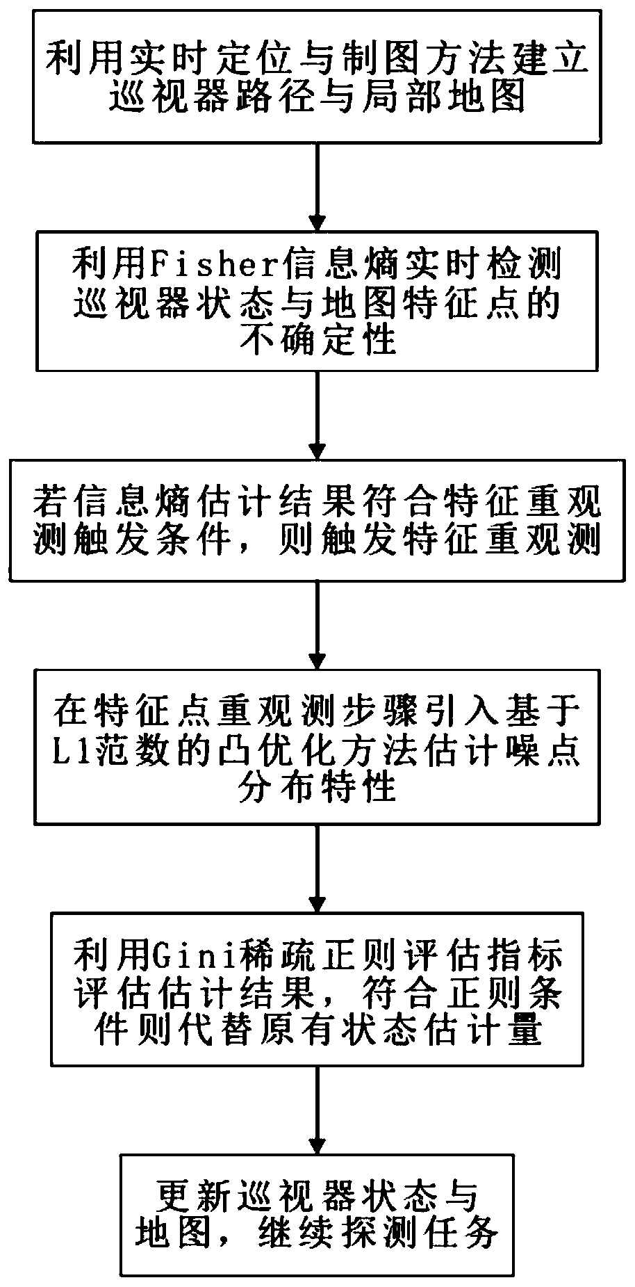
[0059] refer to figure 1 As shown, a method for active path planning of a planetary rovers based on compressed sensing of the present invention comprises the steps as follows:

[0060] 1) Use the robot positioning and mapping method to obtain the relative pose and surrounding map estimation of the planetary rover in real time, and record the state variance of the planetary rover and the covariance with the state and map feature points as a reference for the uncertainty of state estimation ;

[0061] In step 1), the method of recording the state variance and covariance of the planetary patrol is as follows:

[0062] Only the estimated variance matrix P of the relative position and relative ...


PUM


Abstract

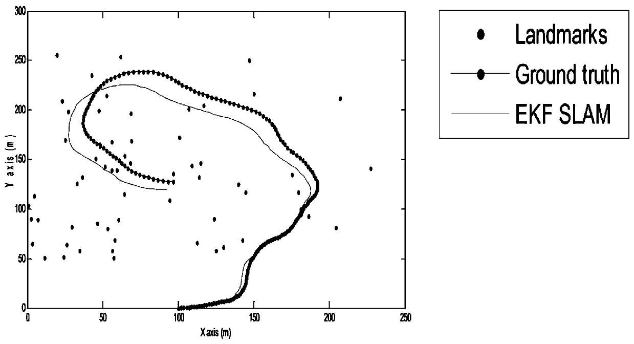
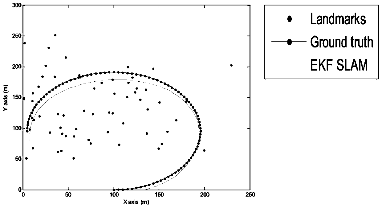
The invention discloses a planetary patrol device active path planning method based on compressed sensing. The planetary patrol device active path planning method comprises steps that: positioning andmapping of a conventional patrol device are carried out by using a SLAM method; Fisher information entropy is used for real-time examination of uncertainty of state estimation and characteristic point estimation, and a characteristic active re-observation decision mechanism is established; the compressed sensing method is introduced, when the map features are re-observed, and an L0 norm optimization problem, which is difficult to solve in the original compressed sensing problem, is replaced by an L1 norm, and noise points of non-Gaussian distribution are estimated; a Gini index function is used for examining the sparse regularities of the noise estimation sequence, and the precision of the L1 norm convex optimization method is guaranteed; and finally, the complete patrol device path planning method is established by taking the maximized Gini evaluation parameter result of the next step as an optimization index. The invention relates to the technical field of navigation guidance and control, and mainly relates to navigation guidance application for a planetary surface roaming patrol mission section.

Description

technical field [0001] The invention belongs to the technical field of navigation guidance and control, and in particular relates to an active path planning method for a planetary patrol based on compressed sensing. Background technique [0002] In the planetary surface roaming patrol mission, the navigation and positioning of the planetary vehicle is an indispensable and important link for the safety of the exploration mission, scientific exploration and the realization of other engineering goals. At present, the navigation and positioning of planetary vehicles generally adopts a semi-autonomous mode, and several types of active / passive sensors are usually used for combined navigation. For example, the Spirit mission launched by the United States in 2004. A portable positioning system such as a unit sensor is also equipped with a visual odometer (Visual Odometry) for optical navigation and positioning. The Curiosity rover launched by NASA in 2012 and the ExoMars rover laun...

Claims


Application Information

Patent Timeline
IPC IPC(8): G01C21/24
CPCG01C21/24
Inventor 余萌李爽孙俊
Owner NANJING UNIV OF AERONAUTICS & ASTRONAUTICS
Why Eureka
Eureka Blog
Learn More