Method for automatically establishing three-dimensional geological information model of coal mine by using point cloud data

A point cloud data and information model technology, applied in 3D modeling, image data processing, instruments, etc., can solve problems such as loss of spatial information, complicated operations, and difficulty in information updating, and achieve high analysis capabilities, high efficiency, and rich performance. effect of form

Active Publication Date: 2019-08-23
CCTEG BEIJING HUAYU ENG
View PDF8 Cites 14 Cited by
  • Summary
  • Abstract
  • Description
  • Claims
  • Application Information

AI Technical Summary

Problems solved by technology

[0004] The current coal mine geological information management mode is mainly based on human management. The geological modeling method commonly used in the engineering field is not only complicated to operate and poor in industry applicability, but also stays in two-dimensional or two-and-a-half-dimensional (2.5D, that is, non-true three-dimensional multi-parameter The essence of the simulation and expression of geological information is to project three-dimensional phenomena onto a plane or directly use two-dimensional semi-models for expression. Both of these two expression methods have the problem of spatial information loss and distortion, especially when establishing The model cannot meet the needs of data interoperability, and it is difficult to update information. It does not have functions such as query, measurement, forecasting and decision-making, and cannot reflect the value of information assets.

Method used


Image

  • Method for automatically establishing three-dimensional geological information model of coal mine by using point cloud data
  • Method for automatically establishing three-dimensional geological information model of coal mine by using point cloud data
  • Method for automatically establishing three-dimensional geological information model of coal mine by using point cloud data

Examples


Embodiment Construction

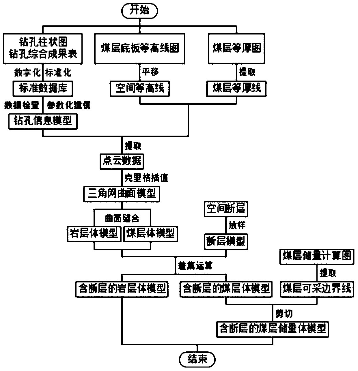
[0032] In order to make the object, technical solution and advantages of the present invention more clear, the present invention will be further described in detail below in conjunction with the examples. The specific embodiments described here are only used to explain the present invention, not to limit the invention.

[0033] Refer to as figure 1 Therefore, the method for automatically establishing a three-dimensional geological information model of a coal mine using point cloud data provided in this embodiment includes the following steps:

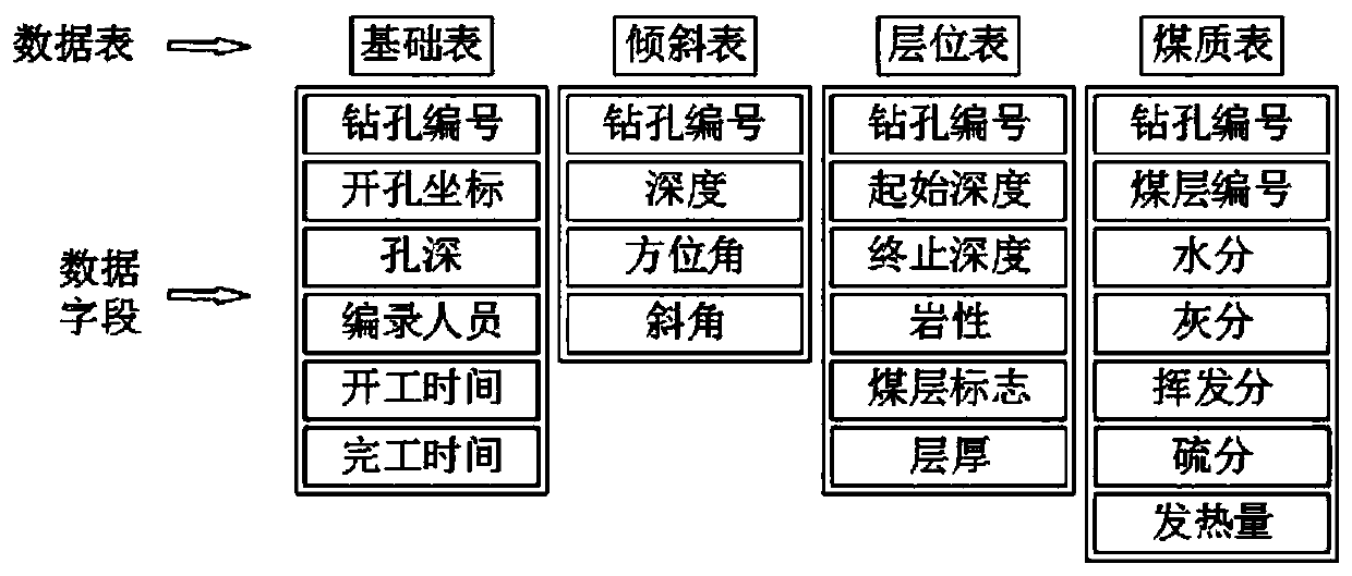
[0034] S1. Obtain 3D point cloud data based on the drilling histogram, comprehensive drilling result table, coal seam contour map, and coal seam floor contour map:

[0035] S11. Convert the contour map of the coal seam contour and the contour map of the coal seam floor into spatial graphic data; the specific method steps for the translation of the contour map of the coal seam floor:

[0036] After the 2D contour map is converted into ...


PUM


Abstract

The invention discloses a method for automatically establishing a three-dimensional geological information model of a coal mine by using point cloud data, which comprises the following steps of: acquiring the three-dimensional point cloud data based on a drilling histogram, a drilling comprehensive result table, a coal bed equal-thickness map and a coal bed floor contour map, and performing three-dimensional drilling information modeling by using the point cloud data; performing three-dimensional coal seam curved surface modeling by utilizing the three-dimensional drilling information model and the space graph data; sewing the coal seam curved surface model into a three-dimensional body model; and processing the three-dimensional body model by using the fault model. According to the method, three-dimensional geological information modeling can have high efficiency, and the model has rich representation forms and high analysis capability; the three-dimensional geological information model established by the method can help a decision maker correctly understand and express the geologic body in a virtual environment with accurate coordinates, time and objects; and a three-dimensionalvisual interaction means is utilized to realize multi-angle and multi-azimuth browsing and query of the geologic body and calculate, analyze and predict the internal geologic structure and geologic anomaly problems.

Description

technical field [0001] The invention relates to the technical field of three-dimensional geological modeling, in particular to a method for automatically establishing a three-dimensional geological information model of a coal mine by using point cloud data. Background technique [0002] The proposal and development of 3D geological modeling theory are closely related to geostatistics. The development of geostatistics benefited from D.G.Krige’s research on kriging technology in the 1950s. The concept of 3D geological modeling was first introduced by Canadian SimonW.Houlding It was proposed in 1993, and the most representative ones are the two articles on the "discrete smooth interpolation" modeling method published by Mallet in 1989 and 1992, which marked a breakthrough in the geological surface technology in the 3D structural modeling technology Subsequently, Carl Youngman, MolenaarMarien and others conducted a lot of research, mainly including the model and structure of spa...

Claims


Application Information

Patent Timeline
Patent Type & Authority Applications(China)
IPC IPC(8): G06T17/05G06T17/20
CPCG06T17/05G06T17/20
Inventor 何利辉王明明严志刚程志荣
Owner CCTEG BEIJING HUAYU ENG
Why Eureka
Try Eureka