A fully automatic topographic map surveying and mapping device and its surveying and mapping method

A technology of surveying and mapping devices and topographic maps, which is applied in the directions of surveying devices, camera devices, surveying and navigation, etc., can solve the problems of unguaranteed surface flatness, high cost and slow speed of drones, etc., so as to ensure the accuracy of framing and protect Landing stability, the effect of reducing the occupied volume

Active Publication Date: 2021-03-19
TAIYUAN UNIV OF TECH
View PDF5 Cites 0 Cited by
  • Summary
  • Abstract
  • Description
  • Claims
  • Application Information

AI Technical Summary

Problems solved by technology

[0003] In the field of surveying and mapping, the flatness of the ground surface cannot be guaranteed, and the speed of traditional ground surveying and mapping methods is slow; the use of high-altitude imaging needs to improve the camera recognition to ensure the accuracy of the device's camera framing; UAVs used in the field need to be easy to carry, can The function of quick disassembly and assembly: and when in use, the cost of drones is high, and self-protection equipment is required

Method used

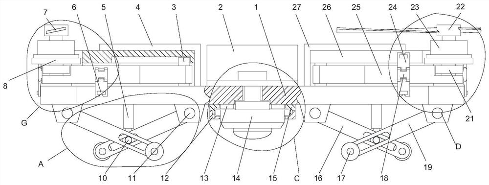
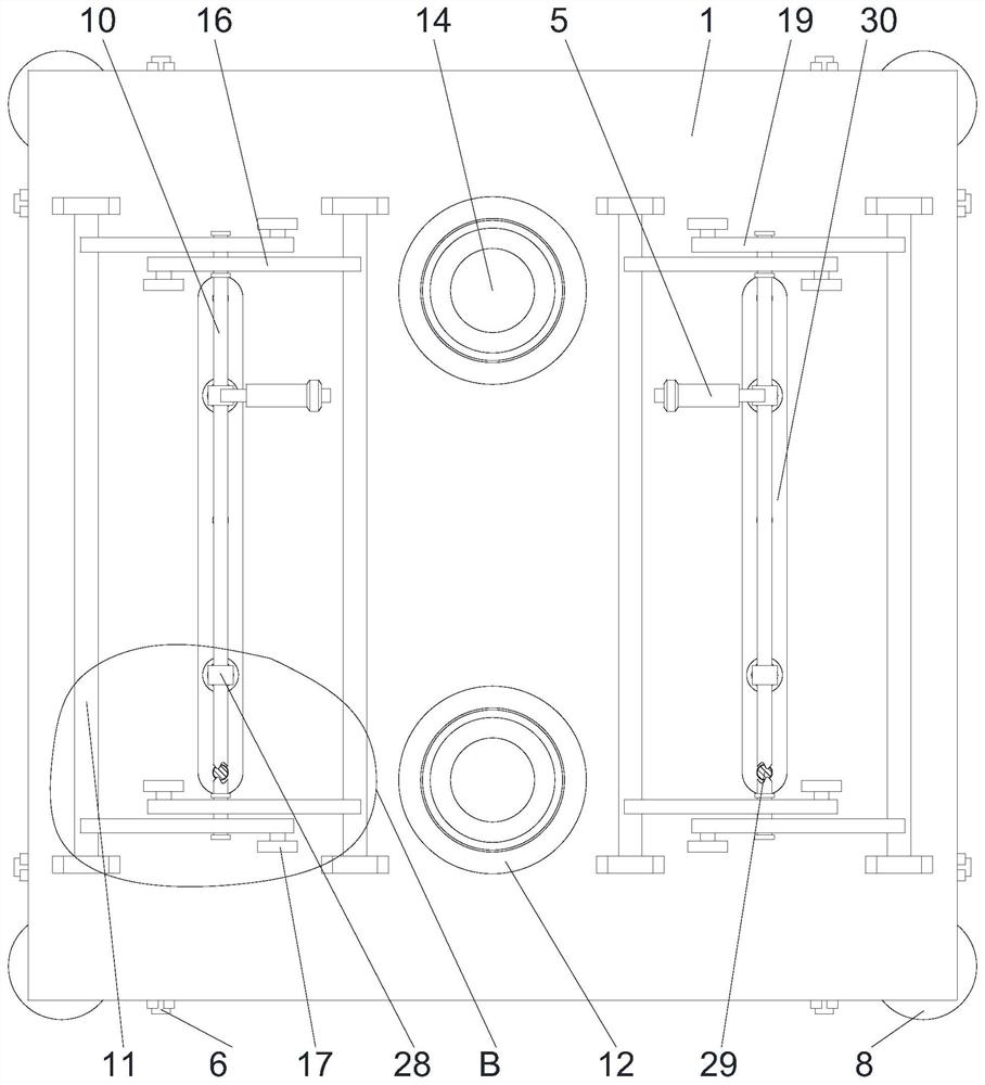
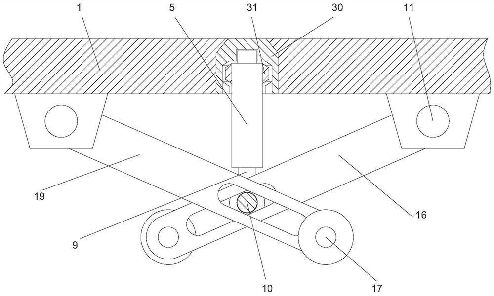

Image

  • A fully automatic topographic map surveying and mapping device and its surveying and mapping method
  • A fully automatic topographic map surveying and mapping device and its surveying and mapping method
  • A fully automatic topographic map surveying and mapping device and its surveying and mapping method

Examples


Embodiment Construction

[0028] The following will clearly and completely describe the technical solutions in the embodiments of the present invention with reference to the accompanying drawings in the embodiments of the present invention. Obviously, the described embodiments are only some, not all, embodiments of the present invention. Based on the embodiments of the present invention, all other embodiments obtained by persons of ordinary skill in the art without making creative efforts belong to the protection scope of the present invention.

[0029] In describing the present invention, it is to be understood that the terms "center", "upper", "lower", "front", "rear", "left", "right", "vertical", "horizontal", The orientations or positional relationships indicated by "top", "bottom", "inner", "outer", etc. are based on the orientations or positional relationships shown in the drawings, and are only for the convenience of describing the utility model and simplifying the description, rather than indica...


PUM


Abstract

The present invention discloses a full automatic topographic map mapping device and mapping method thereof. The device comprises a main body, a buffer frame and a camera, wherein middle side wall of bottom end of the main body is fixedly installed with a rotating seat that is symmetrical front and back, bottom end of the rotating base is screwed and installed with a rotating frame, and the camera is installed in a pressure mode between the rotating frame and the rotating seat. The device has reasonable structural design, and relates to a full automatic topographic map mapping device and a mapping method thereof. In the field of mapping, the method replaces the traditional ground mapping with the aerial image acquisition, thereby improving mapping speed. The device adopts a binocular stereo vision camera module for stereoscopic image acquisition, improves camera recognition degree, ensures framing accuracy of the device, and facilitates use of terrain analysis in later period. An unmanned aerial vehicle used in the field can be quickly disassembled, and after shape is changed, volume is reduced to facilitate handling: and when in use, the unmanned aerial vehicle has function of self-protection equipment, impulse relief, and protects equipment landing stability.

Description

technical field [0001] The invention relates to a surveying and mapping device, in particular to a fully automatic topographic map surveying and mapping device and a surveying and mapping method thereof. Background technique [0002] Surveying is all about measuring and drawing. Based on computer technology, optoelectronic technology, network communication technology, space science, and information science, with global navigation satellite positioning system (GNSS), remote sensing (RS), and geographic information system (GIS) as the technical core, the existing characteristics of the ground Points and boundaries obtain graphics and position information that reflect the current status of the ground through measurement means, and are used for planning, design and administrative management of engineering construction. [0003] In the field of surveying and mapping, the smoothness of the ground surface cannot be guaranteed, and the speed of traditional ground surveying and mapp...

Claims


Application Information

Patent Timeline
Patent Type & Authority Patents(China)
IPC IPC(8): G01C15/00G01C11/02
CPCG01C11/02G01C15/00
Inventor 杜孙稳冯国瑞聂鑫李小琴苏巧梅戚庭野王宇恒
Owner TAIYUAN UNIV OF TECH
Why Eureka
Try Eureka