Urban water surface rate planning method based on water safety

A water surface rate and safe technology, applied in special data processing applications, instruments, climate change adaptation, etc., can solve problems such as difficulty in meeting specification requirements, large differences in underlying surface, and difficulty in determining unit boundaries

Active Publication Date: 2019-12-06
SOUTH CHINA UNIV OF TECH
View PDF4 Cites 8 Cited by
  • Summary
  • Abstract
  • Description
  • Claims
  • Application Information

AI Technical Summary

Problems solved by technology

The problems of this judgment method include: 1) lack of pertinence, the underlying surface varies greatly in different regions, and some areas are difficult to meet the specification requirements; 2) it is difficult to determine the unit boundary of the water surface rate statistics, which is greatl

Method used


Image

  • Urban water surface rate planning method based on water safety
  • Urban water surface rate planning method based on water safety
  • Urban water surface rate planning method based on water safety

Examples


Embodiment Construction

[0074] The technical solution of the present invention will be described in detail below with a specific implementation case.

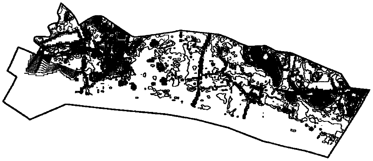
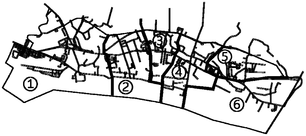
[0075] as attached Figure 5 As shown, urban water surface rate planning based on water security in a region includes the following steps:

[0076] Step 1. Obtain the DEM elevation data of the area

[0077] Use the geodetic method to measure the topographic elevation data of the urban planning area, the mapping accuracy is not lower than 1:200, the mapping accuracy is not lower than 1:500; the mapping elevation accuracy is not lower than level V.

[0078] Step 2. Establish a hydraulic model to identify waterlogged areas;

[0079] Based on the DEM terrain elevation data, the data is converted through GIS and computational hydraulics software, and the closed boundary of the terrain is established;

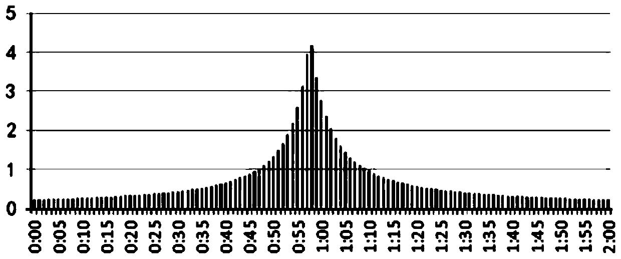
[0080] Design rainfall adopts 2-hour rainfall once every 5 years, design rain pattern and rainfall data according to regional standards, use Chicago meth...


PUM


Abstract

The invention discloses an urban water surface rate planning method based on water safety. The urban water surface rate planning method comprises the following steps: measuring DEM terrain elevation data; defining rainwater management and control subareas; establishing a hydraulic model, and identifying a ponding area; defining the waterlogging risk level of each rainwater control subarea according to the waterlogging area proportion; checking and calculating the rainstorm runoff through the regional rainstorm parameter atlas; and calculating the water storage volume and the water surface rate. According to the method, the area, depth and waterlogging risk of the ponding area of each rainwater control subarea are fully considered, the maximum water area and water surface rate based on water safety are calculated according to urban rainstorm data and urban water storage, and the method is high in operability, reasonable in result and extremely high in reference. Model calculation, rainfall flood calculation and water level safety calculation serve as main means and serve as important supports for urban water safety layout planning and scale design, and scientificity of urban water safety planning is improved.

Description

technical field [0001] The invention relates to the technical field of urban planning, in particular to a water security-based urban water surface ratio planning method. Background technique [0002] Urban water surface rate usually refers to the ratio of the area of ​​rivers (rivers, rivers, canals, etc.), lakes (natural or artificial lakes), wetlands (natural or artificial wetlands) and other areas that carry water functions to the total area of ​​the city within a certain area. Urban water surface has multiple service functions and economic value (He Junshi, Wu Di, Wei Guo. Analysis of urban suitable water surface ratio and its influencing factors[J]. Arid area resources and environment). It has an important impact on urban disaster prevention ability, environmental quality, economic development and other aspects. The existing water surface rate determination methods mainly include: [0003] (1) Trial scheme method: through designing multiple land use schemes, taking in...

Claims


Application Information

Patent Timeline
IPC IPC(8): G06Q10/04G06F17/50G06Q50/26
CPCG06Q10/04G06Q50/26Y02A10/40
Inventor 黄铎王世福霍东权梁嘉欣
Owner SOUTH CHINA UNIV OF TECH
Why Eureka
Try Eureka