Urban street space vitality simulation method, system, computer equipment and medium
A simulation method, street technology, applied in the direction of calculation, design optimization/simulation, instruments, etc., can solve the problems of staying, unable to predict the effect of the built environment, the effect of street vitality changes, unable to meet the scientific rationality of urban planning, etc.
- Summary
- Abstract
- Description
- Claims
- Application Information
AI Technical Summary
Problems solved by technology
Method used
Image
Examples
Embodiment 1
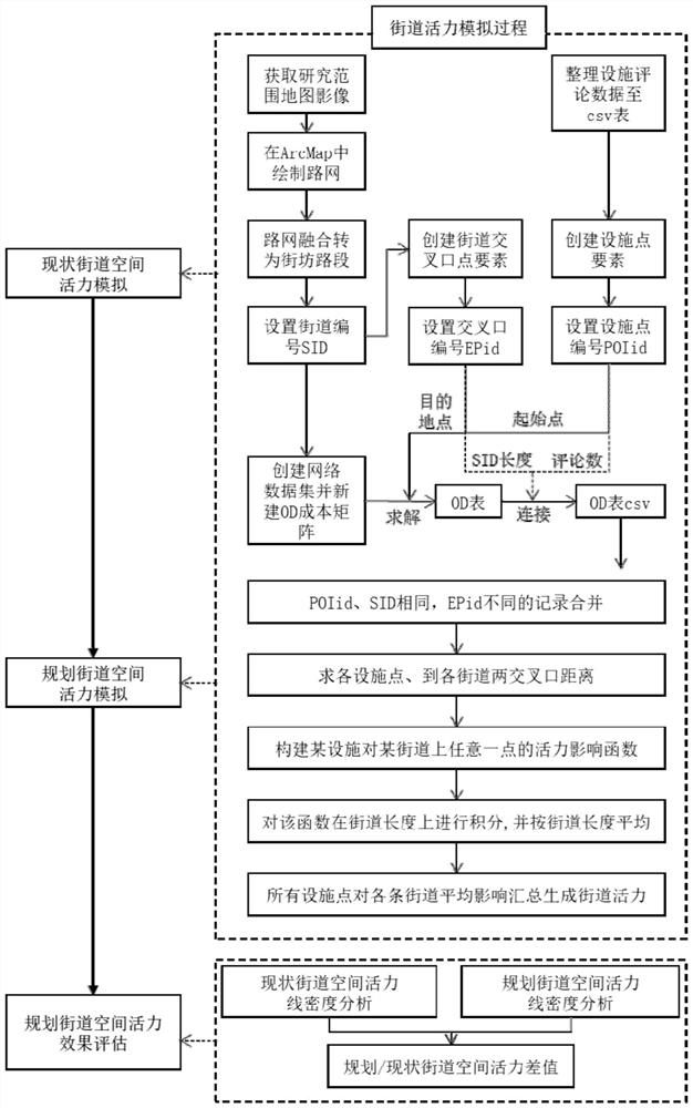
[0088] Such as figure 1 As shown, this embodiment provides a method for simulating urban street space vitality, which is implemented by computer equipment and includes the following steps:
[0089] S1. Acquiring map images within the research area.
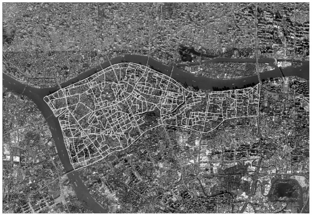
[0090] The research scope of this embodiment is the northwest of Haizhu District, Guangzhou City (west of Guangzhou Avenue, north of Xingang Road), and map images within the research scope can be obtained by downloading, specifically including:
[0091] S101. Load a map image.
[0092] Specifically, open the LocaSpaceViewer software, click to load a suitable map in the [Online Map] menu, and use the drawing surface tool in the [Operation] menu to draw a surface that is slightly larger than and completely includes the research area.
[0093] S102. Download the map image within the research range.
[0094] Select the map within the research area, set the map level to 16, select Tiff as the map format, keep the default output proj...
Embodiment 2
[0187] Such as Figure 8 As shown, the present embodiment provides a simulation system for urban street space vitality, and the system includes an acquisition module 801, a first generation module 802, a second generation module 803, a third generation module 804, a fourth generation module 805, a construction Module 806, calculation module 807, fifth generation module 808 and sixth generation module 809, the specific functions of each module are as follows:
[0188] The obtaining module 801 is used to obtain map images within the research area.
[0189] The first generation module 802 is used to create street line elements, draw street network on the map image, and generate neighborhood segment line elements; wherein, the streets include existing streets and planned streets.
[0190] The second generation module 803 is used to generate facility elements according to the facility data with geographic coordinates and number of comments within the research area, and input dista...
Embodiment 3
[0199] This embodiment provides a computer device, which may be a computer, such as Figure 9As shown, it includes a processor 902 connected through a system bus 901, a memory, an input device 903, a display 904, and a network interface 905. The processor is used to provide computing and control capabilities. The memory includes a non-volatile storage medium 906 and an internal Memory 907, the non-volatile storage medium 906 stores an operating system, computer programs and databases, the internal memory 907 provides an environment for the operation of the operating system and computer programs in the non-volatile storage medium, and the processor 902 executes memory storage During computer program, realize the urban street space vitality simulation method of above-mentioned embodiment 1, as follows:
[0200] Obtain map images within the research area;
[0201] Create a street line feature, draw a street network on the map image, and generate a neighborhood segment line featu...
PUM
 Abstract
Description
Claims
Application Information
 - R&D
- Intellectual Property
- Life Sciences
- Materials
- Tech Scout
- Unparalleled Data Quality
- Higher Quality Content
- 60% Fewer Hallucinations
Browse by: Latest US Patents, China's latest patents, Technical Efficacy Thesaurus, Application Domain, Technology Topic, Popular Technical Reports.
© 2025 PatSnap. All rights reserved.Legal|Privacy policy|Modern Slavery Act Transparency Statement|Sitemap|About US| Contact US: help@patsnap.com


