
Method for generating flight path of unmanned aerial vehicle

A drone and track technology, applied in the field of drones, can solve the problems of poor track efficiency of drones, and achieve the effects of smooth and continuous track, wide application prospects, and improved capabilities.

Inactive Publication Date: 2019-12-27
NAT INNOVATION INST OF DEFENSE TECH PLA ACAD OF MILITARY SCI
View PDF8 Cites 13 Cited by
  • Summary
  • Abstract
  • Description
  • Claims
  • Application Information

AI Technical Summary

Problems solved by technology

[0005] The main purpose of the present invention is to solve the technical problem of inefficiency in UAV track planning in the prior art

Method used


Image

  • Method for generating flight path of unmanned aerial vehicle
  • Method for generating flight path of unmanned aerial vehicle
  • Method for generating flight path of unmanned aerial vehicle

Examples


Embodiment Construction

[0031] Below in conjunction with example, accompanying drawing, the present invention is described in detail.

[0032] Realize the overall flow of the unmanned aerial vehicle track planning that the present invention proposes is:

[0033] Step 1: Modeling of flight environment and UAV dynamic constraints

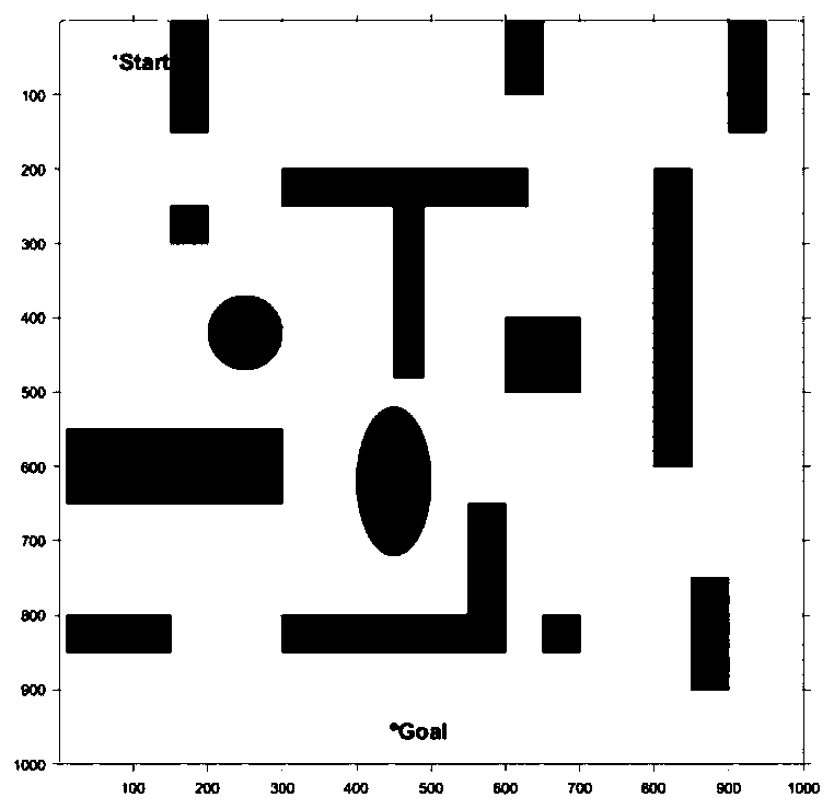
[0034] The flight environment model includes natural environment modeling and threat area modeling. The natural environment modeling is mainly the threat of terrain fluctuations, such as high mountains, and the threat area mainly considers the no-fly zone during the flight of the drone. This method assumes that the UAV is flying at a constant altitude, and the environment is modeled in a two-dimensional horizontal plane, and the mountain peaks and highlands that may pose a threat to the flight of the UAV at the set flying height are projected onto the horizontal plane to form a natural environment model. .

[0035] After the flight environment model is determined, the map ...


PUM


Abstract

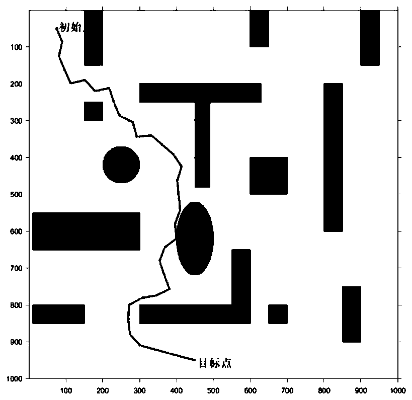
The invention provides a method for generating the flight path of an unmanned aerial vehicle. The method comprises the following steps: using a flight path algorithm to generate an initial flight pathafter modeling dynamic constraints of a flight environment and the unmanned aerial vehicle, and pruning the generated flight path to reduce the number of nodes and shorten the length of the path; andin combination with the dynamic constraint condition of the turning radius of the unmanned aerial vehicle, smoothing the processed flight path until the total voyage constraint of the unmanned aerialvehicle is met. According to the method, in combination with the flight environment of the unmanned aerial vehicle and the initial and final positions of the unmanned aerial vehicle, the speed of a flight path planning algorithm of the unmanned aerial vehicle can be accelerated, the generated flight path is guaranteed to be a feasible flight path meeting the given constraint of the unmanned aerial vehicle, meanwhile, the generated flight path is smooth and continuous, the hang time of the unmanned aerial vehicle can be prolonged, the capability of the unmanned aerial vehicle to execute tasksis effectively improved, and the method has wide application prospects in flight path planning of the unmanned aerial vehicle.

Description

technical field [0001] The invention belongs to the technical field of unmanned aerial vehicles, and in particular relates to the trajectory planning technology of unmanned aerial vehicles. [0002] technical background [0003] With the development of aviation technology and electronic technology, unmanned aerial vehicles (UAVs) are widely used in military and civilian fields due to their advantages of low cost and easy control, such as enemy reconnaissance, coordinated strikes, terrain exploration, geographic mapping, line inspections, etc. Small and medium-sized UAVs perform complex and diverse tasks, use complex environments, and have high requirements for survivability. UAV track planning is to comprehensively consider factors such as UAV arrival time, fuel consumption, threats, and flight areas. The UAV plans the optimal or satisfactory flight trajectory to ensure the successful completion of the flight mission. The UAV trajectory planning method is the core technology ...

Claims


Application Information

Patent Timeline
IPC IPC(8): G01C21/20
CPCG01C21/20
Inventor 陈小庆朱得糠王波孟志鹏吕良李彤
Owner NAT INNOVATION INST OF DEFENSE TECH PLA ACAD OF MILITARY SCI
Learn More