

Method for planning dynamic lines of urban public transport
An urban bus and line technology, applied in traffic flow detection, traffic control systems, road network navigators, etc., can solve the problems of time lag, poor correspondence of on-site conditions, difficult to predict and effective route planning, etc., to achieve reliability. High, good correspondence, fast effect
- Summary
- Abstract
- Description
- Claims
- Application Information
AI Technical Summary
Problems solved by technology
Method used
Image

Examples
Embodiment Construction
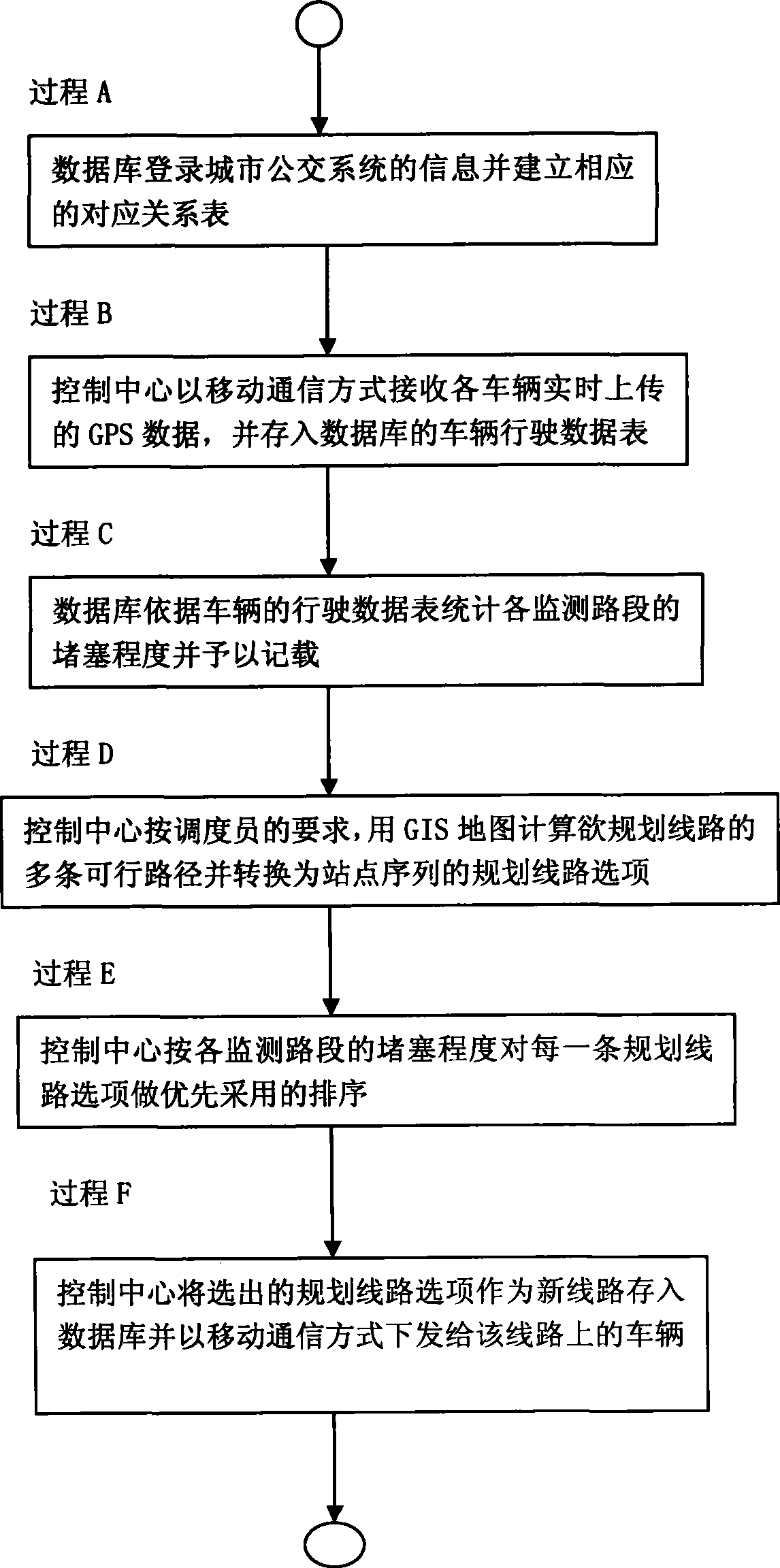
[0023] An urban public transport management system adopting the urban public transport dynamic line planning method of the present invention has a control center and thousands of vehicle-mounted terminals.
[0024] The control center has operation terminal, database server, communication server, Web server, GPRS or CDMA front-end machine and GIS map.
[0025] The operation terminal provides the business functions of the system, such as business management such as vehicle monitoring, dispatching, and system configuration, and information management functions such as line and station configuration. Among them, the business management is jointly completed by the operation terminal and the communication server; the information management is jointly completed by the operation terminal and the Web server.
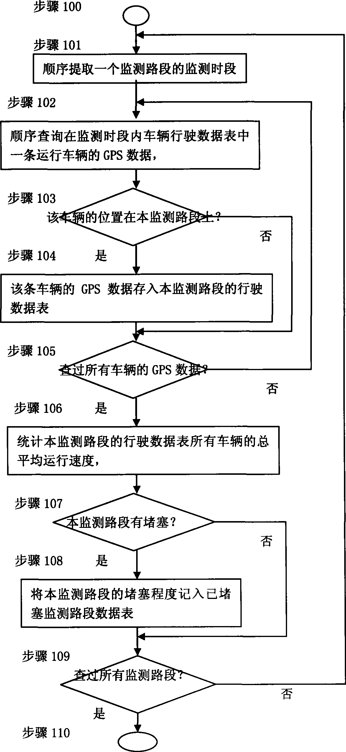
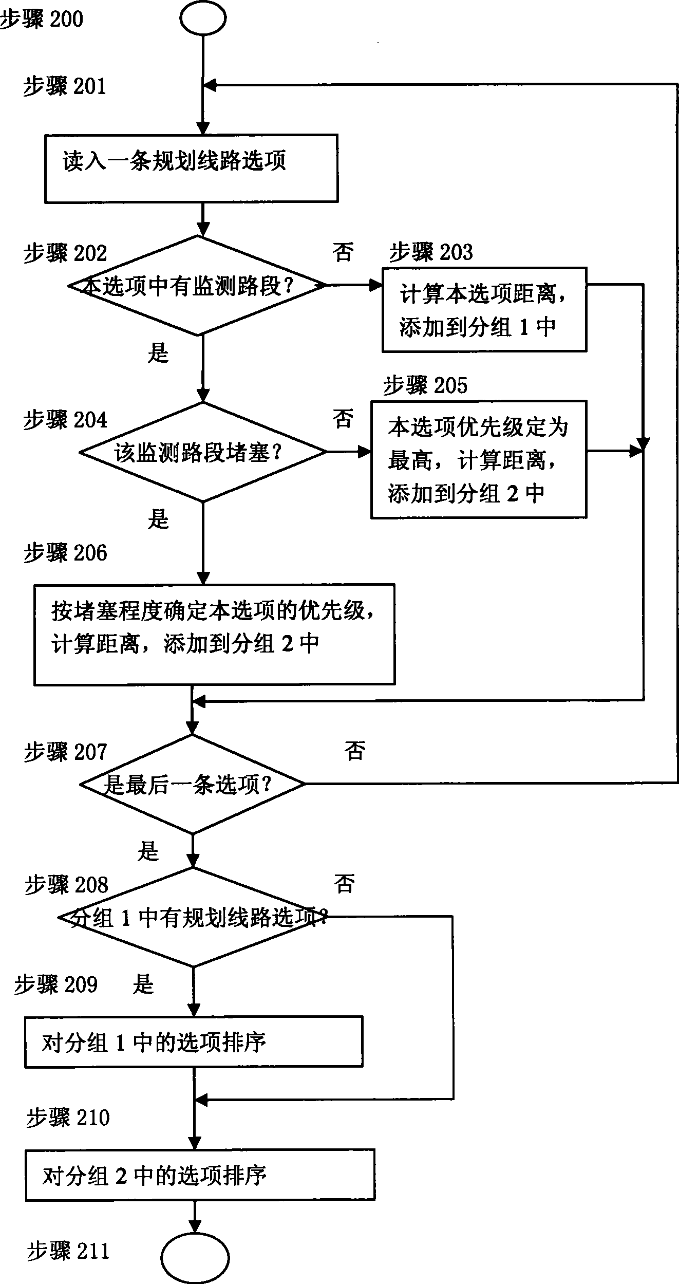
[0026] The database server (hereinafter referred to as the database) is mainly responsible for the storage of information and data and the statistical analysis function of the da...
PUM
 Abstract
Description
Claims
Application Information