

Construction method and system of urban landscaping plant dynamic database
A landscaping and construction method technology, applied in the field of database construction, can solve problems such as impact value, no standard, unclear source, etc., and achieve the effect of easy operation and use, simple data update, and improved sharing
- Summary
- Abstract
- Description
- Claims
- Application Information
AI Technical Summary
Problems solved by technology
Method used
Image

Examples
Embodiment 1
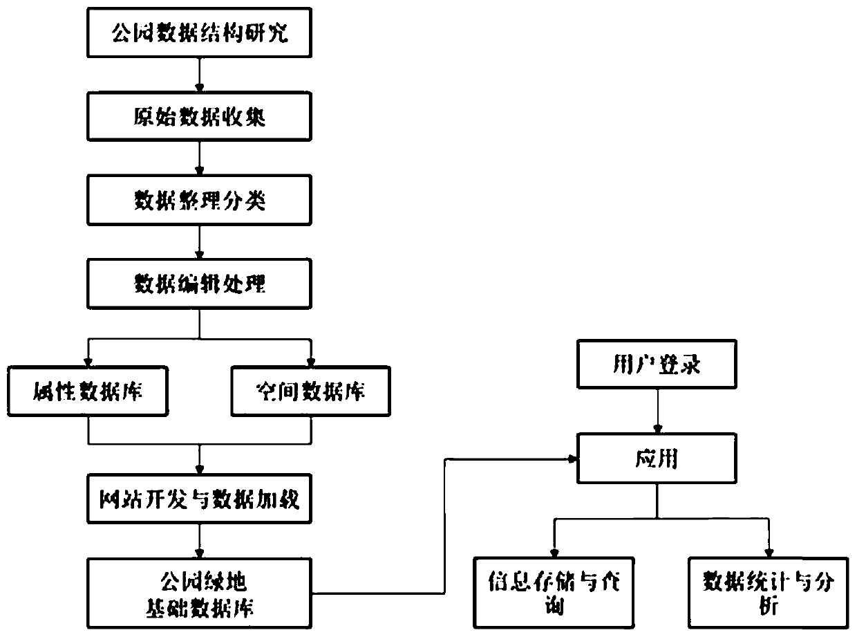
[0043] The present embodiment provides a method for constructing a dynamic database of urban landscaping plants, comprising the following steps:
[0044] (1) Collect urban garden archives data and establish an integrated basic data sub-database.
[0045] Comprehensively collect the archive data of all urban gardens, optimize the data structure and storage method of category information, and process the data through hierarchical classification and structural processing. The established database element number specification ensures that the number of each element unit in the database is unique. According to its specifications, the paper-based materials related to each park are converted into digital information for unified classification and archiving management, the attribute tables of various materials are established, and the basic database of the park is constructed based on the integrated park file data.
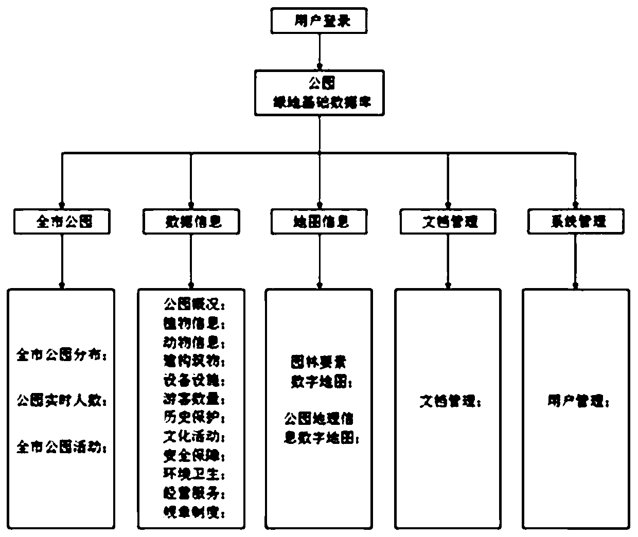
[0046] The urban garden archive data includes urban garden basic inf...
Embodiment 2
[0067] The present embodiment provides a system for constructing a dynamic database of urban landscaping plants, including: a first sub-database building module for collecting urban garden archives data and establishing an integrated basic data sub-database; a second sub-database building module for Collecting urban garden space data, establishing a spatial data sub-database; an association relationship establishment module, used to construct the association relationship between the spatial data sub-database and the integrated basic data sub-database; the website database visualization module, for based on the association Relationship, using the B / S method to realize the visualization of the dynamic database of urban landscaping plants. All the other are with embodiment 1.
PUM
 Abstract
Description
Claims
Application Information