Dynamic coordinate system polyhedron subdivision gravity Bouguer correction method
A correction method and coordinate system technology, applied in the direction of measuring the gravitational field, measuring devices, instruments, etc., can solve the problem of complex terrain influence, achieve the effect of improving accuracy and reducing approximate calculation
- Summary
- Abstract
- Description
- Claims
- Application Information
AI Technical Summary
Problems solved by technology
Method used
Image
Examples
specific Embodiment approach
[0034] The specific embodiment of the present invention is: a dynamic coordinate system polyhedron subdivision gravity Bouguer correction method, comprising:
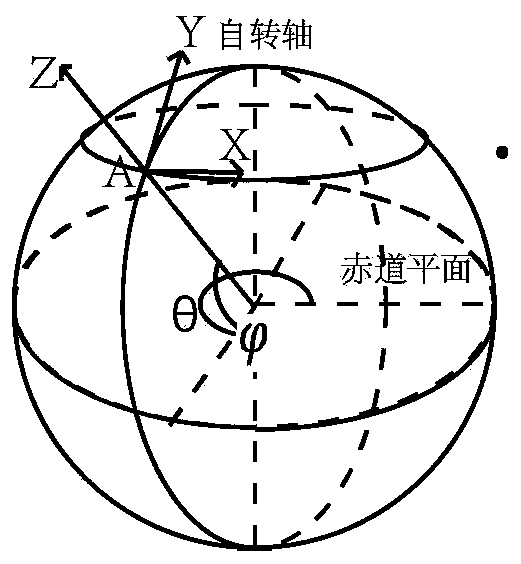
[0035] 1. Transformation of the coordinate system: such as figure 1 As shown, the mass body above the geoid is transformed into a dynamic rectangular coordinate system with the calibration point as the origin, the east direction as the x direction, the north direction as the y direction, and the direction away from the center of the earth as the z direction. The change of the point, so the Cartesian coordinates are dynamically changed, and the origin of the coordinates is also different with the difference of the correction point;
[0036] The equation for transforming coordinates of the mass body is:
[0037]
[0038] Among them, θ is the longitude of the calibration point, is the latitude of the correction point, R is the radius of the earth, h is the elevation of the correction point, B is the mass body above t...
PUM
 Abstract
Description
Claims
Application Information
 - R&D
- Intellectual Property
- Life Sciences
- Materials
- Tech Scout
- Unparalleled Data Quality
- Higher Quality Content
- 60% Fewer Hallucinations
Browse by: Latest US Patents, China's latest patents, Technical Efficacy Thesaurus, Application Domain, Technology Topic, Popular Technical Reports.
© 2025 PatSnap. All rights reserved.Legal|Privacy policy|Modern Slavery Act Transparency Statement|Sitemap|About US| Contact US: help@patsnap.com


