Satellite orbit error refinement method

A satellite orbit and orbit error technology, applied in the field of navigation satellite orbit determination, can solve the problems that the range and process of station deployment cannot be fully guaranteed, and the station deployment area of ​​satellite perturbation model cannot be effectively refined, so as to improve orbit accuracy and space signal Accuracy, precision improvement, practical effects

Active Publication Date: 2020-04-17
SHANGHAI ASTRONOMICAL OBSERVATORY CHINESE ACAD OF SCI
View PDF8 Cites 4 Cited by
  • Summary
  • Abstract
  • Description
  • Claims
  • Application Information

AI Technical Summary

Problems solved by technology

Under the complex and changeable international situation at this stage, the scope and process of overseas station deployment cannot be fully guaranteed. The study of satellite dynamic perturbation models requires a large amount of historical data, and its model refinement is a long-term process.
Therefore,

Method used


Image

  • Satellite orbit error refinement method
  • Satellite orbit error refinement method
  • Satellite orbit error refinement method

Examples


example

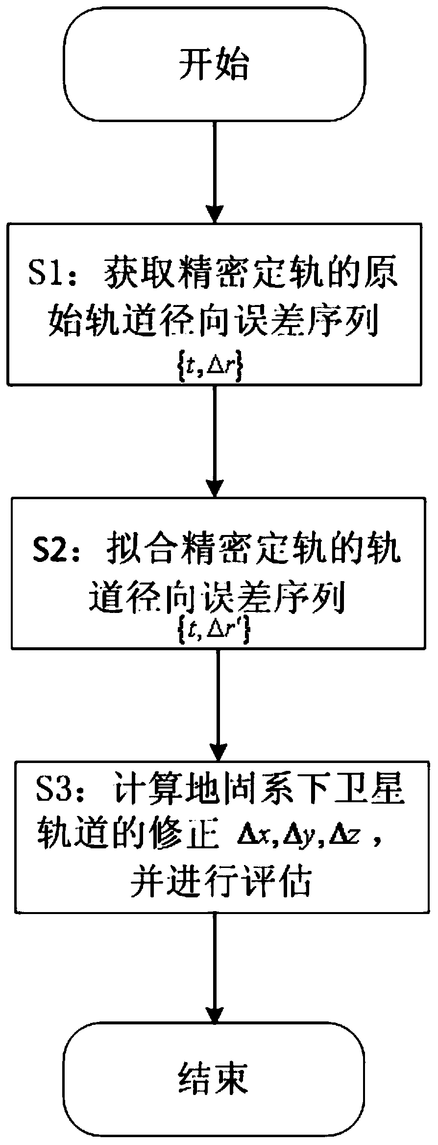
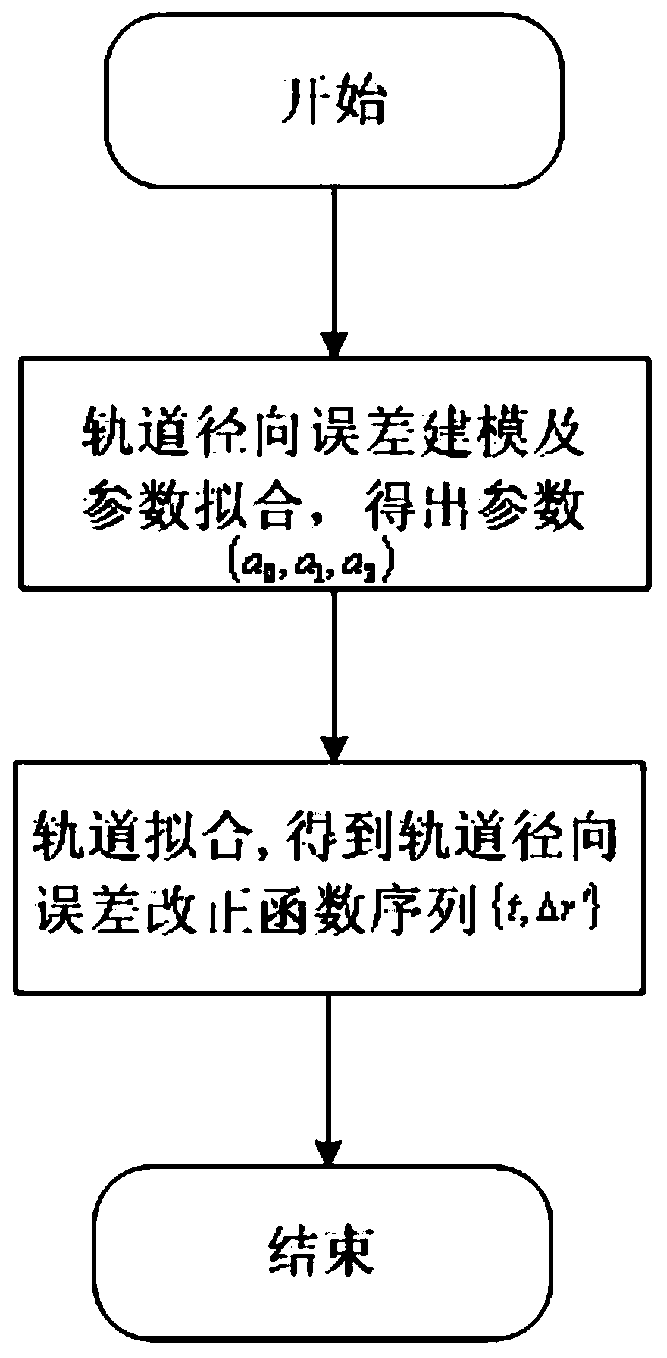
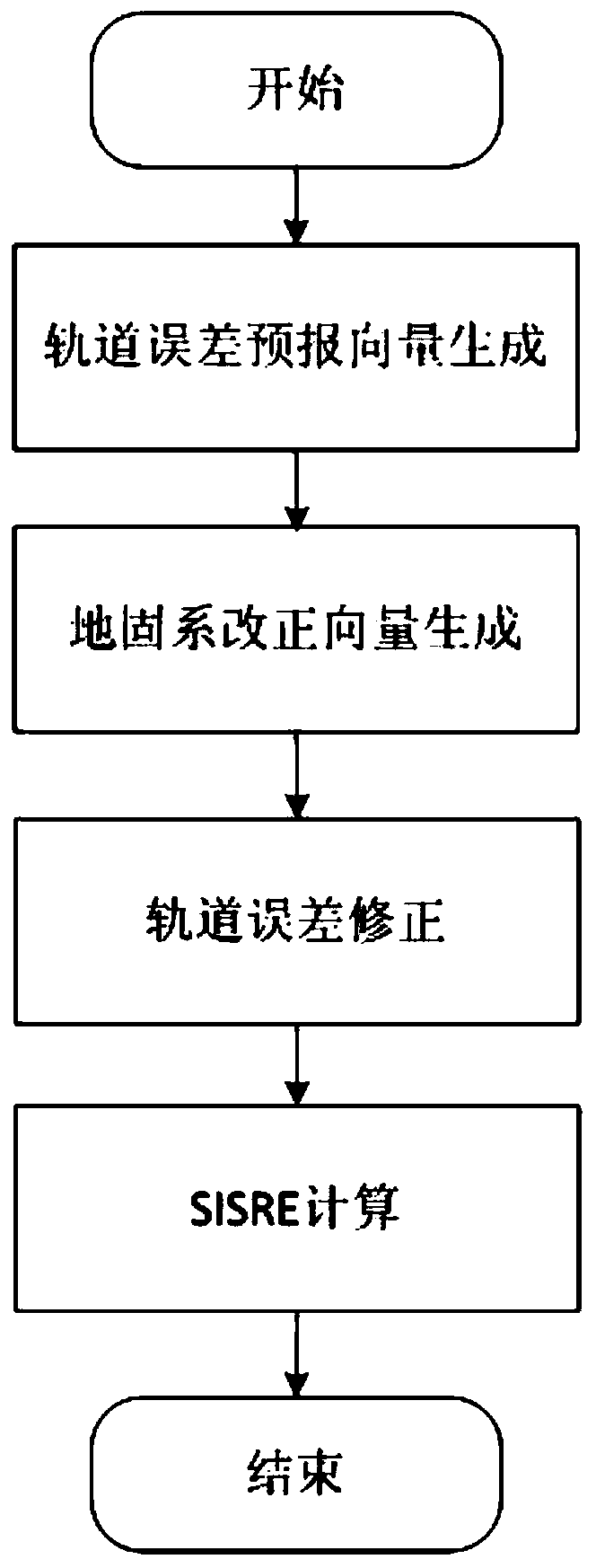
[0142] Below is the selection of orbit error monitoring, forecasting and correction calculations for the Beidou GEO / IGSO satellite clock error and orbit data for 10 days from May 27 to June 5, 2017.

[0143] A total of 3 days from May 28 to May 30, the comparison of the one-way and two-way time synchronization satellite-earth clock difference of GEO satellite C01 and IGSO satellite C07 is as follows Figures 4A-4B shown. in, Figures 4A-4B Different colors represent the error curves of different days. It can be seen that the clock difference value changes with time, and there is a good consistency in the clock difference value under different days. The above clock error difference is refined according to the error refinement method of the satellite orbit of the present invention for the precise orbit determination of the ground-fixed orbit coordinate vector, and the space signal accuracy SISRE is calculated.

[0144] Figure 5 It shows the average value of the space signal ...


PUM


Abstract

The invention provides a satellite orbit error refinement method, which comprises the steps of respectively obtaining satellite-ground clock errors based on one-way and two-way time synchronization, comparing the clock errors, and obtaining an original orbit radial error sequence of precise orbit determination; based on the obtained original orbit radial error sequence, adopting a second-order polynomial to carry out orbit error fitting to obtain an orbit radial error correction sequence; and performing orbit error prediction based on a satellite orbit period by utilizing the orbit radial error correction sequence to obtain an orbit error prediction sequence, and converting the orbit error prediction sequence from an orbit coordinate system to an earth-fixed coordinate system to finish orbit error correction of precise orbit determination. According to the satellite orbit error refinement method, satellite orbit errors are effectively monitored, fitted, predicted and corrected under the conditions that dynamic factors are not considered and the range of a monitoring station is not expanded by means of comparing the two clock errors, and a practical Beidou satellite orbit performance improvement method is provided.

Description

technical field [0001] The invention relates to the field of determination of navigation satellite orbits, in particular to an error refinement method for satellite orbits. Background technique [0002] Since the first generation of three-dimensional positioning satellite system in the United States, the Meridian System, was put into operation in 1964, the satellite navigation system has experienced half a century of development, including the GPS of the United States, the GLONASS of Russia, the Galileo of the European Union and the Beidou system of my country. Several navigation systems have provided services or are under development and construction. The emergence of various satellite navigation systems aims to provide global coverage, all-weather, high-precision navigation, positioning and timing services. [0003] Signal-in-Space Range Error (SISRE) is an important index reflecting the performance of navigation system services. The broadcast information broadcast by navi...

Claims


Application Information

Patent Timeline
IPC IPC(8): G01S19/23G01S19/27G01S19/37
CPCG01S19/23G01S19/27G01S19/37
Inventor 陈俊平王君刚王彬张益泽谭伟杰
Owner SHANGHAI ASTRONOMICAL OBSERVATORY CHINESE ACAD OF SCI
Why Eureka
Try Eureka