Satellite precipitation data correction method based on multi-source information fusion and downscaling

A technology of multi-source information fusion and data correction, applied in visual data mining, electrical digital data processing, structured data retrieval, etc. Problems such as global precipitation distribution and low spatial resolution

Active Publication Date: 2020-04-28
INST OF DESERT METEOROLOGY CMA URUMQI
View PDF6 Cites 20 Cited by
  • Summary
  • Abstract
  • Description
  • Claims
  • Application Information

AI Technical Summary

Problems solved by technology

[0004] The purpose of the present invention is to solve the problems that rain gauges and radars are difficult to accurately obtain large-scale and global precipitation distributions, and the existing satellite precipitation products have low precision and low spatial resolution, and provide a multi-source information fusion based Correction method for satellite precipitation data with downscaling

Method used


Image

  • Satellite precipitation data correction method based on multi-source information fusion and downscaling
  • Satellite precipitation data correction method based on multi-source information fusion and downscaling
  • Satellite precipitation data correction method based on multi-source information fusion and downscaling

Examples


Embodiment 1

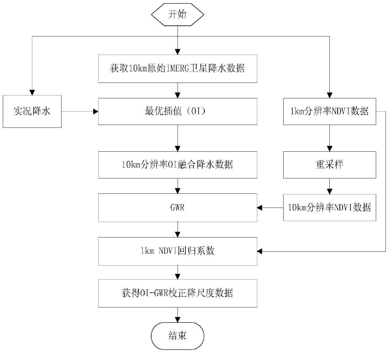
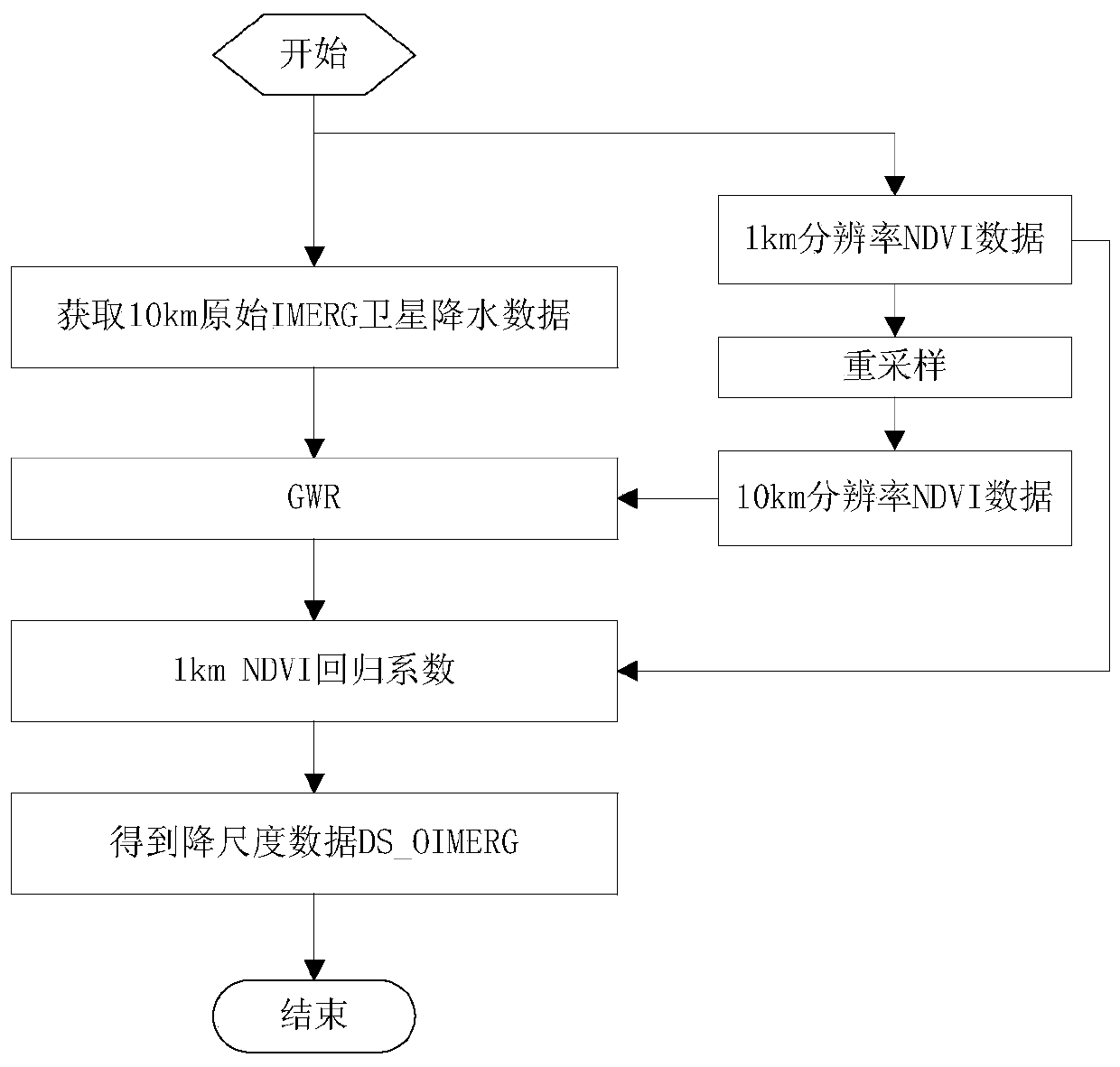
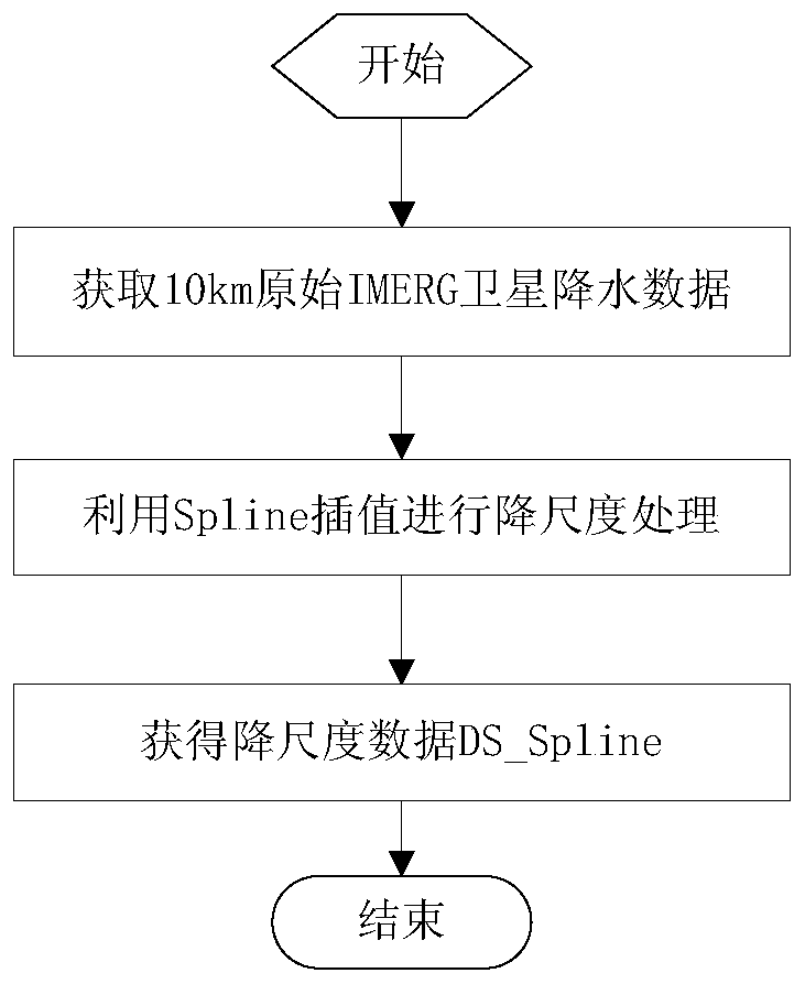
[0062] Embodiment one, such as figure 1As shown, a satellite precipitation data correction method based on multi-source information fusion and downscaling, this embodiment one takes the Tianshan Mountains in Xinjiang as the research area. Tianshan is the mountain system farthest from the ocean in the world, one of the seven largest mountain systems in the world, with an area of ​​about 570,000 square kilometers. As the geographical boundary between southern and northern Xinjiang, the Tianshan Mountains have an average elevation of 4,000m and are composed of a series of landform units such as mountains, intermountain basins, valleys, and piedmont plains. This area is a typical alpine mountainous area in my country, with uneven distribution of precipitation and great differences in time and space. The precipitation in summer is large, while that in winter is small. In this example, a correction study is carried out for IMERG (Integrated Multi-satellit E Retrievals for GPM), a 3...


PUM


Abstract

The invention discloses a satellite precipitation data correction method based on multi-source information fusion and downscaling. The method comprises the following steps: S1) acquiring live precipitation data and a satellite inversion precipitation product; S2) carrying out optimal interpolation according to the real-time rainfall data and a satellite inversion rainfall product; S3) obtaining low spatial resolution NDVI data; S4) selecting an environment variable and low spatial resolution NDVI data, and performing independent variable screening; S5) establishing a GWR downscaling model; S6)utilizing the GWR model to obtain OI-GWR corrected rainfall grid point data of the research area; and S7) checking the OI-GWR corrected precipitation grid point data of the research area by adopting10-fold cross validation. According to the method of the invention, optimal interpolation is introduced to improve the quality of original satellite precipitation data, and a better initial field is obtained; on the basis that an initial field is improved, a GWR method is used for downscaling, and the spatial resolution and precision of obtained downscaled data are improved.

Description

technical field [0001] The invention relates to the field of hydrological and meteorological data analysis, in particular to a satellite precipitation data correction method based on multi-source information fusion and downscaling. Background technique [0002] Precipitation is the main driver of the Earth's water cycle. Accurately obtaining information on the temporal and spatial distribution of precipitation is fundamental to improving the functioning of the Earth system and better predicting weather, climate, and natural disaster events. Currently, there are three main ways to obtain precipitation information: station live observation, radar estimation and satellite remote sensing inversion. Station observations have high accuracy, but most stations are located in low-altitude areas and are unevenly distributed, which cannot effectively reflect the spatial variation characteristics of precipitation, and the spatial representation is insufficient; precipitation data calcu...

Claims


Application Information

Patent Timeline
Patent Type & Authority Applications(China)
IPC IPC(8): G06F16/215G06F16/26
CPCG06F16/215G06F16/26
Inventor 卢新玉刘艳王秀琴王小军
Owner INST OF DESERT METEOROLOGY CMA URUMQI
Why Eureka
Try Eureka